
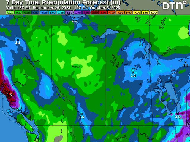
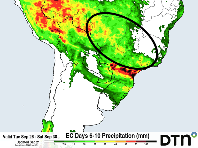
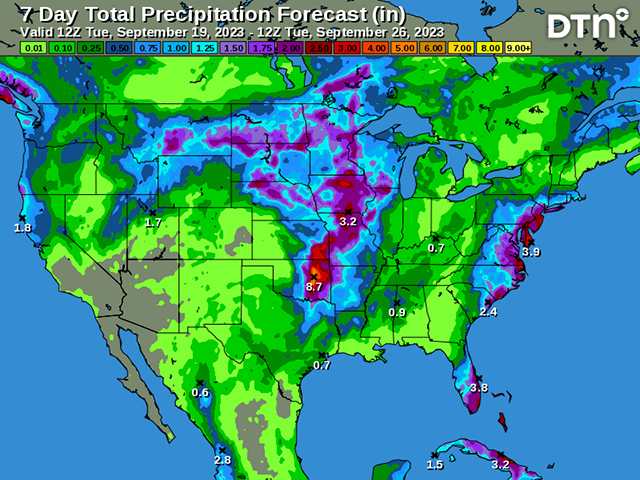
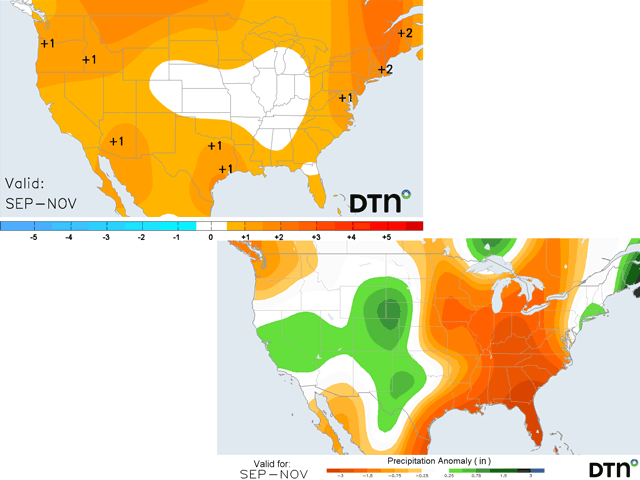
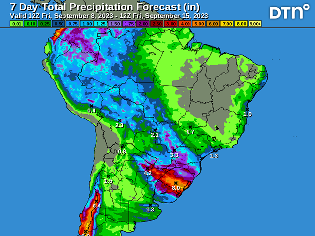
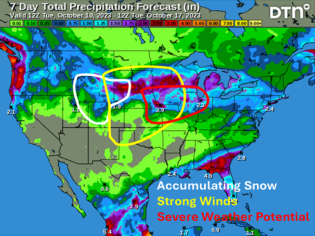
A strong fall storm system will bring areas of heavy rain, strong winds, and even some snow to parts of the Plains and Midwest this week.
A very active pattern has been over South America for the last several months, but the results have been the same: Dry weather for Argentina and heavy rain for southern Brazil.
A progressive pattern during the next week will bring in a drastic shift in temperatures, going from very high to seasonally low, back up above normal again going into next week. The rollercoaster ride should bring widespread frosts to northern areas of the country.
Pacific Ocean trade wind measurements show that the current El Nino still trails 1982, 1997 and 2015 in its intensity.
Since the previous story was posted, computer models made a rather dramatic change to the weather pattern for next week.
The weather pattern continues to be active through next week with plenty of chances for widespread precipitation.
Coming off of a historic drought last season, Argentina had gotten some better rainfall earlier this spring, but not recently. Limited soil moisture is a concern for wheat and early corn plantings.
Some heat early in the fall in the middle of the country will be favorable for the continuing harvest for the next couple of weeks, but fall has to arrive at some point. Can it happen in mid or late October?
A strong Pacific Ocean El Nino and a dry-impact Indian Ocean Dipole indicate minimal rainfall in Australia's primary wheat regions for the 2023-24 wheat crop.
The average date for the start to the rainy or wet season in central Brazil is around Sept. 26. Are those rains going to be delayed?
With four months yet to go, the year 2023 already tops the old calendar-year billion-dollar disaster record by more than 40 percent.
Some isolated showers are developing early this week, but a stronger and slow-moving system could bring heavier rain amounts to the middle of the country later this week and weekend.
Some showers over the next week will not hamper much progress for soybean planting in Brazil next week.
Harvest has already begun but will be increasing over the next few weeks. What does the weather look like as combines roll?
Drought still covers almost half the major winter wheat areas as seeding gets underway for the 2023-24 crop.
The weather pattern has been more active thanks to El Nino across most of South America, but the heavy rain in southern Brazil has led to flooding concerns as spring planting begins.
It did not always feel like it, but bouts of extreme heat were quite frequent for much of the central and Western Corn Belt this summer. Drought conditions likely played a major role in the extreme heat.
Last week, models insisted on extreme heat for most of this week and through mid-September. They made a nearly 180-degree turn as milder air now floats into the Corn Belt and probably sticks around through mid-September instead of the heat.
With the turn to September, the spring planting season is in sight for South America. El Nino will be the biggest influence on the weather pattern for the next several months, and producers down there are likely to be happy about it.
Heat will return to the middle of the country during the next few days. Several days of well-above-normal temperatures are likely for next week, as are drier conditions. But some areas are going to luck out with some more moderate readings while rain is not completely out of...
DIM[2x3] LBL[blogs-ag-weather-forum-list] SEL[[data-native-ad-target=articleList]] IDX[2] TMPL[news] T[]
DIM[2x3] LBL[blogs-ag-weather-forum-list-2] SEL[[data-native-ad-target=articleList]] IDX[5] TMPL[news] T[]