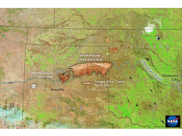
Climate change, fire control efforts and even El Nino played big roles in the February 2024 Texas megafire.

Climate change, fire control efforts and even El Nino played big roles in the February 2024 Texas megafire.
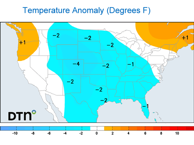
Very warm temperatures so far this winter and early spring might tempt some producers to plant their 2024 crops early. However, a burst of colder air coming in later this month could get some additional support in early April and would be damaging if it is cold enough.
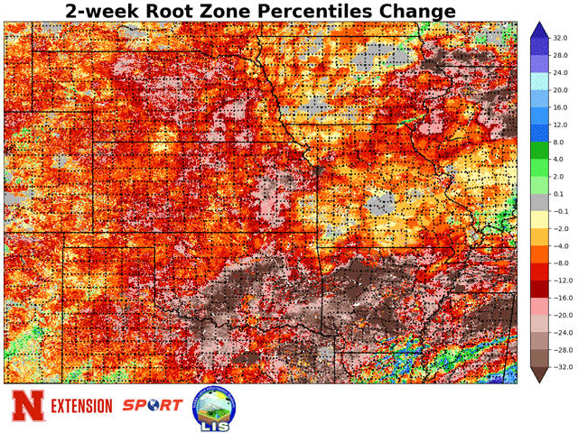
Root zone-level moisture showed a drop-off during the very warm final two weeks of February.
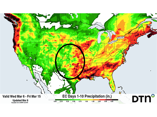
Recent heat, strong winds and overall dry conditions have sapped topsoil moisture for winter wheat in the Central and Southern Plains. However, two storm systems are poised to bring good moisture back into the region.
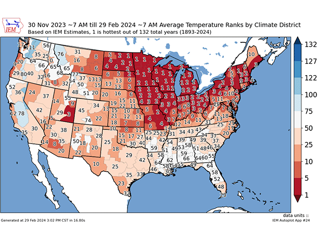
Temperatures this winter season were at or near record highs across the northern tier of the country despite a visit from the polar vortex in mid-January.
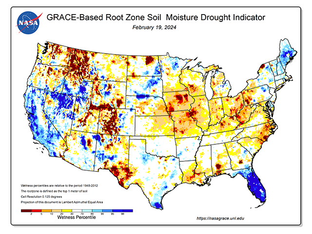
Soil moisture profiles in many prime U.S. crop areas still lack full recovery ahead of the start of spring fieldwork.
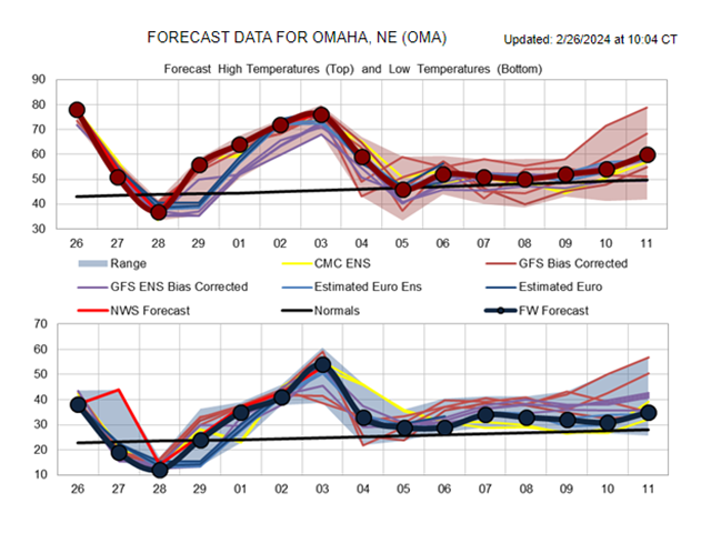
The upper-level pattern has turned very active as we cross the threshold of winter into spring. The next two weeks should see wild swings in temperatures, strong winds, areas of accumulating snow and severe weather.
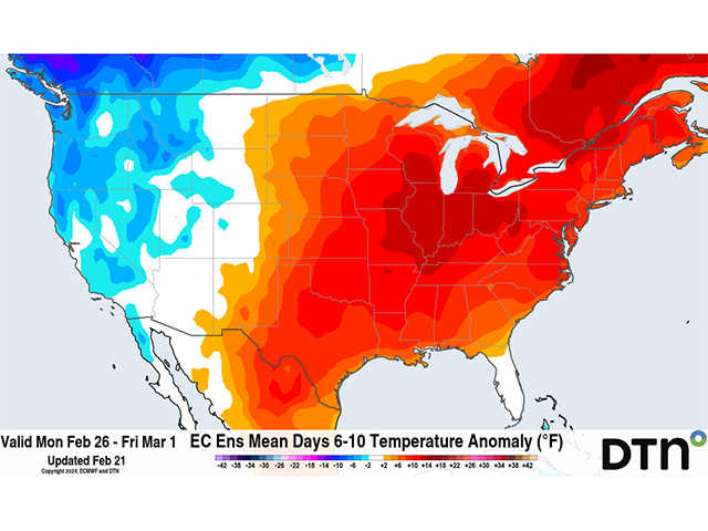
Despite a pair of systems moving through over the next week, temperatures through the end of February -- the end of meteorological winter -- continue to be very warm.
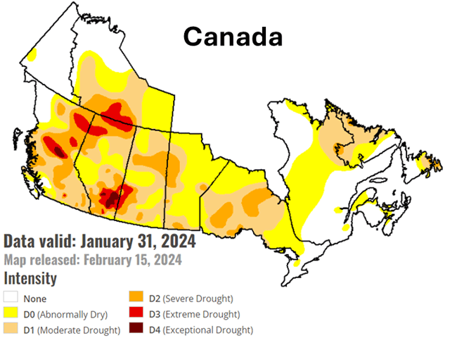
While drought conditions are anchored across the Canadian Prairies this winter, the influences of El Nino may weaken this spring and allow some relief before planting gets started.
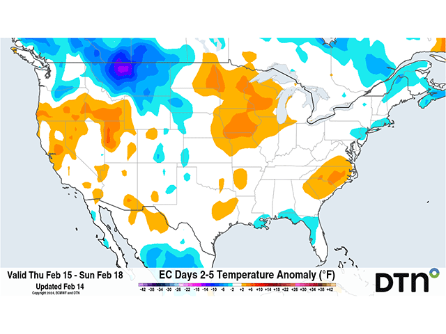
A pair of clippers are moving through this week, which is usually indicative of colder air dropping down from Canada. Models are not insisting on that. Why not?
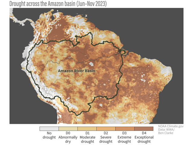
High evaporation rates add to the lack of new storm systems due to El Nino wind patterns.
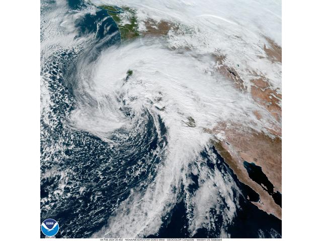
Atmosphere dynamics for California's devastating floods are very similar to those which brought incredible flooding to the Midwest in 2019.
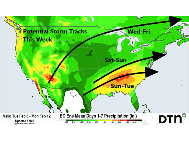
An upper-level trough in the West has already soaked California and is spreading precipitation throughout the region. That trough will send several impulses of energy through the rest of the country this week and weekend, which could be significant in some areas, particularly...

No quick change from El Nino to La Nina is expected by Australian weather and climate forecasters.
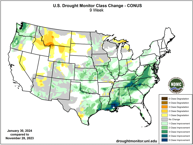
Due to widespread heavy precipitation over the last week, long-term heavy rainfall and improvements in multiple other categories that go into drought classification, the Feb. 1 update from the USDM showed sweeping improvements across much of the U.S.
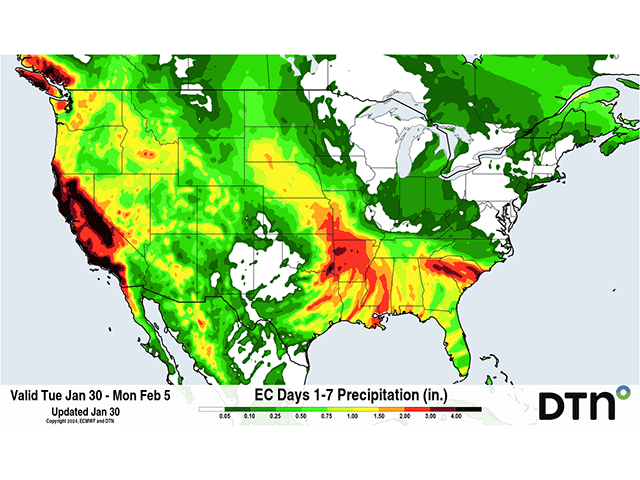
A strong ridge continues to be planted across the middle of North America, blocking up the weather pattern and bringing a lot of warm air to the U.S. and Canada. However, a big trough in the Pacific will try its hardest to push the ridge out. In doing so, it will send a lot of...
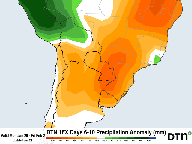
Next week's forecast rainfall across many of the main growing areas across South America calls for below-normal precipitation and drier-than-normal conditions may continue to plague Argentina.
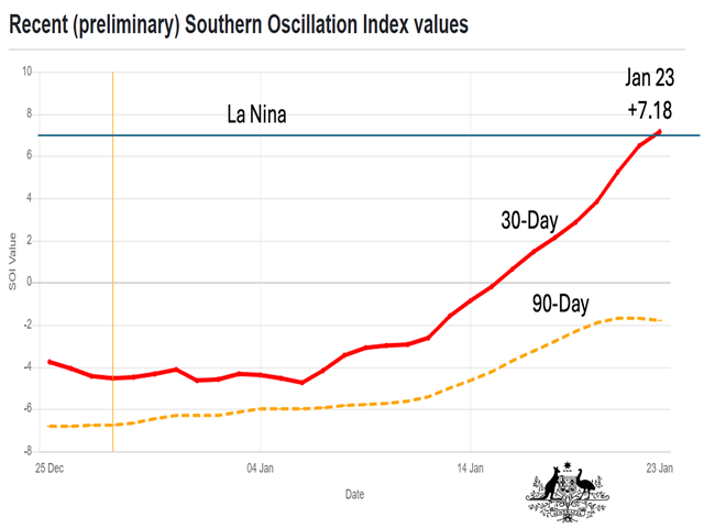
Rising values in the Southern Oscillation Index support the idea of La Nina development sooner rather than later in the 2024 growing season.
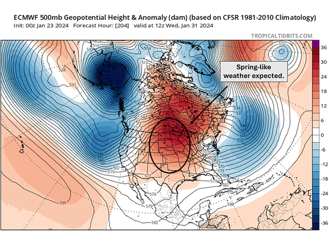
An upper-level ridge in the West will shift into the Central U.S. towards the end of January into early February, providing a taste a spring to the Midwest and Plains.
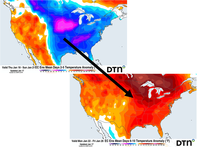
Cold arctic air has flooded the U.S. and Canada during the last week and another burst of harsh cold has hit the end of this week and into the weekend. But that will quickly change next week with temperatures returning to much-above-normal levels as the upper-air pattern...
DIM[2x3] LBL[blogs-ag-weather-forum-list] SEL[[data-native-ad-target=articleList]] IDX[2] TMPL[news] T[]
DIM[2x3] LBL[blogs-ag-weather-forum-list-2] SEL[[data-native-ad-target=articleList]] IDX[5] TMPL[news] T[]