by
John Baranick
,
DTN Meteorologist
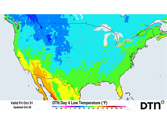
The coldest air of the season is forecast to descend into the Midwest this weekend. Some areas may not make it above zero Fahrenheit on Saturday.