by
John Baranick
,
DTN Meteorologist
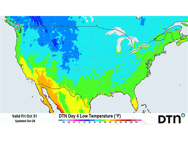
A front moving across the southern tier of the country will bring some chilly weather, including areas of frost.