
Ag Weather Forum
Warm Pacific Ocean May Have Boosted North Dakota Tornado Outbreak

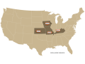
September 14, 2025, was a violent, record-breaking weather day in central North Dakota. Published reports indicate that a total of 20 tornado reports were received by NOAA's Storm Prediction Center in the Dakotas, with 18 in North Dakota. This was a rare and stunning event; in the past 30 years, since 1995, only 15 tornadoes had been reported in the month of September in North Dakota. Typically, the state sees its largest number of tornadoes in June. North Dakota averages 22 tornadoes for an entire year, so this mid-September outbreak was almost an entire year's worth of tornado activity in just one day.
The North Dakota yearly tornado record is also being rewritten. The former record was 61 tornadoes, set in 1999. That record is now up to at least 73, according to the Bismarck office of the National Weather Service and reported by Jamestown, North Dakota, radio station KSJB AM 600. North Dakota tornado records date back to 1950.
P[L1] D[0x0] M[300x250] OOP[F] ADUNIT[] T[]
In addition to the tornado outbreak, heavy rain and flash flooding occurred in the storm event. Bismarck's NWS office logged a new record rainfall total for Sept. 14 of 2.44 inches, far above the old record of 1.5 inches set back in 1900.
This tornado outbreak has several trigger points that came together in mid-September. Sustained warmth and moisture moved into the northwestern Plains during early to mid-September. Warm days and nights were noted; Central North Dakota had overnight low temperatures in the mid-60s Fahrenheit, either matching or breaking minimum temperature records. Regarding moisture, NWS Bismarck forecast comments on Sept. 14 noted that the atmospheric detail identified as "precipitable water" was either near or at its maximum climatological value, suggesting the potential for rainfall of 2 or more inches if storms developed.
Besides the warmth and humidity, an unstable atmospheric pattern meant the build-up of strong storms was possible. "Storm mode could be messy given the strong mid to upper-level forcing and lack of a well-defined surface or low-level boundary," the 5 a.m. (CDT) Bismarck NWS forecast discussion noted. (DTN Ag Meteorologist John Baranick has details on the current central U.S. atmospheric setup here: https://www.dtnpf.com/… .
This late-summer/early-fall outbreak also raises the question of whether a very warm North Pacific Ocean boosted the tornado potential by adding to the amount of atmospheric energy in the Northern Plains. Those Pacific conditions are warm, running from 1-4 degrees Celsius or almost 2-7 degrees F above average across the entire North Pacific as of mid-September. Studies of tornado outbreaks have found warm ocean regions can enhance storm potential by contributing warm and moist air.
Tornadoes are localized and inconsistent. Nonetheless, this outbreak and its timing will no doubt be studied closely, with the ocean temperatures and atmospheric patterns as prime features.
Bryce Anderson can be reached at bryce.anderson@dtn.com
(c) Copyright 2025 DTN, LLC. All rights reserved.

Comments
To comment, please Log In or Join our Community .