
Ag Weather Forum
Mixed Outlook for Prairies
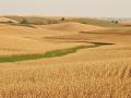
Rainfall and temperatures during June have improved conditions for canola and spring wheat across the Canadian Prairies following early-season dryness. However, rainfall levels still remain well-below normal in many locales. Dryness is most pronounced in southwest Saskatchewan, southern Alberta and in Manitoba.
As we move through the end of June and into July, the questions revolve around whether or not areas now in need of rain will receive what they need, while also limiting the rain in areas that have recently been too wet. The too-wet area includes southeast and northwest Saskatchewan, extreme west Manitoba and a portion of northern Alberta.
P[L1] D[0x0] M[300x250] OOP[F] ADUNIT[] T[]
The short-range forecast for the region covering the next week features a good deal of above-normal temperatures in the key growing areas. This is as a result of an upper-level ridge of high pressure that has moved in over the area this week. The high temperatures each day through Monday are expected to range from the upper 70s to the upper 80s Fahrenheit, or 25 to 32 Celsius. Shower activity during this timeframe will increase somewhat, but in most cases these will be light showers of 0.25 inch (6 millimeters) or less, and favor west and south areas.
The longer-range forecast shows this ridge weakening and moving off to the east. This allows a fairly significant upper-level trough to move into the region from the Pacific. This occurs during the Tuesday-to-Thursday timeframe next week. At first, this trough is expected to generate more wind than rainfall; but, it should allow for cooler weather, especially in western growing areas. This moisture availability for this first trough appears limited.
As we look beyond the middle of next week, changes are indicated that may allow additional chances for rainfall. There looks to be some increase in the ridging in the U.S., especially in the vicinity of the Midwest going into the first week of July. A ridge position in the Midwest, and a mean trough in western North America, should lead to increasing moisture for the Prairies. The southerly flow on the back of the Midwest ridge and ahead of the West Coast trough transports moisture into the Prairies. Temperatures in the region would trend towards cooler in the west and warmer in the east during this period.
This is a long-range forecast and therefore somewhat uncertain; but, if these trends hold, I would expect that dryness and warmth would continue to cause concerns for farmers and increased stress to crops for at least another week. Dryness may continue of concern even beyond this period. However, eventually this pattern should allow improvement, especially late next week or early in the first week of July.
Joel Burgio can be reached at joel.burgio@dtn.com
(BA/ES)
© Copyright 2018 DTN/The Progressive Farmer. All rights reserved.
Comments
To comment, please Log In or Join our Community .