by
Bryce Anderson
,
Ag Meteorologist Emeritus
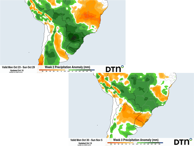
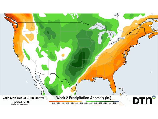
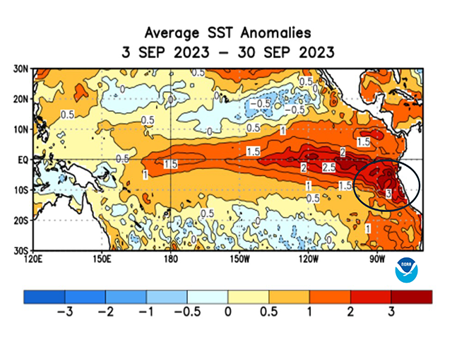
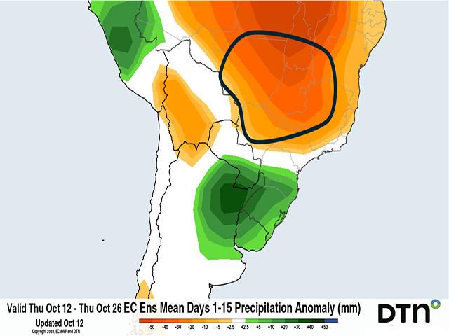
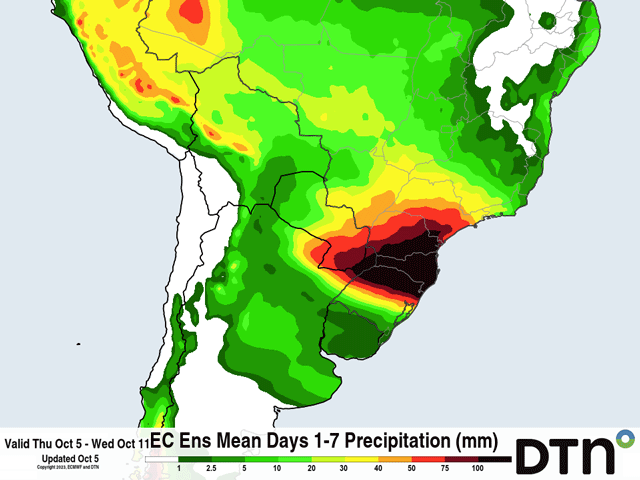
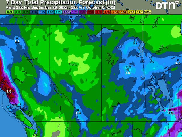
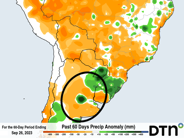
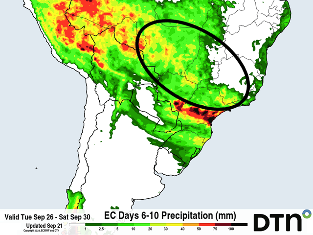
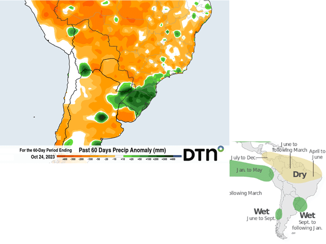
The rainfall pattern across South America has been typical of El Nino, but that has been taken to the extremes so far. Here's a closer look at what has been happening and how it has affected South American crops.