

by
Bryce Anderson
,
Ag Meteorologist Emeritus
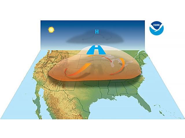
The U.S. is now on a three-year run of damaging June upper-air heat domes thanks to the Texas dome of 2023.