Ag Weather Forum
Recap of the 2023 Crop Season Weather So Far

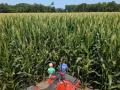
It has been a rough season for a lot of farmers during the 2023 season. Almost all areas of the country have been in some form of drought at some point in the year and stretches of heat have given a lot of attention to the weather patterns throughout the summer. Weather is a typical focal point for markets and producers, but it became a much more highly visible entity given early-season struggles.
LA NINA HANGOVER THROUGH SPRING
Winter tried to hold its grip on the northern portions of the U.S. this spring as La Nina conditions in the Pacific slowly faded away to neutral. Heavy snowpack from a very active winter season across the Northern Plains and Upper Midwest took a long time to melt off. Colder air stuck around well into May, producing late frosts for a lot of areas, and planting delays for a second year in a row across North Dakota. Other areas in the eastern Midwest had planting delays due to wet conditions and cooler soil temperatures, though not to a great degree outside of Michigan and Ohio.
In April, a ridge set up over Hudson Bay, eastern Canada, and into the Great Lakes which produced a block in the upper-level pattern. Storm systems were forced to go around it either through northern Canada or across the Southern Plains and through the Southeast. That gave widespread rainfall, and some late-season snow, to areas that had been in deep drought for the past three years due to La Nina across much of the Plains. While drought was not eliminated across the Central Plains, it essentially was across Texas, the southwestern Plains, and the Northern Plains. Ranchers out in the High Plains saw the largest benefits from the pattern from mid-May to through the spring season as El Nino quickly developed by early June, a signal for more promising temperature and rainfall pattern for the summer season. It would have to wait for the Corn Belt, however.
DROUGHT BECOMES WIDESPREAD ACROSS THE CORN BELT
That eastern Canadian ridge did no such favors for the majority of the Corn Belt, however. Though temperatures remained mild and not overly extreme through mid-June, it was certainly dry. Areas of the Corn Belt that had adequate or surplus soil moisture quickly developed flash drought from mid-May through mid-June as precipitation was hard to come by and was a rare occurrence. The switch to summertime temperatures quickly used up the available subsoil moisture early in the growing season, setting up the need for rain to be frequent and steady through the rest of the summer to save the crop.
With how poor conditions were looking, comparisons in mid-June were being made to the 2012 drought year, one that saw drought conditions and heat worsen throughout the summer. In fact, drought was more widespread this year than in 2012 by that point in the season. However, the forecast kept calling for better rainfall and temperatures afterward. It took some time, but eventually, that did happen.
P[L1] D[0x0] M[300x250] OOP[F] ADUNIT[] T[]
SUMMERTIME RAINS FINALLY ARRIVE
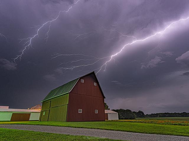
It did not occur all at once but came in streaks and blotches through the Corn Belt. Starting mostly with the southern end, thunderstorms started showing up in late June. And while heat started to build up across the Southern Plains and Southeast, the edge of that heat produced significant precipitation, culminating in bouts of severe weather and a derecho that moved across the Iowa-Missouri border through southern Illinois and into Indiana on June 29. While the severe winds and hail damaged the early-season corn, knocking it over, the rainfall that came with it allowed most of the crop to recover.
The pattern continued to show bulging heat across the south and as it moved northward, so did the rain. Additional storm systems coming out of Canada helped northern areas later in July. Where these streaks missed, drought and crop conditions worsened, but were mostly temporary as rain largely filled in across most of the Plains and Corn Belt.
Overall, the month of July featured below-normal temperatures for many areas except the West and Texas, but that did not mean that heat was not an issue. Dealing with low soil moisture due to the early drought, heat-stressed crop development where rains could not keep up. The last full week of July was the capper to the heat as widespread 90s Fahrenheit moved across the majority of the country, with several days over 100F between the Rockies and the Mississippi River, as well as record heat in the Southwest. It was not an extended heatwave for most areas though, as a cold front moved through the Corn Belt over the final few days of July, bringing relief to the heat and widespread rainfall to many areas. South of that front, it has continued to be very hot, which looks to be a feature in the forecast for a lot of August.
The drought that built up over the Corn Belt has been chipped away over the last month. But looking at the data from the National Drought Mitigation Center, while the coverage of drought has lowered slightly from 58.5% on June 20 to 55.6% on July 25, the area in D3 and D4 drought, the two highest categories of drought, has increased from 2.6% to 5.0% in the Midwest region. That does not include the Dakotas, Nebraska, or Kansas, the latter two states have had continued drought coverage by the Drought Monitor. Rainfall streaks have been missing some areas more consistently and the overall good rainfall pattern that has developed over the last few weeks has not been as widespread as hoped.
REST OF SUMMER FORECAST QUESTIONABLE, BUT LIKELY FAVORABLE
The forecast for the rest of August does feature a more beneficial pattern for the Corn Belt in particular, but most of the country as well. A trough will be building across the middle of the country starting August 6 and that pattern is modeled to be in place to some degree through at least the middle of the month and probably the third week as well. Cooler temperatures and bouts of rain should help keep the drought from getting worse for most areas. If rains happen in the right spots, we may see drought decreasing over the month, an overall unusual situation for August that typically sees drought increasing.
Heavy rain has already been falling since Aug. 1 across the lower Missouri Valley and is shifting slightly into the Mid-Mississippi Valley for Aug. 2-3. These areas are in some of the worst drought situations in the country and will surely benefit from the rain, given no damage from flooding.
The end-of-the-month forecast is still in the air, however. Models do not show a consistent signal moving forward. They could be indicating a continued active pattern of sporadic showers and thunderstorms like we saw in July, but they also favor a return of the heat. They have been doing that in the extended range all summer long, however. Whether looking at the American GEFS or the European Extended Ensemble, both have tended to show heat across a wide area beyond the 10-day time frame all summer long, which of course has not been the case. They have had difficulty with how the pattern will look until it comes into the 10-day time frame.
History suggests as El Nino gains more influence with time, a continued active pattern is the most likely scenario, and one with less heat for the Corn Belt. The far south may not be as lucky unless a rogue tropical system develops, a low-probability event for a strengthening El Nino event.
CORN AND SOYBEAN YIELDS WITH POTENTIAL, THOUGH UNCERTAIN
Putting everything together, it becomes difficult to determine what effect the early drought has had on the season and how the following rainfall in July and August will shape the corn and soybean yields across the country. Without the drought in the late spring and early summer, the weather pattern over the Corn Belt would have been nearly ideal with limited heat and overall widespread rain. That drought really set the tone for the season though, and gives pause to any forecast for record yields.
Thinking abstractly, it would make sense to see some reduced yields below trend line for corn. But as long as soybeans continue to have good rainfall in August, that crop could see close-to- or above-trend yields yet on a national level. The more granular, detailed information about yields will be more interesting though, and may affect the economics in each locality.
That is why this year's DTN Digital Yield Tour will be so important and interesting. Starting August 7, DTN will partner with Gro Intelligence to bring you a more accurate and detailed look and how this season's corn and soybean crops are doing, and if the early season drought can be overcome by the subsequent rainfall. Gro's crop modeling techniques have certainly improved over the past years and gave us an earlier indication about the poorer health of the corn and soybean crops in 2022. What will they show for 2023? Stay tuned to dtnpf.com for more information.
To find more weather conditions and your local forecast from DTN, head over to https://www.dtnpf.com/…
John Baranick can be reached at john.baranick@dtn.com
(c) Copyright 2023 DTN, LLC. All rights reserved.
Comments
To comment, please Log In or Join our Community .