
The jet stream is going to split into two pieces this week, but both a northern jet and a southern one look to remain active across North America, pushing storm systems through that produce regular rainfall.

The jet stream is going to split into two pieces this week, but both a northern jet and a southern one look to remain active across North America, pushing storm systems through that produce regular rainfall.

Wet conditions are leading to the prospect of a four-year low in France's wheat production.

A strong cold front will move through the Plains on Monday and bring a significant risk of severe weather, including long-track tornadoes, massive hail and a line of damaging winds.

A strong cold front will move through the Plains on Monday and bring a significant risk of severe weather including long-track tornadoes, massive hail, and a line of damaging winds.

Harsh springtime dryness in Kansas wheat areas shows the loss of El Nino winter moisture benefits.

Multiple rounds of severe weather and heavy rain ran through the middle of the U.S. late last week and weekend, bringing flooding rains and storm damage. They also delayed planting. But all was not bad as rain has helped increase soil moisture across a vast area.
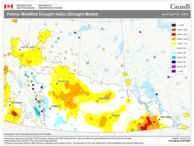
An active storm track in and around the Canadian Prairies won't bring a lot of needed precipitation, but may keep producers out of their fields.
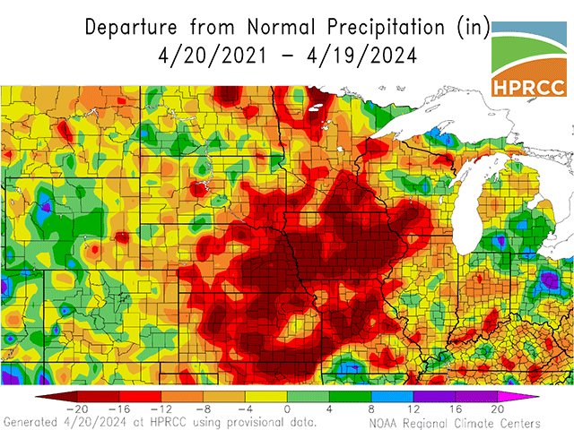
The forecast change from El Nino to La Nina increases concern about soil moisture reserves for corn and soybean crops.
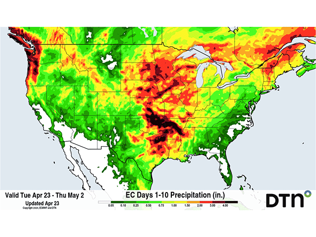
Several storm systems will line up in a pattern that will promote widespread precipitation through much of the Plains and Midwest, including dry areas which missed recent storm systems. A very active pattern is set up to start April 25 that should last into early May.
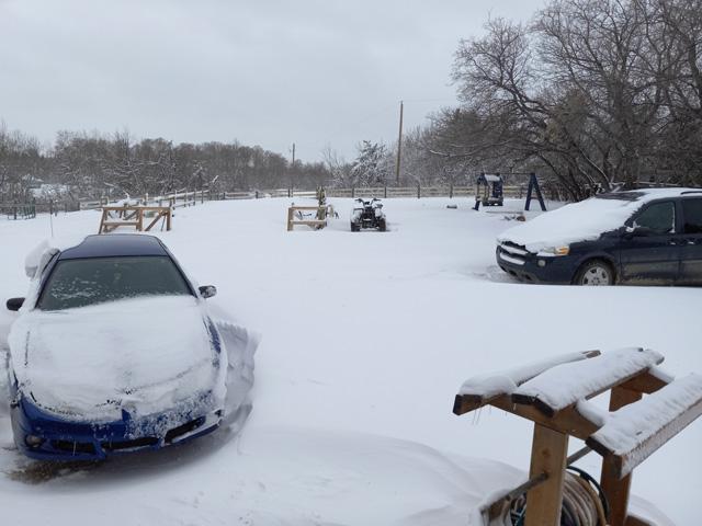
Scattered showers turned into heavy snow this week as a system and low temperatures combined to bring back winter for a brief period. The snow will eventually help to moisten soils prior to spring planting and a more active pattern is likely to set up later next week.
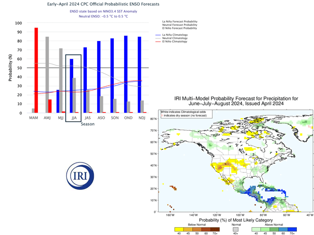
The International Research Institute for Climate and Society's summer forecast suggests summertime dryness due to La Nina development.
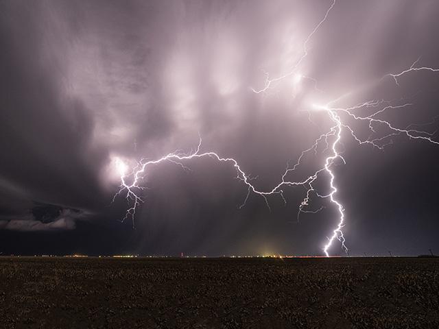
A long and drawn-out system, or pair of systems, will move through the country this week and weekend. Areas of heavy rain will be welcomed in some places and not in others, causing some delays to early planting progress.
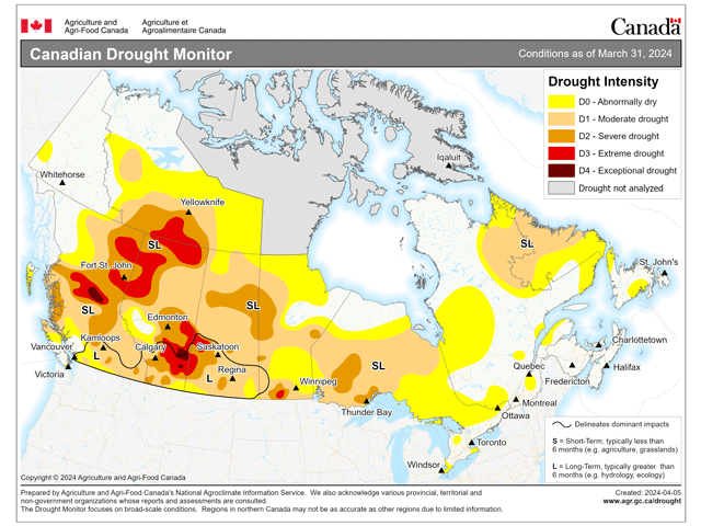
Precipitation during the last six months has been mixed, but drought covers the overwhelming majority of the region as producers begin to think about planting in the Canadian Prairies. Some relief is on the way, but an active spring and summer period are going to be...
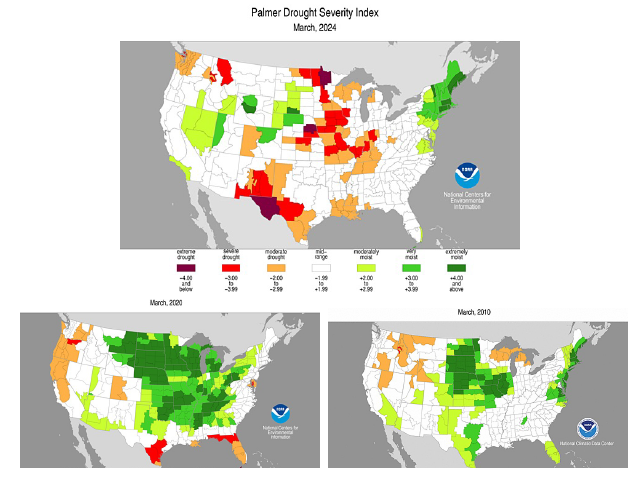
The well-regarded Palmer Drought Severity Index shows much less soil moisture now versus analog years 2010 and 2020.
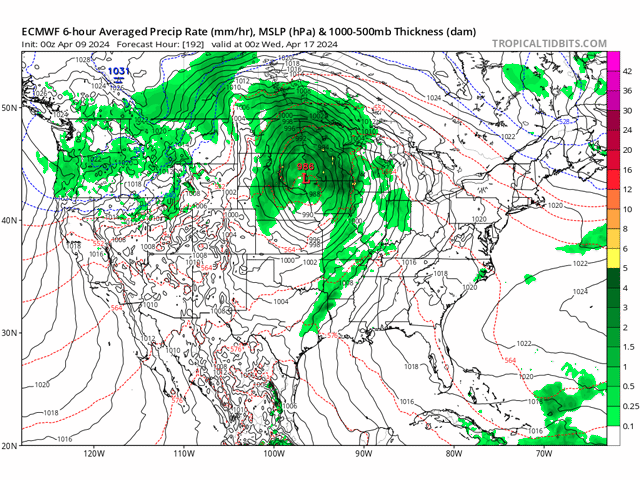
The weather pattern across the U.S. will remain active through mid-April as another significant system from the West could provide widespread precipitation, strong winds and storms to the Central U.S.
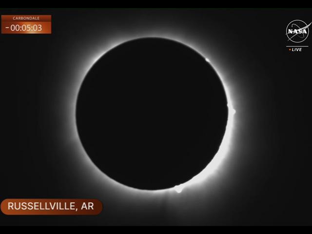
I missed out on the 2017 eclipse but made sure I didn't miss the next one in 2024.
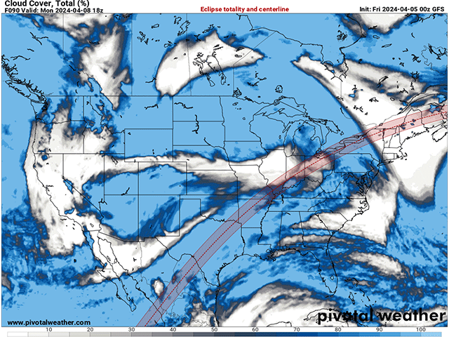
All eyes will be upward on April 8 as the moon blocks out the sun for a total eclipse. But will we see the spectacle or clouds instead?
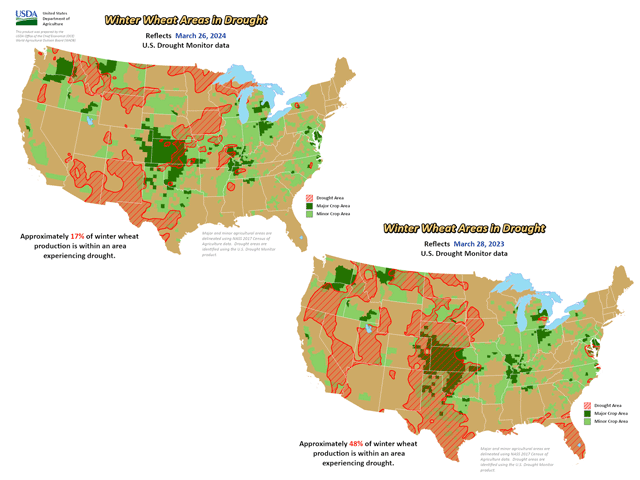
Major U.S. winter wheat areas in drought are less than half compared to a year ago thanks to El Nino-enhanced precipitation so far in 2024.
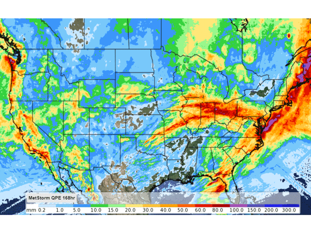
An active pattern continues to bring large storm systems through this spring, which has increased soil moisture in a lot of areas of the country. With spring planting starting up across the south, and those in the north eyeing their start, soils will likely start with some good...
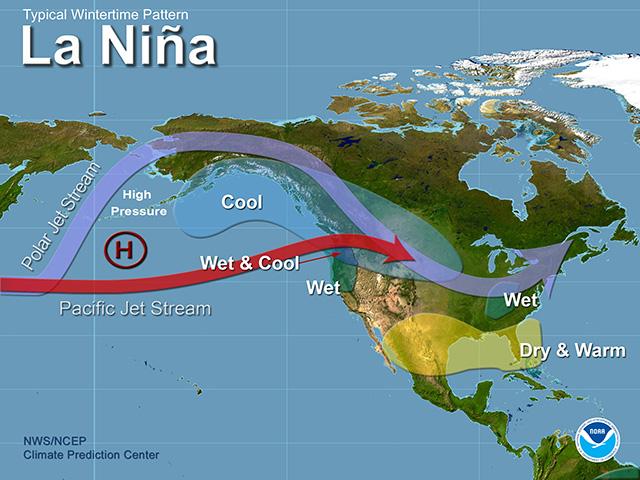
A very strong super El Nino this winter is quickly breaking down and La Nina is forecast to develop this summer. Assuming it does, which is highly likely, here's what we can expect to see this summer and beyond.
DIM[2x3] LBL[blogs-ag-weather-forum-list] SEL[[data-native-ad-target=articleList]] IDX[2] TMPL[news] T[]
DIM[2x3] LBL[blogs-ag-weather-forum-list-2] SEL[[data-native-ad-target=articleList]] IDX[5] TMPL[news] T[]