

Ag Weather Forum
Heavy Snow and Rain This Week Will Delay Fieldwork Progress
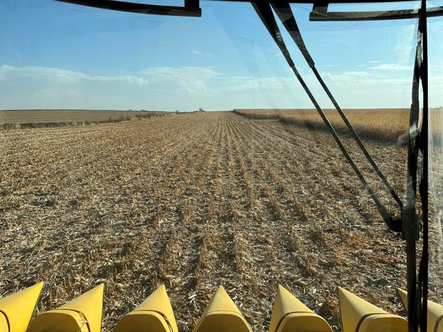
This past weekend featured rather pleasant conditions across much of the Corn Belt as producers were able to get back in the fields and make more progress. Unfortunately, challenges lie ahead for those who are trying to continue fieldwork this week across the central United States.
The weather pattern turns active across the middle of the country throughout this week as multiple storm systems will provide areas of widespread rainfall to the Southern Plains, Central Delta, and Southern Midwest. Meanwhile, the season's first major snowfall will take place across the Dakotas and northern extents of the Midwest. With persistent rain showers, areas of snow, and cold weather returning, there is a high risk for fieldwork delays.
Compared to last week, the central U.S. will have an active weather pattern this week due to a shifting upper-air pattern. Last week, an upper-air ridge extended across the West while an upper-air trough was in the East. This week, those features have shifted east and a trough is developing across the western U.S. while a ridge advances east into the eastern U.S. The most ideal area for storm systems to form is right in between the trough and ridge, which happens to be across the central U.S. this week.
A system in the Southern Plains early this week will be interacting with tropical moisture from former Hurricane Norma, which made landfall in southern Baja California earlier this past weekend. As the system interacts with tropical moisture, localized heavy rainfall is possible in parts of Texas and Oklahoma through the middle of this week. From western Texas into central Oklahoma, a swath of 1.5 to 3 inches of rainfall is possible with locally higher amounts up to 4 to 5 inches. This forecast rainfall is promising to areas of the Southern Plains that are currently experiencing D2 (Severe) and D3 (Extreme) drought levels. Not only does the rainfall have the potential to revive topsoil moisture in some fields, but it could also benefit emerging wheat.
P[L1] D[0x0] M[300x250] OOP[F] ADUNIT[] T[]
Farther north across the Corn Belt, scattered rain showers will build through much of the area along with some occasional thunderstorms. However, for the northern areas of the Corn Belt, rain showers will make a transition to snowfall as lower temperatures make an arrival by the middle of this week.
Across the state of Iowa, most locations will see near 1 inch of rain through Friday with locally higher amounts up to 2 inches. Rainfall totals will be similar across northern Missouri and northern Illinois through Friday.
Higher rainfall totals are expected across southern Minnesota and northern Wisconsin, with rain topping out near 2 to 3 inches throughout these areas by Friday. With not much of a break expected between rounds of showers this week, fieldwork delays are likely. Thankfully, quite a few producers were able to make progress this past weekend with mostly dry conditions and mild temperatures in place.
This week's forecast looks even more dismal for fieldwork progress across northern areas of the Corn Belt, specifically across the Dakotas. A system will enter the Northern Rockies on Tuesday and move into the Dakotas by late Tuesday and continue across the area through Wednesday and Thursday. Precipitation is expected to start out as rain in the western Dakotas before transitioning to snow.
By the end of the day Wednesday, snowfall totals could be near 6 inches across northwest North Dakota. An additional 6 to 12 inches of snow could fall in western North Dakota on Thursday as well. Heavy snowfall is not going to benefit fieldwork progress for producers in this area and neither will the cold conditions that are expected to arrive later this week.
A dramatic temperature swing is also anticipated this week across the central U.S. as a cold air mass from the Canadian Prairies sinks into the region. Through the middle of this week, temperatures will remain above to well-above normal with temperatures approaching 15 to 20 degrees Fahrenheit (F) above normal across the Central Plains and Mid-Mississippi Valley. Although, low temperatures will start to enter the Northern Plains by Thursday and continue to dip south through the remainder of the week and into this weekend across the western half of the country. By Saturday and Sunday, temperatures are forecast to be 15 to 20 degrees F below normal in the western Dakotas. Afternoon high temperatures on Saturday across North Dakota may only approach the upper teens to upper 20s.
With the well-below-normal temperatures expected across the north-central U.S. later this week, producers in the Dakotas may need to wait quite a bit longer to get back out into the fields compared to producers farther south in the Corn Belt. The areas of heavy snow may lend to temperatures staying below normal.
While producers outside of the Dakotas may not have to deal with nearly as much snow, the cooler weather will certainly not expediate the drying process to get back into the fields. This week's weather is going to offer challenges to those producers still trying to get fieldwork done but there is some hope in sight as drier conditions may return by early November as the upper-air pattern shifts yet again.
To find more regional weather conditions and your local forecast from DTN, head over to https://www.dtnpf.com/…
Teresa Wells can be reached at teresa.deutchman@dtn.com
(c) Copyright 2023 DTN, LLC. All rights reserved.

Comments
To comment, please Log In or Join our Community .