
Ag Weather Forum
Details of Flash-Dry September

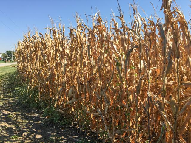
A look at Midwest weather conditions during the last few weeks of the growing season shows that heat and dryness brought flash-dry conditions to the western and central Midwest.
Sharply above-normal temperatures covered these portions of the region during Sept. 1-27, according to the Midwest Regional Climate Center. Northern Illinois, northern Indiana and southern Michigan had mean temperatures (average of daytime high and low readings) that were 4 to 5 degrees Fahrenheit above normal. The remainder of the western and central Midwest saw temperatures that were 2 to 5 degrees F above normal. Daytime high temperatures were notably hot: 4 to 7 degrees F above normal in most of the Midwest, including a record 93-degree-F high temperature in Rockford, Illinois, on Sunday Sept. 19. Late September saw values of around 15 degrees F above normal, and record-category high temperature values of 86 to 91 F in central and north-central Iowa.
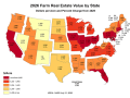
Dry conditions are also prominent. Most of Iowa and Missouri, northern and central Illinois, and Wisconsin have logged from 25% to 75% below-normal precipitation during the first 27 days of September; and precipitation in west-central Iowa is from 90% to 95% below normal during the Sept. 1-27 time frame.
Station September precipitation totals in this dry area and comparisons with normal include the following:
P[L1] D[0x0] M[300x250] OOP[F] ADUNIT[] T[]
ILLINOIS: Peoria 1.09 inches, 2.29 inches below normal; Rockford 0.53 inch, 2.99 inches below normal; Chicago 1.23 inches, 1.86 inches below normal; Moline 0.87 inch, 2.36 inches below normal.
IOWA: Des Moines 0.80 inch, 2.28 inches below normal; Waterloo 1.31 inches, 1.73 inches below normal; Mason City 1.96 inches, 1.38 inches below normal; Ottumwa 1.03 inches, 2.37 inches below normal; Marshalltown 0.73 inch, 2.37 inches below normal; Lamoni 1.19 inches, 2.40 inches below normal; Ames 0.71 inch, 2.50 inches below normal; Cedar Rapids 1.58 inches, 1.72 inches below normal; Davenport 0.63 inch, 2.74 inches below normal; Dubuque 1.30 inches, 2.41 inches below normal.
MISSOURI: St. Joseph 1.18 inches, 1.91 inches below normal; Kansas City 2.10 inches, 1.82 inches below normal; Kirksville 0.43 inch, 3.12 inches below normal; Columbia 2.45 inches, 1.26 inches below normal.
MINNESOTA: Minneapolis 1.48 inches, 1.45 inches below normal.
WISCONSIN: Eau Claire 1.85 inches, 1.70 inches below normal.
The central U.S. has not been entirely dry in September. The Ohio Valley through eastern Great Lakes saw precipitation totals from 50% to 200% above normal, with the greatest departures in central and southern Indiana. And, south of the Ohio River, Kentucky and Tennessee logged amounts of two to three times the normal amounts.
Producer comments about season ending conditions and impact on harvest are available in this DTN Field Roundup article by DTN Staff Reporter Emily Unglesbee: https://www.dtnpf.com/….
Bryce Anderson can be reached at Bryce.anderson@dtn.com
Follow him on Twitter @BAndersonDTN
(c) Copyright 2021 DTN, LLC. All rights reserved.
Comments
To comment, please Log In or Join our Community .