
South America Calling
Southern Brazil Safrinha Corn Faces Possible Frost

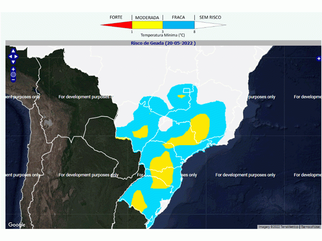
So far, southern Brazil has lucked out and escaped the potential frost conditions this week. A cold front went through Brazil Sunday and Monday. The coldest air of the season filled in behind that front. Average temperatures have been 5 to 10 degrees Celsius (10 to 20 degrees Fahrenheit) below normal since May 16 across Rio Grande do Sul and Parana, and from southern Mato Grosso to southern Minas Gerais and points southward since May 17. That could have been enough to produce frosty conditions and significant risks to southern Brazil's safrinha corn crops that are still in pollination and early grain-fill stages. Coffee, sugarcane, and cocoa have also been at risk.
But so far, the strong system that brought the risks has also insulated the region from it. The best weather conditions to produce frost are under a cold air mass with clear skies and calm winds. Fortunately for southern Brazil, the low-pressure center responsible for bringing in the cold air has sat over the region, bringing in plenty of cloud cover and some decent winds. Clouds absorb infrared radiation emitted from the surface, then re-emit that energy back, acting somewhat like a blanket and keeping temperatures from dropping too far. Winds have remained elevated. Even overnight, when winds generally calm down, wind speeds have been sustained in the 8-to-20 kilometers per hour (5-to-10 miles per hour) range, enough to keep the cooling air at the surface mixing with slightly warmer air above the surface. That also has the effect of keeping temperatures from falling too far.
P[L1] D[0x0] M[300x250] OOP[F] ADUNIT[] T[]
Temperatures this week have had a hard time falling below 4 or 5 C (39 to 41 F) on any of the official measurement stations throughout southern Brazil. There may have been areas in between the observations that have seen localized colder conditions, but frost likely has not been a widespread weather factor in the region.
That is about to change. The low-pressure center is quickly moving well offshore on May 19, pulling the cloud cover and stronger winds away with it. Skies will become clear and winds will turn calm for the next several nights. However, the coldest of the air is starting to moderate as the low-pressure center pulls away and more sun shines across the countryside. Conditions will be best to still produce areas of frost May 20, possibly on May 21 as well, but then temperatures will increase too much.
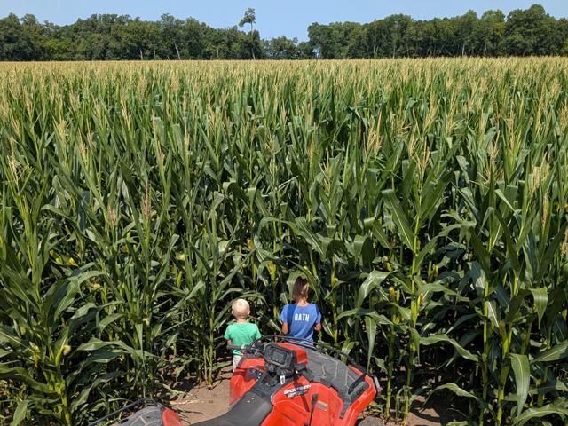
The southern states of Mato Grosso do Sul and Parana, which account for roughly 30% of the safrinha (second-crop) corn production in Brazil, are still hoping for a good corn crop. Rainfall in the region has been adequate to abundant since the crop started to be planted in February. That is in stark contrast to central Brazil, where the wet season ended more than two weeks early. The region has been dealing with critical soil moisture for weeks.
The country of Brazil has been hoping that southern states could make up for at least some of the likely reduced production farther north. Production estimates from both CONAB and the USDA have kept total corn production at a record of 114.6 million metric tons (mmt) and 116.0 mmt, respectively. Should frost occur on a wide enough scale, damage would be significant and exports out of Brazil would be much lower, favoring even more export activity from the U.S.
To find more international weather conditions and your local forecast from DTN, head over to https://www.dtnpf.com/…
John Baranick can be reached at john.baranick@dtn.com
(c) Copyright 2022 DTN, LLC. All rights reserved.
Comments
To comment, please Log In or Join our Community .