
Market Matters Blog
Swollen Upper Mississippi River Stalls Barge Traffic

Minnesota is no stranger to snow. However, this winter saw Duluth break a record with over 139 inches (through April 20), and the Twin Cities is at 90.3 inches.
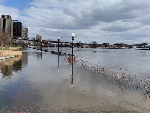
That total in the Twin Cities is what is causing the Mississippi River at St. Paul to flood with the help of its tributaries. To put it in perspective, the annual average snowfall for an entire season is 51.2 inches.
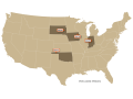
According to American Commercial Barge Line, the Upper Mississippi starting at Meekers, near Hastings (UM 418), northbound to St. Paul (UM 837) is currently closed for barge traffic. By April 23, all locks starting with Lock 17 (UM437) up through Lock 3 (UM796), will be closed and are expected to be down between 12 to 15 days.
On April 17, the U.S. Army Corps of Engineers (USACE), St. Paul District, closed Lock and Dam 4, near Alma, Wisconsin to all commercial and recreational traffic due to the high Mississippi River water levels. As the water continues to rise and head south, more lock closures are expected. The locks are projected to be closed for around a week, but the exact timing will depend on the river levels and when it is safe to resume navigation, according to USACE.
Some predictions are calling for closures all the way through Lock 20, with the projected opening to be May 15 should that happen. Until that last lock opens back up when the river falls back to a safe level, everything above that will be inaccessible by tows heading north or south.
In other words, the Upper and Mid-Mississippi River is closed for business until further notice. Fortunately, there is not a great demand at the Gulf for corn or soybeans right now.
RED RIVER OF THE NORTH
The neighboring Red River to the north of the Twin Cities is also spilling out of its banks. While this river has no barge traffic, the flooding of the small streams and the Red River will slow farmers who are trying to get into the fields to start spring planting.
P[L1] D[0x0] M[300x250] OOP[F] ADUNIT[] T[]
As of April 23, the NWS noted that, "Rapid snowmelt is occurring and will continue to cause flooding. Latest satellite indicates the majority of overland flooding across western Clay County. Red River basin river flooding continues. Slow rises are still ongoing across the far northern basin, while the new snowmelt will result in a slower recession or long slow crest from the central and southern parts of the basin."
The National Weather Service (NWS) added, "The maximum river stage in the 24 hours ending at 8:15 a.m. CDT Sunday April 23 was 29.7 feet. As of 12:15 p.m. Saturday, April 21, the Red River levels at its mainstem were at 29.69 feet, which is only a few inches below major flood stage, but it remains in moderate flood stage."
"It's going to be a very slow decline and that's primarily due to having fresh snowpack that we just received recently that's going to be melting and making its way into the river," said Amanda Lee, service hydrologist at the NWS.
In Grand Forks, the river hadn't been rising as quickly in the last day or so, according to Lee. "The service predicts it will crest at 41.1 feet there around Sunday evening to Monday morning."
The river level in Grand Forks is currently sitting at 40.68 feet. Anything between 40 and 45 feet in that city is considered a moderate flood.
According to the NWS, the northern portions of the mainstem Red River will crest in late April/early May. Ongoing snowmelt may lead to additional rises or prolong high levels within several tributaries.
Between the late snow on top of heavy snow all winter, many farmers in North Dakota, South Dakota and Minnesota are waiting for the snow to melt and the temperatures to rise again. Farmers along the Red River in North Dakota and Minnesota still have to deal with cold weather and snow melting, but some are seeing overland flooding on their fields.
So, the wait is on as to how all this will affect spring wheat and corn planting. The question is which crop may be left out and if we will see any prevented planting acres again this year.
Mississippi River at St. Paul hydrograph: https://water.weather.gov/…
Red River of the North at Fargo: https://water.weather.gov/…
Minnesota snowfall totals throughout the state: https://www.dnr.state.mn.us/…
Mary Kennedy can be reached at mary.kennedy@dtn.com
Follow her on Twitter @MaryCKenn
(c) Copyright 2023 DTN, LLC. All rights reserved.
Comments
To comment, please Log In or Join our Community .