Ag Weather Forum
Heavy Snow, Cold Weather Move Through the Canadian Prairies, More Rain on the Way
Early planting was likely in progress across the Canadian Prairies before a major storm system moved through the region this week. It was a long and drawn-out storm system that started with scattered showers and mostly rain on April 15 before transitioning to snow as colder air moved down from Alaska and the Yukon.
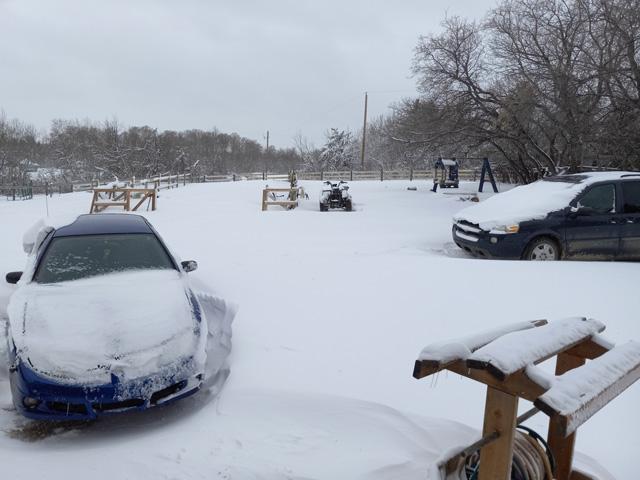
That snow became heavy across northern Saskatchewan and northern Manitoba and combined with strong winds to produce a lot of drifting snow and significant snow cover for a lot of the region.
Trying to measure snowfall amounts in these conditions can be a chore and wildly inaccurate, but estimates of 15 centimeters (about 6 inches) or more were noted from Saskatoon northward in Saskatchewan as well as the northern portions of the Interlake region in Manitoba. Amounts in Alberta were more scattered and localized.
P[L1] D[0x0] M[300x250] OOP[F] ADUNIT[] T[]
But when melted down to liquid that will eventually move into the topsoil, total precipitation amounts of up to 20 millimeters (0.8 inches) in Alberta, 5-20 mm (0.2-0.8 inches) in southern Saskatchewan, and 20-50 mm (0.8-2.0 inches) in northern Saskatchewan and all of Manitoba, will help to reduce drought across the region.
As mentioned last week here, https://www.dtnpf.com/…, drought is a major issue for the Canadian Prairies at the start of 2024 growing season. Though the areas in central Alberta and west-central Saskatchewan were not on the receiving end of the heaviest rain, they did get some. And significant drought in southwest Manitoba certainly did.
The other good news for the region is that nearly 100% got at least some precipitation, though in Alberta that was certainly more limited than farther east. It will just take some time for that snow to melt.
Usually in mid-late April, that would be rather quick as the sun angle has dramatically increased in recent weeks. Also throw in that soil temperatures were thawed prior to the snowfall and melting will take place from below. Cold air temperatures that are in place here on Friday will rise during the weekend. Highs between 5 and 10 Celsius (40 and 50 Fahrenheit) should do the trick by early next week.
And the pattern may be active again next week. A small disturbance will move through the region April 21-23 with scattered showers, likely as rain. And then the pattern gets more interesting for late in the week and weekend. A trough will set up in the West and though the deeper portion of it will be in the southwestern United States, the northern end will probably be more progressive through Canada. That sets the stage for some more active weather heading into May, and a chance at further drought reduction.
To find more international weather conditions and your local forecast from DTN, head over to https://www.dtnpf.com/…
John Baranick can be reached at john.baranick@dtn.com
(c) Copyright 2024 DTN, LLC. All rights reserved.


Comments
To comment, please Log In or Join our Community .