Ag Weather Forum
Australia Weather Bureau Notes El Nino Near Its End
One of the most authoritative agency voices when it comes to Pacific Ocean El Nino or La Nina commentary is that of the Australia Bureau of Meteorology (BOM), headquartered in Melbourne, Australia. The agency has a long history with the El Nino-Southern Oscillation (ENSO) back-and-forth in the Pacific. A prime example of this history is the agency's cataloguing of the Southern Oscillation Index (SOI)--the barometric pressure comparison between Darwin in far northern Australia and the island of Tahiti in the central Pacific Ocean.
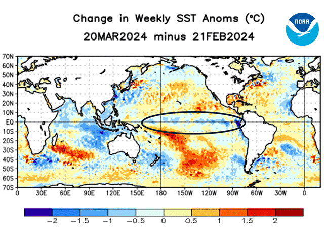
The most recent commentary by the BOM regarding the state of affairs in the Pacific has a straightforward declaration: "El Nino continues and is near its end," the commentary noted. "Climate models indicate sea surface temperatures in the central tropical Pacific are expected to return to ENSO-neutral later in autumn 2024." (A reminder that autumn in Australia comprises the months of March, April and May -- which are spring months in the Northern Hemisphere.)
Analysis details highlighted by the BOM feature below-average cloudiness near the equatorial International Date Line -- a sign that atmospheric moisture due to El Nino is starting to diminish. The bureau's discussion also notes that the 90-day value of the SOI is in neutral territory. The 90-day SOI value on March 26, 2024 was at -3.00, well within the range of ENSO-neutral numbers.
P[L1] D[0x0] M[300x250] OOP[F] ADUNIT[] T[]
When it comes to future developments, the BOM discussion agrees with calls from other international weather and climate agencies for neutral Pacific conditions during the next few months. "International climate models suggest the central tropical Pacific Ocean will continue to cool in the coming months, with four out of seven climate models indicating the central Pacific is likely to return to neutral El Nino -- Southern Oscillation (ENSO) levels by the end of April (i.e., neither El Nino nor La Nina), and all models indicating neutral in May," the BOM discussion said.
Further out, the situation gets more uncertain, leading to some caution by the Australia agency. "While three out of seven international models are predicting a La Nina by late (southern hemisphere) winter, El Nino and La Nina predictions made in early (Southern Hemisphere) autumn tend to have lower accuracy than predictions made at other times of the year," the agency comment noted. "This means that current forecasts of the ENSO state beyond May should be used with caution. ENSO forecasts have historically had their lowest skill for forecasts issued in April, with skill increasing from May."
A final note by the Australia weather experts has to do with how record-warm ocean waters may complicate the ENSO forecasting effort. "The oceans have been the warmest on record globally since April 2023. Sea surface temperatures continue to increase with temperatures in February 2024 setting a record for that month, and March 2024 on track to be the warmest March on record," the BOM discussion noted.
"The Atlantic Ocean in particular is showing exceptional and prolonged warmth in sea surface temperatures. This global pattern of warmth is affecting the typical, historical global pattern of sea surface temperatures associated with ENSO variability. Since we have never observed global sea surface temperatures like this before, inferences of how ENSO may develop in 2024 that are based on past events may be less useful."
That final comment is truly a cautionary one as forecasting navigates the warmest conditions on record around the globe.
DTN Ag Meteorologist John Baranick has written in his blog this week, "5 Things to Know About a Developing La Nina" -- you can find it at https://www.dtnpf.com/….
Bryce Anderson can be reached at Bryce.Anderson@dtn.com
(c) Copyright 2024 DTN, LLC. All rights reserved.


Comments
To comment, please Log In or Join our Community .