
Ag Weather Forum
Small Planting Window Open for North Dakota, Minnesota
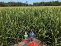
There are a few euphemisms that I could use to describe the grit and tenacity U.S. farmers have, but I'll just say, "I'm impressed." Despite two systems that brought widespread moderate to heavy precipitation to the Corn Belt last week, farmers worked through it and have nearly brought the planting pace back to average. Two weeks removed from a very slow pace that saw corn planting 28 percentage points and soybean planting 12 points behind the average, weather would not slow down the planters and they were rolling to come within 7 percentage points of average in corn (a 50-percentage-point increase) and within 5 percentage points of average in soybeans (a 38-percentage-point increase).
You can read more details about this week's planting progress here:
I had my doubts that last week would see such a strong continuation in planting progress from the week prior, but here we stand -- the majority of the Corn Belt, Delta, Southern Plains and Southeast are near or ahead of the five-year average planting pace. The only states that are significantly trailing average planting pace by more than 10 percentage points are Minnesota and North Dakota in corn, soybeans, spring wheat and sugarbeets. And you can add in South Dakota for soybeans and extend the planting woes north of the border in eastern Saskatchewan and Manitoba. These areas have been too wet this spring with blizzards and heavy rain events causing some flooding on the Red River of the North, James River, and associated smaller streams. Overland flooding has been a concern since mid-April with every precipitation event that comes through. What was a major drought area in 2021 has quickly turned into a waterlogged mess of delays for producers in the region.
Mother Nature, with the help of La Nina in the Pacific Ocean, has kept the region quite active going back to the winter. And she has not let up just yet. Windows of dryness have been very short, especially this spring, and it has been more than difficult for producers to get out into the field to till or plant. DTN Analyst Mary Kennedy wrote about some of the struggles of area producers in this week's Cash Market Moves column here: https://www.dtnpf.com/…. She also mentions that planting windows for spring wheat are closing. This region of the country is going to need to see the same sort of rapid planting pace that the rest of the country has been employing the last couple of weeks to make some deadlines.
There is some good news and bad news in the forecast. First, the good news. Since May 21, very little rain has fallen in the region. Some spotty showers and a few thunderstorms produced rain on May 23 in spots, but they were fairly localized. Large areas of the Dakotas and Minnesota have stayed dry. The next several days are also expected to be dry with increasing temperatures through the daylight hours on May 27. Add in some abundant sunshine and that is almost a week of fairly dry weather to allow soils to drain. It may allow some good planting progress to pick up in these areas. Soil moisture is high in the region and not everyone will be able to get out and get going. But the bad news is the window is short. Showers will move back into the region Friday night, May 27, with waves moving across the region through Memorial Day weekend into next week. Showers and thunderstorms and severe weather potential will close the short window to end the month. That flips the calendar over to June, when guarantees go out of the window and risks for an early fall frost start to mount. Depending on where upper-level troughs and ridges end up, the wetter pattern could last into the early weeks of June as well. The European model is suggesting the wetter pattern will continue, but the American model is forecasting some drier conditions for that first week of the month.
Mother Nature has not been very kind to planting conditions or nerves, but farmers seem to persevere anyway. I am betting on these folks to find the smaller window and take advantage of it if they can. I am betting I will stay impressed.
To find more regional weather conditions and your local forecast from DTN, head over to https://www.dtnpf.com/…
John Baranick can be reached at john.baranick@dtn.com
(c) Copyright 2022 DTN, LLC. All rights reserved.
P[L1] D[0x0] M[300x250] OOP[F] ADUNIT[] T[]
Comments
To comment, please Log In or Join our Community .