
South America Calling
Possible Central Brazil Rain
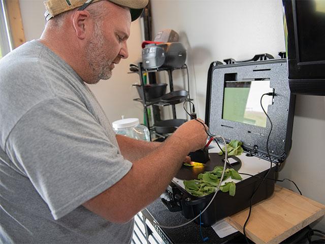
It has been a tough year so far at the farm of Ricardo Arioli Silva in Campo Novo do Parecis municipality in west-central Mato Grosso, Brazil. The wet season started two weeks late and has been underwhelming thus far. "Our first soybeans (are) flowering and very short. Like maybe 30 centimeters (about 12 inches) high. You can see the soil so far. And we are irrigating our first soybeans because it's blooming," Silva stated in a conversation with DTN Senior Ag Meteorologist Bryce Anderson. Being able to see the soil indicates that the canopy is still wide open.
The past week has been a big reason for the concern and has required Silva to irrigate the soybeans that have started the bloom phase. Dryness has come back into most of central Brazil. Showers were more plentiful over the south, from Mato Grosso do Sul and Parana to Rio Grande do Sul. But for Mato Grosso, the country's largest soybean producing state, it has been a struggle. "I (am) miss(ing) 50, 60, maybe 100 millimeters (2 to 4 inches) of rain ... We also have cattle and the pasture is not in good shape also. So it's a really tricky year." Silva continued.
As Silva noted on his farm, soybeans are beginning to bloom, and with temperatures in the upper 30s Celsius (near 100 degrees Fahrenheit) nearly every day, the evaporative losses have been huge. Without rain soon, crops will start to wilt and major yield losses may be imminent. Even with irrigation, Silva is not optimistic on this year's crop. "I believe that at least in our region that we will have a loss on yield."
P[L1] D[0x0] M[300x250] OOP[F] ADUNIT[] T[]
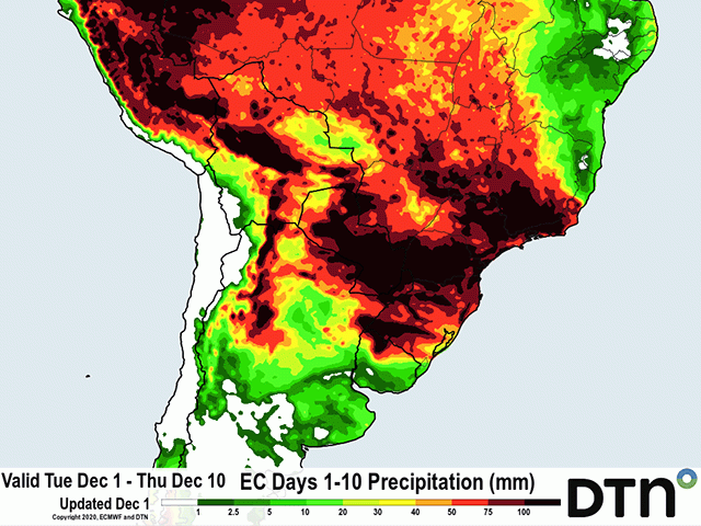
But the rains are expected to come. Models are noting that despite being hot and dry through Dec. 3, rains will move back into the middle of the country. Coverage is also expected to be widespread and amounts likely heavy as rain is forecast to continue for much of the following week.
Estimates from the European forecast model show widespread rainfall amounts of 50 to 100 mm (roughly 2 to 4 inches) of rainfall through Dec. 10 for Mato Grosso, Goias, and Minas Gerais all the way south through Rio Grande do Sul. Of course, this comes with convective thunderstorms and models typically underestimate these types of showers, leaving many areas to receive more than the 100 mm.
The showers may be very timely for much of the region, but some damage may have already been done as Silva fears has already happened, especially for the crop that has already begun to bloom.
Southern areas of the country, from Parana to Rio Grande do Sul, saw those timely showers about a week earlier than their northern neighbors and will have a better chance at saving blooming soybeans and corn nearing reproduction as well. While this portion of the country was dry the prior week, showers after the American Thanksgiving holiday were welcomed in by area producers, seeing rainfall totals of 25 to 50 mm (roughly 1 to 2 inches) and locally up to 100 mm (4 inches) during the last several days.
John Baranick can be reached at john.baranick@dtn.com
(c) Copyright 2020 DTN, LLC. All rights reserved.

Comments
To comment, please Log In or Join our Community .