
Ag Weather Forum
Moisture Still Eludes Western Crop Areas
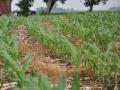
The accompanying image of 7-day total observed precipitation totals (rainfall equivalent) shows in good detail how there is still a "Have" and "Have Not" scenario in effect when it comes to moisture across the central U.S. For the seven-day period ending Monday, March 11 at 7 a.m. CDT, we see some moderate to heavy weekly totals along and east of a line from Owatonna, Minn., to West Plains, Mo. The most notable crowding of this heavier precipitation is across all of eastern Iowa into western Illinois, with more than two inches (liquid equivalent) estimated. Some examples are Waterloo, Iowa, with 2.27"; Moline, Ill., 2.02"; and Kirksville, Mo., 2.63". The Delta has also shared in some of the heavy precipitation. (Data from states grouped in the Ohio Valley was not available for this map.)
But, locations farther west have seen a much more scattered pattern and notably lighter amounts. We have seen several corridors of inch-plus precipitation from western Nebraska north and east, as well as the northern Texas Panhandle into south-central Kansas. But, by and large, the moisture scene has been much more sparse than for areas farther east. Again, for example: Dodge City, Kan., recorded just .09" last week; Guymon, Okla., had just .03"; Scottsbluff, Neb., had just .13"; and Amarillo, Texas, recorded just .13". These areas got no drought relief during the first week of the meteorological spring season.
P[L1] D[0x0] M[300x250] OOP[F] ADUNIT[] T[]
And, for that matter, even the areas that got the heavier precipitation may not get a soil moisture shot in the arm. Four-inch depth soil temperatures Monday morning were below freezing from central Missouri north; so, even the heavy precip areas of eastern Iowa and western Illinois may have seen (or will see after snow melts) that moisture head straight for the river basins. So, there is a lot of actual bona fide soil moisture that is still needed to bolster crop supplies this year.
That makes the 6-10 day forecast have some major clout, because it features a high probability (for such a forecast time frame) of above normal precipitation for the entire Midwest, Delta and Northern Plains. We'll still see some runoff, of course, but to have a chance of avoiding major drought issues again, this is the type of pattern to have in place.
Bryce Anderson can be reached at bryce.anderson@telventdtn.com
Twitter @BAndersonDTN
© Copyright 2013 DTN/The Progressive Farmer. All rights reserved.
Comments
To comment, please Log In or Join our Community .