

Market Matters Blog
After Hitting Rock Bottom, Some US Rivers Near Flood Stage
After months of record low river levels on the Mississippi and Ohio Rivers, river levels have started returning to normal and, in some cases, are nearing minor flood stage.
Gone for now are the rocky river bottom sand bars that grounded barges and caused the inability for some river terminals to load out grain, creating a severe drop in basis for farmers who normally haul their new-crop soybeans to a river terminal at harvest time. Barge lines were stalled or stopped from performing, and one barge line called the consistent low water conditions "catastrophic."
By early January, the river system was in good condition and, heading into February, we saw normal operating conditions, noted Thomas Russell of Russell Marine Group. "Between February and March, we might experience below-normal precipitation levels in the central Midwest. That may cause low water concerns in the St. Louis area. Otherwise, above-normal precipitation in Ohio River Valley will keep the Ohio River and Lower Mississippi well charged. In Baton Rouge and New Orleans, above-normal precipitation in Ohio River Valley will push water levels higher as spring approaches."
In the National Weather Service (NWS) spring flood second update on Feb. 23, NWS said the "overall risk for flooding this spring is above normal along the mainstem of the Mississippi River. The Mississippi tributaries across southeast Minnesota and southwest Wisconsin have near to above normal chances for flooding this spring. The Mississippi tributaries across northeast Iowa have near to below-normal chances for flooding this spring. The greatest chances of flooding this spring are on the mainstem of the Mississippi River." The NWS final spring flood outlook will be March 9. https://www.weather.gov/…
The far Upper Mississippi River is still hibernating as we wait for ice out to be declared on Lake Pepin near Lock and Dam 4 on the Mississippi River. Lake Pepin is the last major barrier for vessels reaching the head of the navigation channel in St. Paul, Minnesota. It is the largest lake on the Mississippi River located on the border between Minnesota and Wisconsin, and it is the last part of the river to break up ice because the river is wider and subsequently the current is slower there than it is in at other parts of the Mississippi River.
Ice measurements at Lake Pepin began on Feb. 17, 2023, by the USACE, St. Paul District, and will continue until they declare the lake ready to allow barges to transit through. They will open the 2023 shipping season once the first barge passes through Lock and Dam 2 in Hastings, Minnesota. A tow pushing barges usually can push through ice that's 12 to 15 inches thick. In the last 30 years, the average opening date of the navigation season declared in the Upper Mississippi River has been March 20. As all the locks start to open after winter maintenance, we will see tows start to position themselves to get up to St. Paul, Minnesota. It is a badge of honor for a tow to push the first barges of the shipping season into St. Paul.
P[L1] D[0x0] M[300x250] OOP[F] ADUNIT[] T[]
For now, water levels look satisfactory, but it pays to keep a watch on the river system because, even if we see spring flooding, steady precipitation in the summer and fall is key to keeping river levels normal for barges to transit.
For a more in depth look at the spring weather, turn into DTN's "Get Set for Spring" webinar as DTN Ag Meteorologist John Baranick will interpret what the long-range weather models say about the season:
Lower Mississippi River current and forecast stage: https://www.weather.gov/…
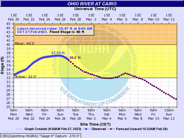
Ohio River at Cairo: https://water.weather.gov/…
Mississippi River at Memphis: https://water.weather.gov/…
Mississippi River at St. Louis: https://water.weather.gov/…
Lake Pepin 2023 ice measurements: https://www.mvp.usace.army.mil/…
Mary Kennedy can be reached at mary.kennedy@dtn.com
Follow her on Twitter @MaryCKenn
Mary Kennedy can be reached at Mary.Kennedy@dtn.com
Follow her on Twitter @MaryCKenn
(c) Copyright 2023 DTN, LLC. All rights reserved.

Comments
To comment, please Log In or Join our Community .