

Ag Weather Forum
Exercise Caution Over Planting Too Early in 2024

The winter of 2023-24 has hardly been a winter at all. Temperatures have been so warm with very few below-normal days that records have been broken across the northern tier of the country. I wrote about the winter that wasn't here: https://www.dtnpf.com/….
The lack of significant cold air for the last few months has meant 4-inch soil temperatures have risen very sharply and very early. The canonical 50-degree Fahrenheit mark has been eclipsed as far north as southeastern Kansas up through southern Ohio according to data from DTN. That mark, and the warm forecast over the next 10-15 days in these areas, may tempt producers to get out into their fields earlier than normal. With a forecast for the summer that is a bit uncertain as La Nina conditions take over in the tropical Pacific Ocean this summer (https://www.dtnpf.com/…), planting early may make more sense to producers in southern areas where conditions are generally pretty good in which to do so.
However, beyond the two-week forecast lies a change in the upper-air pattern that could quickly turn the benefits of an early-planted crop into a poor decision. According to DTN Long Range Weather Risk Analyst Nathan Hamblin, the upper-level pattern is set up to change for the second half of the month.
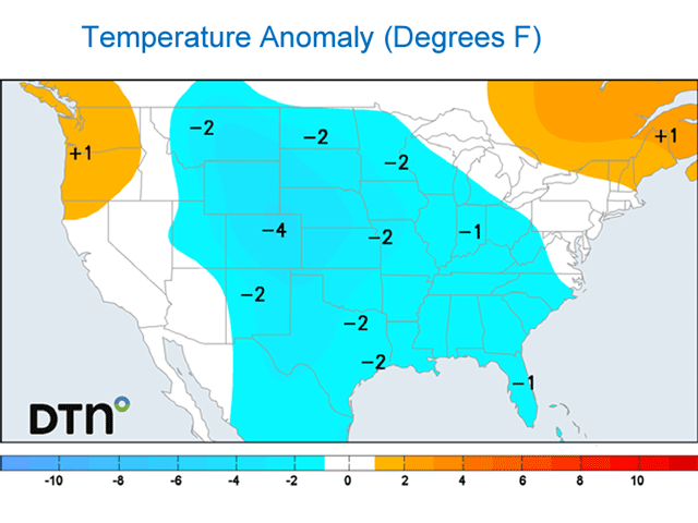
"We should see an upper-level ridge developing over western Canada and into Alaska by the end of next week (March 15)," Hamblin said, "while an upper-level trough digs into the Eastern U.S. Models are slow to bring in some cold air initially but are signaling for below-normal temperatures around and after March 22."
With another upper-level ridge blocking the pattern up around Greenland at the same time, this pattern change is a good setup to produce a burst of colder air east of the Rockies across much of the U.S. as well as the eastern Canadian Prairies eastward through the rest of Canada. The longer-range models disagree on the timing and extent of how cold and for how long a drop in temperatures may occur, but the risks for a colder pattern east of the Rockies are there. Models typically do not do well with the introduction of colder air until it is within the 10-day window, so we could see forecasts at the tail-end of the 15-day period taking a dive over the next few days.
To combat the cold, the dwindling effects of El Nino will still hold some power over the forecast. Also, snow cover across western Canada is not very deep, allowing for a shorter event that may have trouble reaching extremely cold values for very long. However, models are unsure how long a cold snap may last, and another burst of cold air may develop in early April due to several features.
P[L1] D[0x0] M[300x250] OOP[F] ADUNIT[] T[]
Hamblin noted that several other factors, like the destruction of the polar vortex across the North Pole, groups of thunderstorms around the equator associated with the Madden-Julian Oscillation and a similar pattern development from 2016, the last strong El Nino, all point toward a risk of colder temperatures for agricultural land in the middle of the U.S. in the April 5-15 time frame. Should that pan out, crops that might be planted over the next 10 days would be at risk of freezing conditions as they are popping out of the ground or germinating, which could lead to some unfortunate consequences.
Typically, mid- to late-April is the average last frost date for these same areas outlined above from Kansas through the Ohio Valley, so that should not come as a surprise and producers that far north are unlikely to plant much. But for those farther south, such as in southern Oklahoma through the Lower Mississippi Valley, that last frost date typically occurs in March and their good fortune so far this year may be enticing producers to start early.
Corn and other grasses are usually at a lower risk of frost damage than soybeans and other legumes, but more at risk for seed chilling so germination may be a problem instead. Winter wheat and other grains or oilseeds could also be at risk of a later frost due to more advanced development from the abnormally warm temperatures of the last few months. There is no reasonable idea how cold it may get across the far south, but the risk of winter grains and oilseeds will be another thing to worry about during the coming cold snap.
You can find more information about frost damage to corn, soybeans, and wheat here:
For more information about how crops germinate poorly in cold soils, go here:
To find more weather conditions and your local forecast from DTN, head over to https://www.dtnpf.com/…
John Baranick can be reached at john.baranick@dtn.com.
(c) Copyright 2024 DTN, LLC. All rights reserved.
Comments
To comment, please Log In or Join our Community .