by
John Baranick
,
DTN Meteorologist
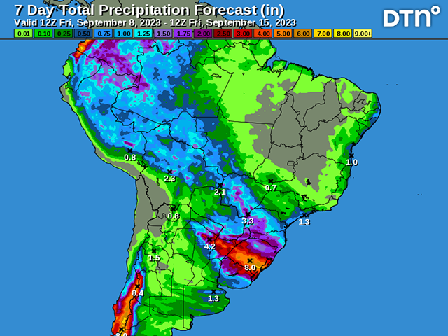
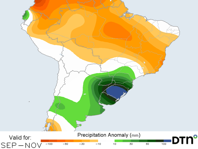
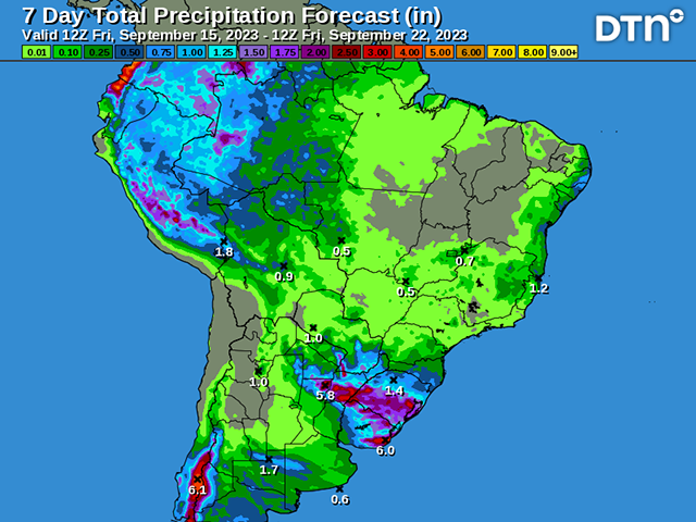
Some showers over the next week will not hamper much progress for soybean planting in Brazil next week.