Melissa is the third of this year's Atlantic Basin hurricanes to reach Category 5 status.

Melissa is the third of this year's Atlantic Basin hurricanes to reach Category 5 status.

The proposed 2026 federal science budget would be the lowest this century.

Despite some good rainfall during the weekend, local rivers, including the Mississippi, have not seen much of an increase in water levels, which remain very low for yet another fall season.

A strong front this weekend may clear out rain for Southern, Central Brazil next week. Here's how it may affect crops.

Fall's first freeze is as much as 2-3 weeks later than in 1970.

Though the first half of October has generally been quiet, the second half looks to favor frequent storm systems through the country.

Above-normal winter temperatures forecast for Texas would favor the New World screwworm survival if the parasite were to migrate from Mexico.

Lower-than-normal sea surface temperatures in the tropical Pacific Ocean are close to the threshold for La Nina.

Soil moisture is rated wet over high-production Kansas winter wheat districts as the new winter wheat cycle begins.

Your local weather forecast may be in for some more significant shifts during the next several weeks.

The weather pattern that is giving much of the U.S. warmer conditions is expected to continue for the next two weeks, if not longer.

The percentage of U.S. corn areas in drought almost tripled in two weeks from early to mid-September.

A tornado outbreak on Sept. 14, 2025, pushed the North Dakota yearly tornado total past the old record of 61 from 1999.

A system that has found itself cut off from both jet streams across North America will only slowly move through the U.S. through early next week.

The El Nino-Southern Oscillation is starting to show signs of returning to a weak La Nina this fall and early 2026.

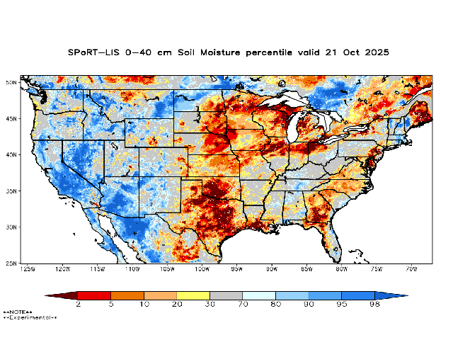
Precipitation deficits of 2 to 4-plus inches in the past 30 days have brought widespread degradation to soil moisture conditions in the eastern Midwest.

Another couple of bursts of colder air will descend through the U.S. going through the weekend. Conditions will be awfully chilly, but could an early frost occur?

Rainfed corn in the latest UN-L Hybrid-Maize yield forecast shows no better than average yield prospects east of the Mississippi River.

This week's shot of cooler temperatures in the Corn Belt is a reminder that fall is just about here. Those cooler temperatures may be here to stay through at least mid-September.

Summary: Rainfall forecast this week would be the first occurrence of precipitation in almost a full month.
DIM[2x3] LBL[blogs-ag-weather-forum-list] SEL[[data-native-ad-target=articleList]] IDX[2] TMPL[news] T[]
DIM[2x3] LBL[blogs-ag-weather-forum-list-2] SEL[[data-native-ad-target=articleList]] IDX[5] TMPL[news] T[]