
Ag Weather Forum
Drought-Easing Rain Hits Midwest
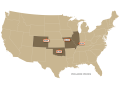
Going into the time frame of Friday, Aug. 16 through Tuesday, Aug. 20, things did not look good for a big swath of the Midwest. From central Iowa to central Indiana, soil moisture showed a notable drying trend going back to early July. There were fears the record-wet spring was going to give way to a very dry pattern to finish out the 2019 growing season.
Then came the period that brought not only rain, but some meaningful rain. From central Iowa through western Indiana, rainfall of approximately one to more than four inches notably eased the dryness in this big swath of the Midwest. Here are some examples of the rain totals:
Iowa: Des Moines 4.81 inches (including a record 2.77 Tuesday, Aug. 20); Waterloo 2.34; Cedar Rapids 3.49; Iowa City 2.90; Dubuque 1.78; Davenport .87.
P[L1] D[0x0] M[300x250] OOP[F] ADUNIT[] T[]
Illinois: Peoria .97; Champaign .90; Decatur 1.91; Lincoln 2.46; Springfield 1.27.
Indiana: 1.67.
These rain totals are useful. While they do not completely solve recent dryness, rainfall in mid-August is certainly a benefit for filling corn and soybeans.
Bryce Anderson can be reached at Bryce.anderson@dtn.com
Follow him on Twitter @BAndersonDTN
(CZ)
© Copyright 2019 DTN/The Progressive Farmer. All rights reserved.
Comments
To comment, please Log In or Join our Community .