



Ag Weather Forum
Powerful Storms Strike America's Dairyland
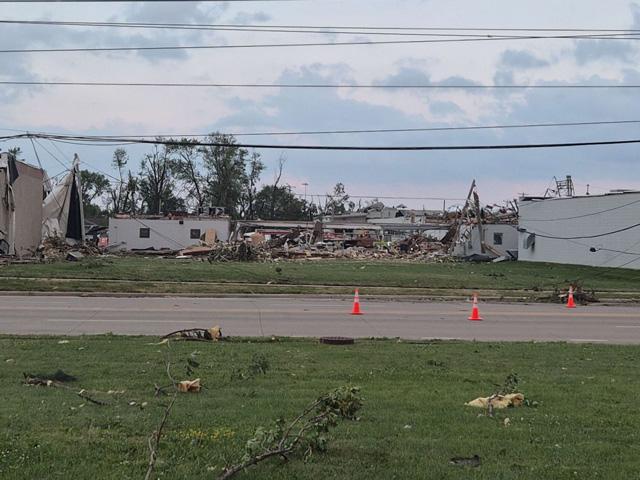
On July 27, swaths of wind damage, up to grapefruit-sized hail, and tornadoes tore through eastern Wisconsin. A low-pressure system that developed along a cold front from southern Canada was one of the main drivers for this round of the severe weather. Damage sprawled past Wisconsin, extending into Illinois and Indiana as well. While preliminary storm damage reports have been released by the National Weather Service (NWS), damage is still being assessed.
The Storm Prediction Center estimated at least six tornadoes touched down, mainly across Illinois and Wisconsin on Monday. Near Appleton, Wisconsin, a preliminary storm survey from the local Green Bay, Wisconsin, NWS office suggested that a tornado touched down around 12 p.m. CDT July 27. On the Enhanced Fujita Scale, or EF Scale, the scale that meteorologists use to rate a tornado's strength, the tornado was determined to be an EF-3 with estimated wind speeds around 140 mph. A few additional tornadoes were also reported in DuPage, Cook and Vermilion counties in Illinois.
In addition to tornadoes, very large hail caused damage through eastern Wisconsin and northeast Illinois. Three-inch diameter hail was reported across Door, Kewaunee and Shawano counties in Wisconsin during the late morning hours of July 27. Hail up to 4.5 inches in diameter, approximately the size of a grapefruit, was reported near Gresham, Wisconsin.
P[L1] D[0x0] M[300x250] OOP[F] ADUNIT[] T[]
How did such strong and widespread storms develop across eastern Wisconsin, Illinois and Indiana that day? For starters, the atmosphere was very moist ahead of storms that formed in Michigan's Upper Peninsula and northern Wisconsin during the morning hours. Minneapolis reported a dew point of 81 degrees Fahrenheit Monday morning, just short of the record dew point of 82 degrees Fahrenheit that was set on July 19, 2011.
Storms also need a lifting mechanism, such as a warm or cold front, that acts as a wedge to force warm air over cold air or vice versa. With Monday's storms, a cold front was moving south from northern Wisconsin into southern Wisconsin throughout the day while a warm front ran parallel to the border between Illinois and Indiana. Both the warm front and cold front helped promote storms to form across these areas.
Wisconsin has seen an uptick in the number of tornadoes across the state this year. According to Wisconsin Public Radio and Amanda Latham, a climate outreach specialist with the Wisconsin State Climatology Office, the state has had 43 tornadoes this year and it is tied with the fourth-highest number of tornadoes the state has seen in one year since 1950. To read more about the tornado that struck the Appleton area on Monday, see: https://www.wpr.org/….
It takes all the right ingredients to come together at the same time for severe weather, like Monday's event, to happen. While meteorologists are very familiar with the ingredients it takes for tornadoes, large hail and damaging winds to form, predicting the exact location of where these severe weather components will take place is much more challenging until a storm actually develops.
To find more weather conditions and your local forecast from DTN, go to https://www.dtnpf.com/….
Teresa Wells can be reached at teresa.wells@dtn.com
(c) Copyright 2026 DTN, LLC. All rights reserved.