Under the Agridome
Smoky and Dry: The Grain Market Continues to Yawn
I have often said on these pages that we love our American friends. Sure, living above one of the richest and most powerful countries in the world has its challenges, but so many benefits, too. I often kid my American friends when there comes to trade disputes between the United States and Canada, we have the ultimate weapon. Of course, that is always the threat of sending cold Canadian air down to the U.S. in winter during a polar vortex. If there are not guffaws, at least it breaks their attention.
Then came this past week where smoke from eastern Canadian wildfires caused dangerous levels of air pollution in major American cities like New York and Philadelphia.
For eastern Canadians, these smoke-filled days are very strange. However, in Western Canada it is not so strange as we have seen it before. There are often fires in British Columbia and Alberta that send smoke into western Canadian farm country as well as the U.S. Northern Plains.
However, this year as DTN Ag Meteorologist John Baranick documents in his DTN Ag Weather Forum, precipitation in the greater North American Corn Belt has been below normal caused by a stagnant weather pattern caused by a ridge of high pressure across central Canada. (See his blogs https://www.dtnpf.com/… and https://www.dtnpf.com/….) Translate that into the abundance of forests in northern Ontario and Quebec and we've got wildfires.
The images are striking especially from the big East Coast American cities where pollution levels are considered dangerous. In Ontario and Quebec, it's the same especially near the Quebec border where the horizon is masked by the dull curtain of smoke generated only a few 100 miles away. Yesterday on Twitter I couldn't help but feel for a friend of mine who mentioned he couldn't see his grain elevator half a kilometre away. He also said the smoke was causing him headaches.
P[L1] D[0x0] M[300x250] OOP[F] ADUNIT[] T[]
Here in southwestern Ontario the smoke was not as bad as that, but it was still very evident. Today almost seems like one of those dull January cloudy days but the temperature is about 23 degrees Celsius and there is a sun up there somewhere. We continue to suffer from the drought that Baranick has documented. However, rain is on the way apparently for next week.
That will be a complete game changer for crops in southwestern Ontario if it materializes. Interestingly enough, the Ottawa area has been an epicenter for the smoke in Canada and even though it is always a centre for political hot air you couldn't help here some politicians explaining all of this away because of climate change. Needless to say, Ontario Premier Doug Ford wanted to avoid that saying something about lightning strikes causing fires.
The unfortunate part of all this is you cannot deny the tangible reality of air pollution in this situation. What we have is people being exposed to fine particulate matter which can be highly dangerous when inhaled and can get into the bloodstream in the lungs, possibly causing health problems in the future. Raising the federal government's carbon tax to fight this present danger isn't going to help. Rain and a good stiff wind the other way might.
In the meantime, you might wonder how all of this dry weather and smoke is affecting the crop in the ground across the greater North American Corn Belt. Crop ratings are falling as Illinois's good to excellent corn rating fell 19 points last week while Michigan and Ohio fell 20 points in 17 points respectively. (See more on Illinois' dryness in the blog by DTN Ag Meteorologist Bryce Anderson at https://www.dtnpf.com/….)
In the good old days where information was at a premium, you would be expecting the markets to skyrocket. However, in 2023 that has not happened, in fact the market has had a collective yawn over the whole thing. (See story by DTN Business Editor Katie Dehlinger at https://www.dtnpf.com/…). We expect to find out more from the USDA when it releases its latest World Agricultural Supply and Demand Estimates (WASDE) report Friday at 11 a.m. CDT. (You can hear DTN Lead Analyst Todd Hultman's review of that report by signing up at https://www.dtn.com/….)
It really wasn't supposed to be this way. You might remember some of my musings during the last several weeks that El Nino was supposed to represent opportunity. Well, at this stage many of us wonder if that opportunity means some timely rain next week. We will have to wait till tomorrow, but it is unlikely that the USDA will change its 15.265-billion-bushel corn production estimate in the June report. Keep in mind our Brazilian friends are pushing out a record high 5.12-billion-bushel corn crop this year even at very cheap domestic Brazilian cash prices.
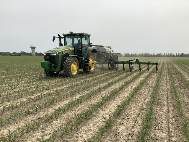
Clearly, on the Ontario front, crops are suffering. Where once dry weather helped us get the crop planted and get it up, it's pretty obvious when you walk the fields there is an increasingly high level of concern. However, it's not hot and dry, it's smoky and dry which is really weird.
It might be leading up to a crescendo of market making action in the grains. We not only have the June WASDE report on tap tomorrow, but we also have the June 30 USDA final acreage report on the horizon. Then there is July 4, where often times traders decide the crop is made. Within this dull and smoky horizon there is certainly the potential for greater market risk. However, we are not there yet. The grain market continues to yawn. Seeing clearly has never been so hard.
**
The views expressed are those of the individual author and not necessarily those of DTN, its management or employees.
Philip Shaw can be reached at philip@philipshaw.ca
Follow him on Twitter @Agridome
(c) Copyright 2023 DTN, LLC. All rights reserved.


