

Ag Weather Forum
Will Farmers Get the Dry Weather Needed to Finish Harvest?
Weather conditions for the 2026 harvest season have proven to be a mixed bag for my family's farm, located in southwestern Minnesota. We got a slow start to soybean harvest after some heavy rain during the first half of September. Southwest Minnesota wasn't the only area across the Corn Belt to see a wet start to this year's harvest as portions of Kansas, Nebraska and Iowa also dealt with wetter-than-average conditions. While it was a wet start to the season, will the remainder of October into early November prove to be challenging as farmers try to wrap up harvest?
During the end of August into early September, the soybeans on my family's farm started to rapidly mature as temperatures spiked into the upper 80s to lower 90s. I remember thinking it was a promising sign that we could have an early start to harvest, but those thoughts were quickly squashed when we received around 1.5-2 inches of rain from Sept. 6 through Sept. 8. Unfortunately, this was only the start to additional waves of rain moving through the Midwest during the month of September.
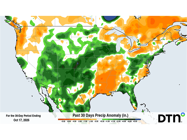
Over the past 30 days, southern Minnesota, southern Wisconsin, much of Iowa, eastern Nebraska, northern Illinois and Kansas experienced above-average precipitation. Precipitation was around 1-4 inches above average across these areas and with temperatures still reaching above average at times, heat and wet conditions caused quality concerns, especially in corn.
P[L1] D[0x0] M[300x250] OOP[F] ADUNIT[] T[]
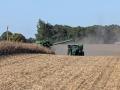
Soybean harvest didn't get into full swing on my family's farm until the first few days of October. Since then, we've been able to make some significant headway by taking advantage of longer stretches of dry conditions. Similarly, other states across the Corn Belt have made steady progress on corn and soybean harvest. In the latest USDA Crop Progress report, that was released on Oct. 13, Illinois, Kentucky, and Tennessee continue to be ahead of the curve when it comes to the percentage of corn harvested. For example, from Oct. 4-11, Illinois was able to achieve a 15-percentage-point increase in corn harvested, landing at an estimated 51% of their total corn crop harvested. Compared to the 2021-2025 average, they are 7% ahead of schedule.
Other states, such as Iowa, are still behind schedule as they catch up from the heavy rain in September. The Oct. 13 Crop Progress report showed that just 14% of Iowa's corn had been harvested and compared to the 2021-2025 average, at 34%, they have a lot of catching up to do. They are in a similar boat for soybean harvest as 31% of their soybeans were harvested as of Oct. 11. Compared to the 2021-2025 average, at 59%, these next few weeks will be crucial to how quickly farmers across the state can make progress.
This week, the weather conditions across most of the Corn Belt will be dry through at least Thursday as strong high pressure resides across the eastern half of the United States. By Friday and Saturday, a low-pressure system from the West will advance northwest into the Northern Plains. Scattered rain showers will target the Dakotas, Nebraska, western Kansas and Minnesota as a cold front enters these states. Up to 0.5-1 inch of rain could target southwest Minnesota, western Iowa, eastern Nebraska and western or central Kansas.
After this weekend's system passes through, another stretch of drier conditions could return across the center of the country from Oct. 26-29. During the last few days of October into early November, a pattern change could be in store for the Plains and Upper Midwest as an upper-air trough builds in the West with ridging in the East. Above-average precipitation could target the Southern Plains into the Ohio Valley.
Harvest progress may advance quicker for eastern Corn Belt states, such as Kentucky, Indiana, Illinois and Ohio, over the next 1-2 weeks. Meanwhile, some slowdowns are likely for parts of Iowa, Minnesota, Nebraska and Kansas through the end of the month. Unfortunately, these are some of the same areas that were hit by rainfall early in the harvest season, so further setbacks are possible if they can't take full advantage of the short stints of dry weather.
To find more weather conditions and your local forecast from DTN, head over to https://www.dtnpf.com/….
Teresa Wells can be reached at teresa.wells@dtn.com
(c) Copyright 2026 DTN, LLC. All rights reserved.