
DTN Ag Weather Brief
DTN Ag Weather Brief
A collection of troughs continue across the Central and East, a ridge is pushing into western Canada, and another trough is moving underneath the ridge in the Southwest. That trough will continue across the far south through the weekend. Another trough will move over the western ridge and into the Canadian Prairies for the weekend.
EXTENDED OUTLOOK:Yet another trough will follow underneath that ridge next week as another goes over the ridge again. All of these features will feed a western ridge and eastern trough look for the next 10 days that is generally stormier and colder east of the Rockies.
The U.S. and European models are fairly similar, but have timing differences with all the disturbances moving through. I will use a blend, but favor the European.
A small system will move through in the middle of next week, probably with more widespread precipitation through the country. And we should see another system for next weekend into the following week. Largely below-normal temperatures will exist east of the Rockies, a threat for some frosts at times.
A lot of moving parts will likely lead to changes in the forecast for the next couple of weeks.
NATIONAL TEMPERATURE/RAINFALL EXTREMES:HIGH THU...98 AT 2 NNE LA PUERTA, TX
LOW THU...5 AT PETER SINKS, UT
24-HOUR PRECIPITATION ENDING AT 7PM CDT THURSDAY...PORTLAND, ME 1.04 INCHES
US OUTLOOK AND MODEL DISCUSSION:A collection of troughs continue across the Central and East, a ridge is pushing into western Canada, and another trough is moving underneath the ridge in the Southwest. That trough will continue across the far south through the weekend. Another trough will move over the western ridge and into the Canadian Prairies for the weekend. Yet another trough will follow underneath that ridge next week as another goes over the ridge again. All of these features will feed a western ridge and eastern trough look for the next 10 days that is generally stormier and colder east of the Rockies.
The U.S. and European models are fairly similar, but have timing differences with all the disturbances moving through. I will use a blend, but favor the European.
A small system will move through in the middle of next week, probably with more widespread precipitation through the country. And we should see another system for next weekend into the following week. Largely below-normal temperatures will exist east of the Rockies, a threat for some frosts at times.
A lot of moving parts will likely lead to changes in the forecast for the next couple of weeks.
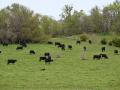
MAJOR WORLD HIGHLIGHTS/IMPACT:NORTHERN PLAINS (LIVESTOCK/WHEAT/CORN/SOYBEANS): Isolated showers may move through into next week, but it should be largely dry. Temperatures will largely remain below normal through the first half of May, producing more consistent frosts and freezes. No damage is expected since planting has been slow for corn and soybeans, but the colder temperatures could cause slower planting or growth for wheat that has already been planted.
CENTRAL/SOUTHERN PLAINS (LIVESTOCK/WINTER WHEAT/CORN/SOYBEANS): Some rain fell over Colorado and western Kansas on Thursday, which was beneficial for where they hit, but many areas remained dry. A system is moving across Texas on Friday with more of a shield of showers that should mean widespread precipitation. The widespread rain will improve soil moisture for some areas of west Texas, though Nebraska, western Kansas, and parts of Oklahoma are still extremely dry. The drought is deep and intense and will take a long time to undo. Another storm system is looking likely for next Tuesday and Wednesday, which may be helpful as well as another system for late next week or weekend.
The more active weather may bring some showers to drier wheat areas, though many fear it is too late now that it is May. Cold temperatures at times will be creating frosts through next week if skies clear out and winds calm down, which may cause damage to winter wheat and emerging soybeans.
P[L1] D[0x0] M[300x250] OOP[F] ADUNIT[] T[]
MIDWEST (LIVESTOCK/WINTER WHEAT/CORN/SOYBEANS): Showers will continue across the region through Sunday, but with lower coverage and amounts than we have seen recently. That should allow some wet areas to drain and planting to pick up. Two systems will move through next week that could bring more areas of heavy rain, keeping soil moisture well-stocked. However, it will also be cold through next week with potential for frosts, primarily across the north if skies clear out and winds calm down. That will likely cause a delay in planting as northern areas wait for the risk of frosts to subside.
DELTA (SOYBEANS/COTTON): Periods of heavy rain have been moving through this week and continue into early Saturday before getting a break. The rain is more than welcome, easing the extreme drought in the region. However, rainfall deficits are incredibly large and will take much more rain to significantly reduce. There will be more chances next week and beyond to continue the trend of reducing drought.
CANADIAN PRAIRIES (SPRING WHEAT/CANOLA): Temperatures are a bit higher over the next few days, but more cold air is forecast to move in next week. The cold is causing issues this season as snow has been slow to melt and soils are still relatively cold. This is causing a short planting window for the season. Soil moisture is at least very good, which is favorable for once the crop is planted.
BRAZIL (CORN): A stalled front across the south has been producing scattered showers for Parana in the south this week. Some showers will continue there into Monday. Central Brazil has gotten very hot and dry as the wet season has come to an end a couple of weeks early. The country will see if fronts moving up from Argentina can be of some help for occasional rainfall, and one will come through late next week, but soil moisture will be running out soon, a poor sign for safrinha corn.
ARGENTINA (CORN/SOYBEANS/WINTER WHEAT): Crops continue to mature and harvest is increasing across the country. Occasional rain may disrupt the maturing process as well as harvest at times, but conditions are overall favorable. Soil moisture has been falling a bit ahead of the winter wheat planting, but conditions are still favorable. A system moving through later next week should add some moisture to wheat areas.
EUROPE (WHEAT/CORN): Dry conditions in the northeast have not been favorable for winter wheat and more rain is needed. Scattered showers continue across western Europe and should push eastward next week, hitting some of the driest areas with scattered showers. Conditions for wheat development and corn planting are overall favorable for most of the continent.
BLACK SEA (WINTER WHEAT/CORN): Cooler temperatures have been around all week, but frosts have mainly occurred over the less developed places in the north.
Southern areas that are farther along may have some damage, but the overall prospect for widespread frost and freeze damage is low. Occasional rain showers and the clouds that come with it have been limiting the overall low temperatures from falling too much. The cold could discourage corn planting, however. Temperatures should moderate next week, though the showers are likely to continue. Some soggy areas in the east could use a break from the recent persistent rains, but western areas could use more rain.
AUSTRALIA (COTTON/SORGHUM/WINTER WHEAT/CANOLA): Dry weather continues to be the theme for eastern Australia, unfavorable for winter wheat and canola planting and establishment. Some showers have been moving through the west, but are only producing moderate conditions at best. We should see showers across the east this weekend, but widespread heavy rain is not in the forecast and drier conditions are again expected next week. A developing El Nino is not favorable for winter crops in Australia.
CHINA (WINTER WHEAT/CANOLA/CORN/SOYBEANS): The North China Plain and the northeast continue to be drier, which may be favorable for corn and soybean planting, but not for development of wheat. Only occasional light showers are forecast for the next couple of weeks. Canola areas in the south-central are in better shape from more consistent precipitation.
EXPANDED SUMMARIES FORECASTS:Midwest (corn, soybeans and winter wheat)
Summary:
West: Isolated showers. Temperatures below normal.
East: Scattered showers. Temperatures below normal.
Forecast:
West: Mostly dry Friday. Isolated showers Saturday-Sunday. Isolated to scattered showers Monday-Tuesday. Temperatures below normal through Saturday, near normal Sunday, near to above normal Monday, below normal Tuesday.
East: Isolated to scattered showers Friday. Mostly dry Saturday. Isolated to scattered showers Sunday-Tuesday. Temperatures below normal through Saturday, near to below normal Sunday, near to above normal Monday, near to below normal Tuesday.
6- to 10-day outlook: Isolated to scattered showers Wednesday-Friday. Mostly dry Saturday-Sunday. Temperatures below normal Wednesday-Friday, near to below normal Saturday-Sunday.
Central and Southern Plains (winter wheat/corn/livestock)
Summary: Isolated showers. Temperatures below normal.
Forecast: Isolated showers Friday. Mostly dry Saturday-Sunday. Isolated to scattered showers Monday-Tuesday. Temperatures below normal through Saturday, near to above normal Sunday-Monday, near to below normal Tuesday.
6- to 10-day outlook: Isolated to scattered showers Wednesday. Mostly dry Thursday-Friday. Isolated to scattered showers Saturday-Sunday. Temperatures near to below normal Wednesday-Thursday, near to above normal Friday-Sunday.
Rio Grande do Sul and Parana...
Summary: Mostly dry. Temperatures near to below normal.
Forecast: Mostly dry Thursday. Isolated to scattered showers Friday-Monday.
Mostly dry Tuesday. Temperatures above normal Friday, variable Saturday-Sunday, above normal Monday-Tuesday.
Mato Grosso, MGDS and southern Goias...
Summary: Mostly dry. Temperatures above normal.
Forecast: Mostly dry through Tuesday. Temperatures above normal through Tuesday.
John Baranick can be reached at john.baranick@dtn.com
(c) Copyright 2026 DTN, LLC. All rights reserved.