

Ag Weather Forum
Heat Benefiting Short-Term Crop Growth, Causing Long-Term Concerns
After a slow start to the season, planting progress is mostly back to the normal pace across the country. There are still some slow spots including North Dakota for all crops but sugarbeets, Kansas in soybeans, Pennsylvania in corn, and Minnesota in spring wheat. But most of the country has caught up to normal planting pace, quite the amazing feat given the weather conditions during the last couple of months. Attention now turns to growth and development and the weather from here on out will be much more tied to the impact on plants than on equipment.
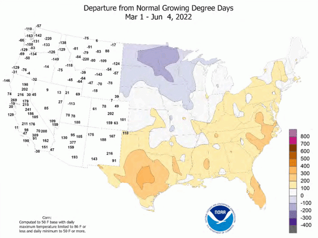
It has been cold across the northern half of the country this spring and growing degree days (GDDs) are behind normal. In contrast, southern areas have been much warmer and are near or ahead of their normal total. You can read more about the spring weather recap in Teresa Deutchman's blog here: https://www.dtnpf.com/….
Heat has been needed to rapidly increase plant growth in these areas that are behind either by lower temperatures, later planting, or a combination of both. This week, the northern areas have certainly been getting it. Temperatures on June 13 reached into the 90s or 100s Fahrenheit for almost all of the main growing regions east of the Rockies. Areas cooler than that were across the north, but the Dakotas and Minnesota still got into the 80s and lower 90s F which are above the normal high for this time of year
Another day of high temperatures occurred June 14 ahead of a cold front that is sweeping across the northern states this week. Conditions will cool down behind the front, but the coolness is still close to normal and only short-lived. By June 18, temperatures will again be well-above normal in the Northern Plains and Upper Midwest, with highs approaching or exceeding 100 F.
P[L1] D[0x0] M[300x250] OOP[F] ADUNIT[] T[]
Several days of high heat will occur before another cold front moves through and reduces temperatures, but the overall above-normal temperatures will hasten crop growth and get overall crop development closer to average for this time of year. While it will be hot only occasionally across the north, southern areas will see much more sustained heat.
Of course, the heat is only good if there is enough soil moisture for growth. Overall, soil moisture is in a pretty good position to start the season. Dry spots in the Plains and Midwest from the winter received plenty of rainfall this spring, reducing or eliminating drought for much of these areas.
On a national level, the area of the country listed as neither in drought nor dry according to the U.S. Drought Monitor stood at 41.68% as of June 7. On March 1, that percentage was only 26.46%, meaning drought and dryness was eliminated for roughly 15% of the entire country. That is no small feat.
Also according to the Drought Monitor, the overall coverage of drought has been reduced. In the same time frame, the Drought Severity and Coverage Index (DSCI) fell from a rating of 187 to 165. This index measures the "footprint" of the severity of drought. More area with higher categories of drought receives a higher rating. So overall, this reduction is an indicator that drought severity over the country as a whole has improved significantly. And considering that drought has worsened for much of the southwest quarter of the country, the improvement means a great deal to American farmers and ranchers. We have not seen a DSCI rating this low since June 1, 2021, when the rating fell to 164 for one week. To get to more consistently lower ratings, we have to go back to fall of 2020. In other words, drought has not been this contained across the U.S. in almost two years.
However, heat and dryness can quickly change the outlook in just a few short weeks. Northern areas of the country, that will be more on the roller-coaster ride of temperatures, should still see periods of showers moving through during the next few weeks. However, those will come with thunderstorms and coverage is never guaranteed, there are always areas that get missed.
From Kansas to Missouri and south of the Ohio River, it will be more difficult to see showers developing during the next few weeks and likely throughout the rest of the summer. It is unlikely for these areas to be completely dry for the next few months, but amounts are likely to be below normal.
The ridge of high pressure that is causing the favorable heat in the short term, may end up causing more harm in the long term with increased dryness and drought through the summer.
To find more regional weather conditions and your local forecast from DTN, head over to https://www.dtnpf.com/…
John Baranick can be reached at john.baranick@dtn.com
(c) Copyright 2022 DTN, LLC. All rights reserved.