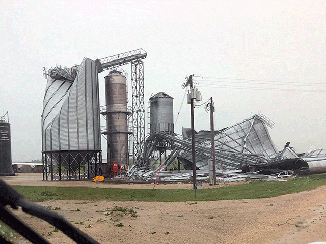
Derecho Smashes Grain Storage
Straight-Line Winds Picked Up Speed Across Iowa, Illinois
OMAHA (DTN) -- Grain bins were among the structures damaged by a widespread thunderstorm that slammed the Midwest on Monday, picking up speed and destructive power as it moved from Nebraska into Iowa, Illinois and Wisconsin.
The storm hit wind speeds in Nebraska as high as 70 miles per hour Monday morning. Then, the storm, classified as a "derecho" by meteorologists, continued to pick up speed as it swept across much of Iowa, hitting 99 mph, and then reaching speeds of more than 100 mph once it reached a large swath of Illinois and Wisconsin by midafternoon.
Damage assessments will become more detailed as the week progresses, but by Monday afternoon, Twitter was filled with photos and videos of smashed bins and scattered debris from the storm. Many bins on farms and at local elevators were empty -- or close to it -- as they were gearing up for an expected large corn crop at harvest.
In central Iowa alone, multiple grain bins were knocked out at elevators and cooperatives in a stretch of towns over about 50 miles, including Minburn, Luther, Slater and Collins, Iowa.
P[L1] D[0x0] M[300x250] OOP[F] ADUNIT[] T[]
Ben Riensche, a farmer in eastern Iowa, shared a photo of crumpled bins on his farm near Marion, Iowa.
With USDA this week expected to forecast a large U.S. corn crop this fall, it's unlikely the market will acknowledge much crop loss from the storm, though there were also social media images of flattened corn and soybean fields.
"We had the makings of a problem before this storm," said DTN Lead Analyst Todd Hultman. "We've got a huge harvest on the way, and how much can the elevators handle?"
Depending on their capacity to make repairs quickly, farmers and elevators could be looking at piles and bags to store their crops. On social media, farmers noted the grain bin damage will affect fall basis levels in areas where elevators and farm bins were hit hardest.
"It will make it more difficult at harvest when they have to figure out what to do with all of their grain," Hultman said. "It will intensify pressure to sell at harvest time."
The system began as a thunderstorm on the edge of a cold front as it was moving south, but the front structure flattened out into a hot air mass in the Mississippi River Valley. "A cannonball of thunderstorms just began rolling eastward and built on itself with momentum and winds," said DTN Senior Meteorologist Bryce Anderson. "You had all of the cold-front energy coming on into the teeth of that hot air mass over the Mississippi Valley that helped to fuel it."
By midafternoon, the storm had been labeled as a derecho, classified for its strong, straight winds. At one point, more than 50,000 in Nebraska lost power, a total that reached more than 480,000 in Iowa by late afternoon with Illinois also reporting more than 200,000 without power. (https://poweroutage.us/…)
Mike Naig, Iowa's secretary of agriculture, pointed out the damages, as well. "Many farmers and agribusinesses experienced damage to crops, grain bins and buildings as severe storms tracked across the state this morning. My thoughts are with everyone who was affected as they begin clean up," Naig said.
Chris Clayton can be reached at Chris.Clayton@dtn.com
Follow him on Twitter @ChrisClaytonDTN
(c) Copyright 2020 DTN, LLC. All rights reserved.


