

Technology Can Play Role on Ranches
With Increasingly Tight Margins, New Technology Can Aid Ranchers
OMAHA (DTN) -- For many, the iconic image of cow-calf producers in the High Plains region includes horses, cowboy hats and branding irons. But with new technology being developed that aims to help producers become even more efficient, this view could someday include more electronic devices, cameras and drones.
Technology on the ranch was a topic explored on the first day of the virtual 2020 Nebraska Grazing Conference, Aug. 11-12. The conference, held annually in Kearney, Nebraska, went online this year because of the COVID-19 pandemic.
MONITORING TECHNOLOGY
Many challenges face cow-calf producers as they try to remain profitable, according to Travis Mulliniks, University of Nebraska-Lincoln (UNL) Extension range cow production system specialist. His presentation was titled "Using New Technology on the Ranch."
While calves continue to average the same number of pounds at weaning time, feed costs as well as labor costs are increasing steadily. In addition, other issues such as environmental and animal welfare concerns and locating skilled labor plague producers, he said.
"Production outputs have not changed but nearly everything else has," Mulliniks said. "We need to embrace new technologies to better utilize the resources we have."
Most of newer technology involves closely monitoring different aspects of a ranch business including cattle performance, the environment and the forage/range.
Mulliniks said precision animal monitoring uses technology to focus on preventable health and performance issues at the cow level. This technology will help producers make more timely and informed decisions, he said.
Improved animal health and well-being increases production efficiency, reduces costs and helps improve the end product, he said. Other possible benefits of animal monitoring would be minimizing adverse environmental impacts, helping with risk analysis and helping producers make objective decisions.
WATCH THE ENVIRONMENT
Monitoring the environment could include keeping a closer eye on such things as water and soil, Mulliniks said.
P[L1] D[0x0] M[300x250] OOP[F] ADUNIT[] T[]
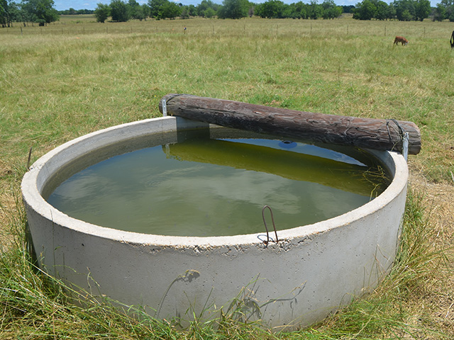
Remote cameras and sensors, some via drones, to monitor water sites is one practice, he said. The importance of livestock having access to water is obvious and simple monitoring can save producers both time and money.
With any new technologies there are some limitations with monitoring the environment, he said.
Cameras and sensors at remote water sites would have some issues in terms of cell phone signal, which is how the data would be sent. Drones would be limited on their flight distances, which would be an issue for the most remote water sites.
Mulliniks said despite their limitations, drones can have many applications on ranches. Along with monitoring water sites, drones could aid in calving checks, herd counts, herd health and forage biomass estimates.
Other emerging technologies include different ear tags to aid in monitoring, devices that attach to cows which send texts to producers when calving begins and even virtual fencing which would allow for location management of livestock.
Ranchers will need to be able to take this data and integrate it into their operation to become more efficient, Mulliniks said. Other aspects such as connectivity, willingness to pay for new technologies and the cost of maintaining these technologies will all factor into how successful ranchers will be.
"Many of these tools are in their infancy stages and there is a lot of little things that can go wrong," he said. "Not all new technology is a good investment for everyone."
PLANNING FOR GRASS
In terms of monitoring forages and rangeland one newer technology that helps cow-calf producers monitor how much grass will be grown is Grass-Cast (https://grasscast.unl.edu/…). Dannele Peck, director of the USDA Northern Plains Climate Hub located in Fort Collins, Colorado, said during her presentation Grass-Cast can help producers reduce this economically important source of uncertainty.
Grass-Cast uses almost 40 years of historical data on weather and vegetation growth and combines this with seasonal precipitation forecasts. This forecast will predict if rangelands in individual grid cells (whose size is 6 miles by 6 miles) are likely to produce above-normal, near-normal, or below-normal amounts of vegetation.
Peck said cow-calf producers in the High Plains region often face great variations on how much grass will be available from year to year. Many ranchers will cull part of their herds once it turns dry to have more grass the next year with fewer animals to graze the now available grass, she said.
"A seasonal outlook can allow them to have the flexibility with their herd size to take advantage when there could be more grass," Peck said.
DIFFERENT PRECIPITATION SCENARIOS
Grass-Cast gives the user three different situations depending how much precipitation falls. The color-coded maps show the percent variation on how much vegetation is expected to grow, from more than a negative 30% to more than 30%.
Peck said sometimes two of the three maps will show a situation in which more grass could be available and thus cattle producers could plan on running more cattle. The same could be true the other way and producers could cut back on their numbers.
"These are just estimates, but it can help producers match forage demand and supply," she said.
Grass-Cast is updated every two weeks and available for the Great Plains region and recently the Southwest (Arizona and New Mexico) was added. This is the result of a collaboration among Colorado State University, USDA, the National Drought Mitigation Center and the University of Arizona.
Peck said another useful tool in terms of monitoring the environment is the Vegetation Drought Response Index (VegDRI) (https://vegdri.unl.edu/…). This map, also from the National Drought Mitigation Center, is a weekly depiction of vegetation stress across the contiguous U.S., she said.
Russ Quinn can be reached at russ.quinn@dtn.com
Follow him on Twitter @RussQuinnDTN
(c) Copyright 2020 DTN, LLC. All rights reserved.

