
DTN Ag Weather Brief
DTN Ag Weather Brief
There is a strong ridge in the West and Central with multiple troughs spinning around Canada. The ridge will weaken this weekend and allow systems to move along the border region into next week.
EXTENDED OUTLOOK:The ridge will remain next week, but be suppressed a bit in the Southwest as systems continue to move along the northern border.
The U.S. and European models are fairly similar. I will use a blend, but favor the European.
Temperatures will stay very warm in the Southwest and be colder in the Northeast, but go on a bit of a rollercoaster ride across the rest of the country as we see a few systems move through. A larger system moving through late next week has the best chance to produce precipitation, but even then the Plains look awfully dry. It's possible we see a system next weekend that could bring some precipitation into the Plains, but models are currently mixed on that.
NATIONAL TEMPERATURE/RAINFALL EXTREMES:HIGH THU...110 AT 2 MILES WEST-NORTHWEST OF MARTINEZ LAKE, AZ
LOW THU...5 BELOW ZERO AT 4 MILES EAST-SOUTHEAST OF ESTCOURT STATION, ME
24-HOUR PRECIPITATION ENDING AT 7PM CDT THURSDAY...SEATTLE, WA 0.42 INCHES
US OUTLOOK AND MODEL DISCUSSION:There is a strong ridge in the West and Central with multiple troughs spinning around Canada. The ridge will weaken this weekend and allow systems to move along the border region through the end of March. The ridge will remain, but be suppressed a bit in the Southwest.
The U.S. and European models are fairly similar. I will use a blend, but favor the European.
Temperatures will stay very warm in the Southwest and be colder in the Northeast, but go on a bit of a rollercoaster ride across the rest of the country as we see a few systems move through. A larger system moving through late next week has the best chance to produce precipitation, but even then, the Plains look awfully dry. It's possible we see a system next weekend that could bring some precipitation into the Plains, but models are currently mixed on that.
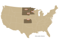
MAJOR WORLD HIGHLIGHTS/IMPACT:NORTHERN PLAINS (LIVESTOCK/WHEAT): A cold front will move through this weekend with limited showers and some cooler air, but the region will be on a rollercoaster ride of temperatures through the end of the month as multiple systems move through. Despite that, the precipitation forecast is limited to spotty, lighter showers through next week.
CENTRAL/SOUTHERN PLAINS (LIVESTOCK/WINTER WHEAT/CORN/SOYBEANS): Extreme heat has built into the region, breaking some records for Friday and Saturday. With drought conditions continuing to build, that is creating poor conditions for winter wheat and degrading soil moisture for the coming corn and soybean crops. Multiple fronts are forecast to move through the region through next week but are not forecast to produce much, if any precipitation.
MIDWEST (LIVESTOCK/WINTER WHEAT/CORN/SOYBEANS): Warmer air has flooded the region, melting a lot of the heavy snow from last weekend. A cold front will move through this weekend, but with limited precipitation. The same goes with a couple more fronts next week. Eastern areas may get some moderate showers at times with the fronts, but western areas will not. The fronts will cause rollercoaster-like temperatures across the region through the end of the month. Soil temperatures are starting to get into a range for some areas to think about planting and conditions are mostly favorable in which to do so.
P[L1] D[0x0] M[300x250] OOP[F] ADUNIT[] T[]
DELTA (TRANSPORTATION/SOYBEANS/COTTON): Recent rainfall has improved drought conditions a bit, but not as much as expected as the Drought Monitor still showcases a lot of drought in the region. Still, soil moisture is somewhat improved as planting starts to become more prevalent going into April. Despite a couple of fronts moving through this weekend and next week, precipitation is forecast to be very limited, which will not help the drought situation and may be a concern for early growth if that does not pick up in April.
BRAZIL (CORN/SOYBEANS): Scattered showers continue across central Brazil through next week but may thin out, which would not be favorable for safrinha corn. Dryness over the south has been unfavorable for filling corn and soybeans there. But a couple of fronts are forecast to move through this weekend and next week, which may bring scattered showers and some more beneficial rainfall, a turn from the forecast earlier this week.
ARGENTINA (CORN/SOYBEANS): A front brought some heavy rain to southern areas earlier this week, which will help to stabilize crop conditions. Another couple of fronts are forecast to move through into early next week with some beneficial rainfall as well. Though the rainfall appears to be favorable, much of the crop is either in the midst of harvest, as is the early-planted corn, or heading toward maturity, such as early-planted soybeans. So the rainfall is only somewhat helpful.
EUROPE (WHEAT/CORN): Drier conditions are settling in across much of Europe into early next week, though some showers will occur around Spain and Italy. A system will drop through the continent mid-late next week and has potential for more widespread precipitation. Eastern areas could really use some precipitation as winter crops continue to green up and spring planting gets underway.
BLACK SEA (WINTER WHEAT): Patchy dryness still exists in the region as wheat comes out of dormancy in mixed condition. Precipitation this week has been limited to southwester Russia, but has been light. Drier conditions will continue until maybe later next week when a system from Europe has a chance to bring more widespread showers. Even then, coverage and amounts do not look very favorable until maybe early April. However, if the rain does pick up in April, conditions will certainly improve.
AUSTRALIA (COTTON/SORGHUM): Recent precipitation in eastern Australia has improved soil moisture, but with cotton and sorghum continuing to mature, will not help those crops as harvest gets underway. More rainfall is needed for the coming winter wheat and canola crops, however, which start to be planted in April.
CHINA (WINTER WHEAT/CANOLA): Scattered showers continue over south-central China through next week, favorable for some winter wheat and especially canola areas that are coming out of dormancy. Wheat on the North China Plain has good soil moisture, but precipitation has been limited this winter. More rain would be favorable sooner rather than later.
EXPANDED SUMMARIES FORECASTS:Midwest (corn, soybeans and winter wheat)
Summary:
West: Mostly dry. Temperatures above to well above normal.
East: Isolated showers. Temperatures above normal.
Forecast:
West: Mostly dry Friday. Isolated showers Saturday-Sunday. Mostly dry Monday-Tuesday. Temperatures well above normal Friday-Saturday, near to above normal Sunday-Monday, above normal Tuesday.
East: Isolated showers east Friday. Mostly dry Saturday. Isolated showers Sunday. Mostly dry Monday-Tuesday. Temperatures above to well above normal through Sunday, near to below normal Monday, near to above normal Tuesday.
6- to 10-day outlook: Isolated to scattered showers Wednesday-Friday. Mostly dry Saturday-Sunday. Temperatures above normal Wednesday-Thursday, near to below normal Friday-Saturday, near to above normal Sunday.
Central and Southern Plains (winter wheat/corn/livestock)
Summary: Mostly dry. Temperatures well above normal.
Forecast: Mostly dry through Tuesday. Temperatures well above normal Friday-Saturday, above normal Sunday-Monday, well above normal Tuesday.
6- to 10-day outlook: Mostly dry Wednesday-Sunday. Temperatures above to well above normal Wednesday-Thursday, near to above normal Friday-Saturday, above normal Sunday.
Rio Grande do Sul and Parana...
Summary: Mostly dry. Temperatures above normal.
Forecast: Mostly dry Friday. Isolated to scattered showers Saturday-Tuesday.
Temperatures above normal through Tuesday.
Mato Grosso, MGDS and southern Goias...
Summary: Scattered showers. Temperatures near normal.
Forecast: Isolated to scattered showers through Tuesday. Temperatures near normal through Tuesday.
John Baranick can be reached at john.baranick@dtn.com
(c) Copyright 2026 DTN, LLC. All rights reserved.