
DTN Ag Weather Brief
DTN Ag Weather Brief
HIGH WED...108 AT 4 MILES EAST OF NORTH SHORE, CA
LOW WED...12 BELOW ZERO AT MOUNT WASHINGTON, NH
24-HOUR PRECIPITATION ENDING AT 7PM CDT WEDNESDAY...SEATTLE, WA 0.36 INCHES
US OUTLOOK AND MODEL DISCUSSION:There is a massive ridge in the West and Plains with troughs up in Canada. The ridge will weaken this weekend, which will allow troughs in Canada to move along the border through the rest of the month.
The U.S. and European models are fairly similar. I will use a blend, but favor the European.
A front will move through later next week that may produce some scattered showers. Temperatures will generally be above normal outside of the Northeast, which will be cooler. Temperatures will fall behind the late-week system, but are still expected to be extremely warm in the Southwest.
MAJOR WORLD HIGHLIGHTS/IMPACT:NORTHERN PLAINS (LIVESTOCK/WHEAT): A cold front will move through this weekend with limited showers and some cooler air, but the region will be on a rollercoaster ride of temperatures through the end of the month. Fronts will move through next week, but little precipitation is in the forecast.
CENTRAL/SOUTHERN PLAINS (LIVESTOCK/WINTER WHEAT/CORN/SOYBEANS): Extremely warm air will break some records in the south through Saturday. This is coming after some frost damage earlier this week. This weekend and next week, a couple of fronts will move through but with very little precipitation in the forecast. The recent frosts, followed by heat and dryness, will not be favorable for winter wheat conditions as a lot of areas dry out significantly. Drought continues to grow over the southwestern Plains, increasing stress for wheat, and being unfavorable for the start of planting as well.
MIDWEST (LIVESTOCK/WINTER WHEAT/CORN/SOYBEANS): Temperatures are rising in the region and will be quite warm until a front moves through this weekend. Only limited showers are expected with it and the cooler air that follows will not last long as temperatures rise again next week. Another front will swing through later next week with some showers as well, but precipitation amounts are forecast to generally be light. Despite some recent cold, conditions for winter wheat are likely to be positive with all the recent rainfall and drought reduction.
DELTA (TRANSPORTATION/SOYBEANS/COTTON): Recent rainfall has done a good job at increasing soil moisture and reducing drought, as well as pumping up water levels on all area rivers. The increase in soil moisture should be a positive impact, though long-term drought still resides throughout most of the region. Drier weather this week will not be favorable for reducing the drought further. And if dry conditions continue next week as well, as currently forecast, the tendency for deeper drought may continue.
BRAZIL (CORN/SOYBEANS): Scattered showers continue across central Brazil throughout the week, favorable for safrinha corn, but may thin out this weekend into next week, which would not be. Dryness over the south has been unfavorable for filling corn and soybeans there. A front moved in with scattered showers earlier this week, but not heavy amounts. More rain will be needed there as it is getting much drier. There is limited opportunity for more rainfall on the current forecast.
P[L1] D[0x0] M[300x250] OOP[F] ADUNIT[] T[]
ARGENTINA (CORN/SOYBEANS): A front brought some heavy rain to southern areas earlier this week, which will help to stabilize crop conditions. Another front will do something similar for Friday through the weekend with potential for another early next week. Though the rainfall appears to be favorable, much of the crop is either in the midst of harvest, as is the early-planted corn, or heading toward maturity, such as early-planted soybeans. So the rainfall is only somewhat helpful.
EUROPE (WHEAT/CORN): Much of Europe will be drier through the weekend outside of Spain, where some showers will be possible. A chance for a system will drop into the continent next week, which would be favorable for drier areas in the east. With warmer temperatures bringing winter wheat out of dormancy, some of the crop is doing so in fairly dry conditions, especially in the northeast.
BLACK SEA (WINTER WHEAT): Patchy dryness still exists in the region as wheat comes out of dormancy in mixed condition. More precipitation would be preferred, but very little is in the forecast outside of southwestern Russia that is forecast to get some patchy light rainfall into next week.
AUSTRALIA (COTTON/SORGHUM): A system produced scattered showers for eastern Australia earlier this week. Not all areas got rainfall, but that isn't necessarily favorable as cotton and sorghum continue to mature and harvest begins in some areas. The moisture will be important for the coming winter wheat crop, however, which starts to be planted in April.
CHINA (WINTER WHEAT/CANOLA): Scattered showers will continue over south-central China through at least this weekend, favorable for some winter wheat and especially canola areas that are coming out of dormancy. Wheat on the North China Plain have good soil moisture, but precipitation has been limited this winter. More rain would be favorable sooner rather than later.
EXPANDED SUMMARIES FORECASTS:Midwest (corn, soybeans and winter wheat)
Summary:
West: Mostly dry. Temperatures near to above normal.
East: Isolated showers. Temperatures near to below normal.
Forecast:
West: Mostly dry through Friday. Isolated showers Saturday-Sunday. Mostly dry Monday. Temperatures well above normal Thursday-Saturday, near to above normal Sunday-Monday.
East: Isolated showers through Friday. Mostly dry Saturday. Isolated showers Sunday. Mostly dry Monday. Temperatures above to well above normal through Sunday, near to below normal Monday.
6- to 10-day outlook: Mostly dry Tuesday. Isolated to scattered showers Wednesday-Thursday. Mostly dry Friday-Saturday. Temperatures near to above normal Tuesday-Thursday, near to below normal Friday-Saturday.
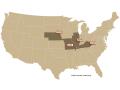
Central and Southern Plains (winter wheat/corn/livestock)
Summary: Mostly dry. Temperatures above to well above normal.
Forecast: Mostly dry through Monday. Temperatures well above normal through Saturday, above normal Sunday-Monday.
6- to 10-day outlook: Mostly dry Tuesday-Saturday. Temperatures above normal Tuesday-Thursday, near to below normal Friday, near to above normal Saturday.
Rio Grande do Sul and Parana...
Summary: Mostly dry. Temperatures above normal.
Forecast: Mostly dry through Saturday. Isolated showers Sunday-Monday. Temperatures above normal through Monday.
Mato Grosso, MGDS and southern Goias...
Summary: Scattered showers. Temperatures near normal.
Forecast: Isolated to scattered showers through Monday. Temperatures near normal through Monday.
John Baranick can be reached at john.baranick@dtn.com
(c) Copyright 2026 DTN, LLC. All rights reserved.