
DTN Ag Weather Brief
DTN Ag Weather Brief
There is a ridge in the West into the Plains with a series of troughs in Canada. Multiple pieces of energy will rotate around Canada and along the border through the middle of next week, resulting in several storm systems as the ridge does its best to spread across the U.S.
EXTENDED OUTLOOK:A trough out in the Pacific will move into the Southwest early next week and will have to be watched for a larger and more widespread storm system for later next week with another over the weekend.
The U.S. and European models are fairly similar. I will use a blend, but favor the European.
A system will move through the middle of the country with scattered showers Sunday and Monday across the Midwest. A larger storm system may be possible across the country mid-late next week with another over the weekend. Colder air in Canada will contrast with warmer temperatures across the south for most of next week, resulting in some variability across much of the country based on the precipitation and track of systems. But overall, above-normal temperatures are favored next week.
NATIONAL TEMPERATURE/RAINFALL EXTREMES:HIGH TUE...90 AT OCOTILLO WELLS, CA
LOW TUE...9 BELOW ZERO AT 2 MILES WEST-SOUTHWEST OF REXTON, MI
24-HOUR PRECIPITATION ENDING AT 7PM CDT TUESDAY...MEDFORD, OR 1.25 INCHES
US OUTLOOK AND MODEL DISCUSSION:There is a ridge in the West into the Plains with a series of troughs in Canada. Multiple pieces of energy will rotate around Canada and along the border through the middle of next week, resulting in several storm systems as the ridge does its best to spread across the U.S. A trough out in the Pacific will move into the Southwest early next week and will have to be watched for a larger and more widespread storm system for later next week with another over the weekend.
The U.S. and European models are fairly similar. I will use a blend, but favor the European.
A system will move through the middle of the country with scattered showers Sunday and Monday across the Midwest. A larger storm system may be possible across the country mid-late next week with another over the weekend. Colder air in Canada will contrast with warmer temperatures across the south for most of next week, resulting in some variability across much of the country based on the precipitation and track of systems. But overall, above-normal temperatures are favored next week.
MAJOR WORLD HIGHLIGHTS/IMPACT:NORTHERN PLAINS (LIVESTOCK/WHEAT): The region will be on the edge of colder air to the north and warmer air to the south through next week, causing variable temperatures. Multiple storm systems will move through over the next two weeks, which may result in some better precipitation and potential reduction in drought if it can be heavier and widespread enough. That is uncertain.
CENTRAL/SOUTHERN PLAINS (LIVESTOCK/WINTER WHEAT): Strong winds and dry soils have led to elevated wildfire conditions as well as falling conditions for winter wheat. The storm track remains busy, but only limited precipitation is forecast until the middle of next week as a couple of storm systems may bring through more widespread precipitation. Drought is a big problem across Nebraska, Oklahoma, and Texas, and will start to develop in Kansas if the precipitation doesn't materialize.
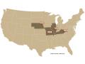
MIDWEST (LIVESTOCK/WINTER WHEAT): Snowpack is extremely low across most of the region and we will need to see significant precipitation prior to spring planting to feel good about soil moisture. Streaks of drought, especially from Missouri to northwestern Ohio, are the major issues heading into spring. Quick-hitting systems will move through this week, which will result in streaks of lighter precipitation. A better chance for more widespread precipitation will occur on Sunday and Monday and another pair of systems may bring some more precipitation later next week and weekend. The region will be on the edge of colder air to the north and warmer air to the south, resulting in mixed temperatures through early March.
DELTA/LOWER MISSISSIPPI RIVER (RIVER TRANSPORTATION): Water levels along the Mississippi River are rising despite the ongoing drought in the Delta region. Precipitation farther north in the Midwest is helping to keep river levels from dropping too low. However, this drought is long-standing and an issue prior to spring planting. Several fronts are forecast to move through this week and next, but with limited precipitation in the region as the drought continues into March.
P[L1] D[0x0] M[300x250] OOP[F] ADUNIT[] T[]
BRAZIL (CORN/SOYBEANS): Widespread heavy rain continues in Brazil on Wednesday before it starts to go isolated and migrate to northern areas. The current rain favors newly-planted safrinha corn, but soil moisture is still tenuous.
Consistent, heavy rainfall needs to continue for the next two months to put the corn in good standing for pollination and grain fill. Currently, the forecast is not favorable for that situation, which will cause problems for corn should this not reverse.
ARGENTINA (CORN/SOYBEANS): Showers have become spotty over the last week, which is forecast to continue into March. This will not be enough to lift areas out of drought in any significant way, and the trend toward lower crop ratings will likely resume. Outside of a few lucky spots, February rainfall has been below-normal like January had been, which is causing concern for both corn and soybean production.
EUROPE (WINTER WHEAT): Though a few fronts will move through this week with some showers, the pattern is drying out for the continent this week into next week. That is fine after the last few months of seemingly non-stop active weather. However, the pattern looks favorable for increased precipitation across Spain by the middle of next week. Spain found a needed break after heavy precipitation. If showers come back in a significant way, there could be issues with flooding.
BLACK SEA (WINTER WHEAT): Scattered showers continue to move through the region over the next day or two. Precipitation has been more consistent lately, but not heavy. Still, soil moisture and snow cover are building in some areas, which will favor winter wheat when it awakens from dormancy.
AUSTRALIA (COTTON/SORGHUM): A stalled front will continue to provide beneficial rainfall to cotton and sorghum in the fill stage across southeast Australia into the weekend. Not all areas are benefiting from the increased rainfall, however. But the tropics appear to be becoming more active, which could help to bring heavy precipitation into the country in March.
CHINA (WINTER WHEAT/CANOLA): Soil moisture is low across southeast China while central and northern areas have adequate soil moisture, even though showers have been limited the past few months. Once wheat and canola start awakening from dormancy in the next month or so, they will need more precipitation. Through next week, multiple systems will bring showers across the southern half of the agricultural areas, but the North China Plain and northeast will likely miss out as systems pass by to the south.
EXPANDED SUMMARIES FORECASTS:Midwest (corn, soybeans and winter wheat)
Summary:
West: Isolated snow north. Temperatures near to above normal.
East: Scattered snow. Temperatures near to below normal.
Forecast:
West: Isolated showers Wednesday. Mostly dry Thursday-Friday. Scattered showers Saturday, south Sunday. Temperatures near to above normal through Friday, below normal north and above normal south Saturday, below normal Sunday.
East: Isolated to scattered showers through Thursday. Mostly dry Friday.
Scattered snow Saturday-Sunday. Temperatures near normal through Thursday, above normal Friday-Saturday, below normal Sunday.
6- to 10-day outlook: Isolated to scattered showers Monday-Friday. Temperatures below normal Monday, near to above normal Tuesday-Wednesday, above normal Thursday-Friday.
Central and Southern Plains (winter wheat/corn/livestock)
Summary: Isolated showers north. Temperatures above normal.
Forecast: Isolated showers Wednesday-Thursday. Mostly dry Friday-Saturday.
Isolated to scattered showers Sunday. Temperatures above normal through Friday, below normal north and above normal south Saturday-Sunday.
6- to 10-day outlook: Isolated to scattered showers Monday-Friday. Temperatures below normal north and above normal south Monday, above normal Tuesday-Friday.
Rio Grande do Sul and Parana...
Summary: Isolated showers. Temperatures near normal.
Forecast: Isolated showers Wednesday. Mostly dry Thursday-Sunday. Temperatures near to below normal through Sunday.
Mato Grosso, MGDS and southern Goias...
Summary: Scattered showers. Temperatures near normal.
Forecast: Scattered showers through Wednesday, north Thursday-Sunday.
Temperatures near normal through Sunday.
John Baranick can be reached at john.baranick@dtn.com
(c) Copyright 2026 DTN, LLC. All rights reserved.