
South America Calling
USDA, Other Agencies Forecasting Lower Production in Argentina Following Months of Poor Weather
During the last 24 hours, the three major agencies that forecast corn and soybean production in Argentina made significant cuts to this year's crop. On Jan. 11, both the Buenos Aires Grain Exchange (BCBA), and Rosario Grain Exchange (BCR) made significant cuts to their estimates, while on Jan. 12, the USDA did the same.
BCBA gives an estimate based on two scenarios: rains returning by February (scenario A), or continuing to be dry (scenario B). These numbers are listed in the table at the bottom of this article.
USDA was not as harsh as the two in Argentina, but USDA is notorious for slowly stepping down estimates instead of doing so all at once. With the weather situation continuing to be poor in the country, scenario B from BCBA is not out of the realm of possibility, close to where BCR lowered their estimates to. If the situation does not improve, then we could expect more cuts down the line from the USDA.
P[L1] D[0x0] M[300x250] OOP[F] ADUNIT[] T[]
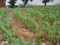
Of course, these estimates all hinge on the weather. BCBA also came out with their new report on crop conditions on Jan. 12 and it was not good. Excellent ratings for corn decreased 6 percentage points from 13% to 7%. For soybeans, ratings decreased 4 percentage points from 8% to 4%. What is worse are the poor ratings, which now stand at 47% for corn, up from 32% last week, and 56% for soybeans, up from 38% last week. Drought conditions continue to worsen and the country is now in desperate need for rain.
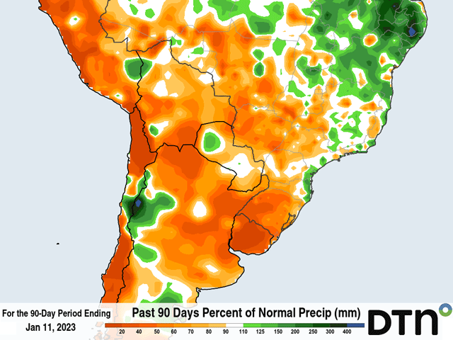
A cold front went through during the last couple of days, but did not produce much precipitation over the Pampas region, the main growing region in Argentina. Rainfall amounts were less than 25 millimeters (about 1 inch) and most areas saw less than 10 mm (0.4 inches) and many areas were left without, though some rain was falling over northern Cordoba as this was being written. The lack of rain follows five days of temperatures approaching 40 degrees Celsius (near or over 100 Fahrenheit), another hazard in this season of drought.
The pattern does not look to change drastically in the near-term. Some spotty showers may develop this weekend and next week, but most areas are likely to see little or no rainfall for another week, and temperatures will rise again next week after a nice cooldown behind the cold front. Some model simulations point to the last full week of January into the first few days of February as getting some good rains in the country, though that is hard to trust out of the current La Nina pattern, and would be too short to turn around the drought situation even if it materializes. Prospects for further cuts are high.
Here are the various estimates mentioned earlier:
Corn:
| In MMT | USDA | BCBA-A | BCBA-B | BCR |
| Prev. Estimate | 55 | 50 | 50 | 55 |
| Jan. Estimate | 52 | 41 | 37.8 | 45 |
| Difference (% change) | -3 (-5.5%) | -9 (-18%) | -12.2 (-24.4%) | -10 (-18.2%) |
Soybeans:
| In MMT | USDA | BCBA-A | BCBA-B | BCR |
| Prev. Estimate | 49.5 | 48 | 48 | 49 |
| Jan. Estimate | 45.5 | 44.5 | 35.5 | 37 |
| Difference (% change) | -4 (-8.1%) | -3.5 (-7.3%) | -12.5 (-26%) | -12 (-24.5%) |
You can find more information about the recent USDA World Agricultural Supply and Demand Estimates (WASDE) here: https://www.dtnpf.com/… and https://www.dtnpf.com/…. To find more international weather conditions and your local forecast from DTN, visit https://www.dtnpf.com/….
John Baranick can be reached at john.baranick@dtn.com
(c) Copyright 2023 DTN, LLC. All rights reserved.