

Extreme Weather Preparedness Tips
Be Prepared: It's Always Storm Season on the Farm
ANKENY, Iowa (DTN) -- Randy Uhrmacher, a row-crop farmer near Hastings, Nebraska, was busy Tuesday getting his farm and recreation property prepared for another battle with Mother Nature.
Another round of severe thunderstorms with damaging winds, which could also spawn tornadoes, are forecast to batter much of the Midwest on Wednesday. Wind gusts approaching or exceeding 75 miles per hour are expected to start midmorning Wednesday and last most of the day for the Central Plains and Upper Midwest, including Nebraska, according to DTN Ag Meteorologist John Baranick. (See https://www.dtnpf.com/….)
Preparing for severe weather before it hits can minimize damage potential on farms.
Uhrmacher made sure vehicles and as much equipment as possible were safely in sheds and doors were shut. He checked grain bins and made sure his homes were ready for the storm, such as reattaching skirting on his cabin at a nearby lake. In the fall, he made sure all his irrigation pivots were positioned in a straight line to better withstand strong prevailing winds, which often come from the northwest.
"After you prepare, all you can do is cross your fingers and hope you don't have damage or too much of it," Uhrmacher said.
Baranick doesn't expect Wednesday's storm to be as dangerous as the deadly and devasting storms in the Midwest and Midsouth on Dec. 10 that produced several tornadoes, but severe weather will likely occur. Read an initial DTN story on the recent storm at www.dtnpf.com/agriculture/web/ag/news/article/2021/12/13/storms-tornadoes-wreak-havoc-across.
STORM BREWING
Warm and moist air is out ahead of a deepening low-pressure system that is pulling moisture northward. Winds from the southwest to the northeast are likely to be mixed down to the surface, creating strong gusts across the Central Plains from South Dakota to the Texas Panhandle.
"The storm track will be different from last week, going from Nebraska through Minnesota, and this will impact the severe weather potential," Baranick said. "The midlevel moisture will not be as great, and the shear may be too high to organize thunderstorms into significant supercells like we saw rip through the Midwest and Midsouth.
P[L1] D[0x0] M[300x250] OOP[F] ADUNIT[] T[]
"Instead, we are more likely to see a low-topped line of thunderstorms with an enhanced wind threat," he continued. "Some tornadoes will still be possible, however. Power outages across a wide area are likely."
SAFETY TIPS
DTN gathered several tips to help farmers prepare for extreme weather events.
-- The National Weather Service (NWS) in Dodge City, Kansas, issued a warning to farmers that empty agricultural irrigation pivots can flip over if winds exceed 75 mph. If farmers fill pivots with water to weigh them down, it could be risky due to forecast freezing conditions. NWS predicts lows Thursday morning in the mid-20s Fahrenheit in the east and the upper teens in the west.
Uhrmacher said strong winds this spring, possibly hitting 75 mph, damaged one of his corner irrigation pivots.
"It probably got bouncing and broke. The wheels were still on the ground, but the span was on the ground too," he said. "If farmers haven't faced the pivot to be in line with the prevailing winds or protected by a hill, they should do that."
Tying down irrigation pipe piles may also be a good idea.
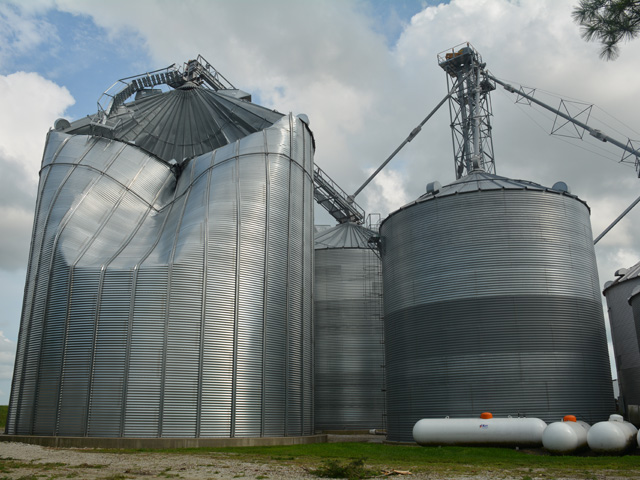
-- Double-check bin doors and lids to make sure they're secured. John Tuttle, director of sales for Brock Grain Systems, said making sure bins are sealed up tight is about all farmers can do to protect grain and the grain structures in the hours leading up to a storm.
Tuttle said grain bins by code are designed to withstand 105 mph winds for a three-second gust. Structures in areas frequently hit by hurricanes are often constructed to handle higher winds.
To find out more about wind-proofing bins, read this previous DTN story: www.dtnpf.com/agriculture/web/ag/news/article/2020/10/22/grain-bins-can-built-sustain-force.
"With upcoming windstorms, you batten down the hatches. If bins are full, they are pretty bulletproof except for the roof," he said, referring to bins handling high winds.
-- Ensure livestock have enough feed, water and adequate shelter. Russ Euken, Iowa State University Extension beef specialist based in northcentral Iowa, recommends farmers grind or prepare feed rations before storms so they don't have to in the wind and rain and feed is ready to go at a moment's notice.
Euken also said providing access to bedding and windbreaks to livestock that have access or predominantly reside outdoors is a good idea to help them better weather storms. When extreme cold isn't an issue, he said, non-confinement animals, such as in pastures, usually manage storms well or go to the cattle shed.
"They find a place to hunker down," Euken said.
-- Test electrical generators and other power sources.
-- Tie down or move objects inside that can blow away or be a danger if airborne.
For more high-wind safety tips, go to https://www.weather.gov/….
Matthew Wilde can be reached at matt.wilde@dtn.com
Follow him on Twitter @progressivwilde
(c) Copyright 2021 DTN, LLC. All rights reserved.