
Commodities Market Impact Weather
One System Moving Out, Clipper Bringing Snow This Weekend
MINNEAPOLIS (DTN) -- A dwindling large storm in the United States, a clipper system bringing a band of snow this weekend, and favorable rains in South America are the weather factors holding the market's attention Friday.
DELAYS CONTINUE FOR MIDWEST
A large storm system continues to affect the Midwest. A wave of moderate rain moved through during the past two days and snow has developed under the low center in the northwest. The low will move east through Saturday with scattered showers continuing to limit harvest progress. A clipper system will move through this weekend and is likely to produce a band of snow over northern areas, further limiting progress.
SOUTHWESTERN PLAINS UNFAVORABLY DRY
Poor conditions continue for winter wheat in western areas of the Southern Plains while eastern areas are faring better after a system brought showers this week. Drier weather is expected into early next week. While a front will bring some showers through next week, it is not forecast to be much and will likely miss western areas again.
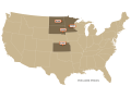
MORE SNOW FOR NORTHERN PLAINS
Snow and winds will come to a brief end during the day Friday across the Northern Plains. But a clipper system will move through on Saturday with another stripe of snow possible across the region, mainly in North Dakota. Any producers with work to do in their fields will find it difficult to do so for a while. A system next week is expected to miss the region with precipitation.
DELTA KEEPING DRIER
A system brought some showers to the Delta this week, benefiting winter wheat establishment. Drier weather follows into next week, allowing harvest to continue.
P[L1] D[0x0] M[300x250] OOP[F] ADUNIT[] T[]
SOUTHEAST DRYING OUT
A front moved through the Southeast on Thursday with scattered showers that could negatively impact harvest. But drier weather will follow through most of next week so this should only be a brief bump in the road.
MORE LIGHT SHOWERS FOR PACIFIC NORTHWEST
Several waves of precipitation will move through the Pacific Northwest through early next week, bringing potential for helpful showers. But most areas are likely to only see light precipitation.
DRYNESS CONCERNS FOR BLACK SEA
Some showers moved through Ukraine and western Russia earlier this week, but has not been enough to reverse the dryness so far this fall for winter wheat establishment. Mostly dry weather through the weekend will not be beneficial and temperatures are forecast to fall early next week as a fairly dry system moves through.
DAILY SHOWERS CONTINUING ACROSS BRAZIL
Daily scattered showers will continue across central Brazil for the next week. Dryness over Rio Grande do Sul this week has been the only area with detrimental conditions. The dryness has helped with the remaining wheat harvest though. Scattered showers are likely to move through southern areas next week for overall beneficial conditions for corn and soybeans across the country.
WIDESPREAD SHOWERS FOR ARGENTINA
Isolated showers have been popping up in Argentina through the week, mostly for the drier western areas, keeping soils from getting too dry. A system should push through the country over the weekend and bring widespread scattered showers, and another will follow closely behind it by a day or two. The expected rain will be favorable for corn and soybean planting and early growth. It may start to get drier after the second front pushes through, but models are mixed on if precipitation will occur next week.
WET HARVEST CONDITIONS FOR EASTERN AUSTRALIA
Systems moving through eastern Australia since last week continue to provide good moisture for summer cotton and sorghum, but are putting some pressure on wheat and canola harvest. As a system continues to push east and out of the region this weekend, dryness should follow for next week. Soils will need some time to dry out, however.
**
Get a full rundown on the 2022 outlook for weather affecting U.S. and international crop areas during the DTN Ag Summit, Dec. 5-7, in Chicago. Visit www.dtn.com/agsummit for more details about the summit and to register. Register before Nov. 26 for the early bird rate.
John Baranick can be reached at john.baranick@dtn.com
(c) Copyright 2021 DTN, LLC. All rights reserved.