
Commodities Market Impact Weather
Variable South America Rainfall
OMAHA (DTN) -- Variable rainfall amounts in the South America forecast and a polar vortex cold outbreak in the central United States are the primary weather features for the commodity market's attention Thursday.
MIDWEST POLAR VORTEX COLD
The DTN ag weather forecast calls for a strong polar vortex-origin cold wave to sprawl across the Midwest through the coming weekend. This bitter cold air will combine with periods of snow and strong winds to produce blizzard conditions in portions of the region. During the coming weekend, air temperatures falling to below zero Fahrenheit are likely in many locales. This is the coldest period of the winter so far with disruption to transport along with safety hazard and possible stress to exposed winter wheat.
SOUTHERN PLAINS COLD WAVE
P[L1] D[0x0] M[300x250] OOP[F] ADUNIT[] T[]
Southern Plains wheat areas have very cold conditions in store through the next seven days. Temperatures are forecast to decline to the single digits Fahrenheit. The cold air along with strong winds may be stressful to winter wheat. Snow cover is limited to a few inches in northern Kansas. Dry conditions remain as the primary threat to winter wheat.
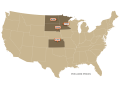
HARSH NORTHERN PLAINS COLD
The Northern Plains have a strong cold wave moving into the region. Temperatures are indicated to plunge to well-below-normal values by the weekend. This pattern will be stressful to livestock and will hinder transportation. The colder pattern remains in place through at least the 10- to 14-day time frame.
CENTRAL BRAZIL RAIN FOCUS
Across Brazil, moderate to heavy rain is indicated in the seven-day forecast for central and northern areas. The rain will disrupt soybean harvest and planting of safrinha corn. Lighter rain is in store for southern areas.
LIGHT ARGENTINA FOLLOW-UP RAIN
Argentina's central crop areas have light rain in the seven-day forecast. Rain offers limited follow-up precipitation following moderate to heavy rain and much improved soil moisture during the past week to 10 days. Temperatures are forecast to be seasonal to below normal during the next week which will minimize the effect of a generally drier pattern.
Bryce Anderson can be reached at bryce.anderson@dtn.com
Follow him on Twitter @BAndersonDTN
(c) Copyright 2021 DTN, LLC. All rights reserved.