
DTN Ag Weather Brief
DTN Ag Weather Brief
HIGH TUE...121 AT DEATH VALLEY CA
LOW TUE...27 AT PETER SINKS UT
24 HOUR RAINFALL ENDING AT 8PM MONDAY...SPRINGFIELD IL 2.35 INCHES
US OUTLOOK AND MODEL DISCUSSION 6-10 DAY PERIOD:A ridge remains planted over the southern U.S. with troughs moving through Canada and the northern U.S. through early next week. The ridge looks to be much firmer implanted this weekend with hot and humid weather through the middle of the country yet again. A trough will dig into the eastern U.S. in the middle of next week and squash the heat in the Midwest while the ridge shifts westward, centered over the Four Corners and Southern Plains.
The U.S. and European models are in fair agreement, so I will use a blend of the models.
For the outlook period, temperatures on Monday will be above normal east of the Mississippi River and over the West with near to below temperatures in the Plains. Temperatures will fall east of the Mississippi as a cold front moves through the region. Precipitation will follow a cold front that pushes southeast through the country through midweek. Showers will continue to pop up over the Southeast in the heat ahead of the front. We will also have to watch a potential tropical system in the Gulf, which may move through southern and west Texas over the weekend into early next week.
MAJOR WORLD HIGHLIGHTS/IMPACT:
NORTHERN PLAINS (SPRING WHEAT/CORN): Scattered showers will continue every couple of days as the storm track is through the region through the next 10 days, overall beneficial to crops though severe weather will continue to be a threat at times.
CENTRAL/SOUTHERN PLAINS (WINTER WHEAT/CORN/COTTON): Showers have been beneficial for developing corn and cotton in the region where they have occurred but have been notably absent for much of West Texas outside of the Panhandle where heat has continued to put increased demand on irrigation.
Scattered showers will continue over northern sections of the region as a front lingers and systems scrape by through this weekend. Otherwise only isolated showers are expected over the dry south and heat will build back into at least the southern half of the region by this weekend. We will have to watch for a potential tropical system moving through Texas over the weekend into early next week and the heavy rain that it may bring.
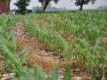
MIDWEST (CORN/SOYBEANS/WHEAT): A system will sweep through the eastern half of the region Wednesday with widespread moderate showers, benefiting much of the region. Scattered showers may linger across the southern half of the region, and maybe into drier western Iowa as well, through Friday. With showers being scattered, there will be places that are missed but many of the recent dry spots will see meaningful rainfall through Friday before the ridge firms up and the heat returns for the weekend. A front early next week will bring some shower activity along with more normal temperatures.
DELTA (SOYBEANS/COTTON): Showers have been and continue to be isolated through the next week. Northern portions of the region stand the best shot at showers, but with both soybeans and cotton in reproductive phases, more moisture will be needed as temperatures remain in the 90s through the weekend.
SOUTHEAST (COTTON): Isolated to scattered showers continue to support mainly adequate to surplus soil moisture for reproductive cotton over the next week.
BRAZIL (CORN/COTTON/WHEAT): Dry conditions continue to favor harvest activities for corn and cotton in the central and north, while conditions remain favorable for developing wheat in the south. Diminishing showers will push northward on Friday over Rio Grande do Sul. With adequate moisture in this portion of the region, favorable conditions continue for developing wheat. More heavy rain will be possible over the south early next week.
ARGENTINA (WINTER WHEAT): Showers will continue to spread over the country through Friday, bringing much-needed showers for developing wheat. However, behind the showers, temperatures will again fall below freezing and much of the shower activity will be too light to reverse recent dryness.
EUROPE (SPRING GRAINS/CORN): Spotty showers earlier this week have been very welcome for portions of the west that have been drier recently. Otherwise, mostly favorable weather continues for the continent as crops head toward or through reproduction. The Atlantic may open up a bit more over the weekend and into next week with more widespread showers over the continent.
UKRAINE/WEST RUSSIA (SPRING GRAINS/CORN/SUNFLOWERS): The eastern two thirds of the region continue to be dry, especially in the Volga region of Russia, and stress corn and sunflowers in reproduction and some damage has been likely.
P[L1] D[0x0] M[300x250] OOP[F] ADUNIT[] T[]
Prospects are much better across the western third of the region as showers have been much more plentiful. Showers continue to be more limited through the middle of next week with better opportunities in Ukraine and northwest Russia.
CANADIAN PRAIRIES (SPRING WHEAT): Scattered showers continue to move across the region through this weekend, with favorable conditions for much of the region.
The exception is in central and northern Alberta where soggy soils and cooler temps have stunted growth.
AUSTRALIA (WINTER WHEAT/RAPESEED): Scattered showers have fallen and been beneficial for the western wheat belt last weekend, but largely missed the eastern wheat belt. Southern areas in the east have better soil moisture and irrigation reserves for developing wheat and rapeseed, but Queensland has seen far few shower activity over the last 30-60 days. Queensland will see some shower activity through Wednesday and more again Friday through Sunday, along with the rest of the eastern wheat belt, which would ease concerns.
CHINA (CORN/SOYBEANS/SUGARCANE/RICE): Overall favorable conditions continue in the northeast for developing to reproductive corn and soybeans. Intense rainfall this season near the Yangtze River has caused significant flooding, otherwise, adequate showers continue for sugarcane and rice in the central and south.
INDIA (SUGARCANE/RICE/COTTON/SOYBEANS): Monsoon moisture continues to spread across the country, benefiting developing crops across the region. The outbreak of locusts continues in western India from Uttar Pradesh to Madhya Pradesh and across the north as well. Extensive damage has been reported for all crops in the region as the swarms feed on developing to reproductive summer crops.
EXPANDED SUMMARIES FORECASTS:
Midwest (corn, soybeans and winter wheat)
Summary:
West: Scattered showers. Temperatures near normal.
East: Scattered showers, some moderate. Temperatures near to above normal.
Forecast:
West: Scattered showers south Wednesday, central and south Thursday. Isolated showers Friday-Saturday, most likely north. Scattered showers north Sunday.
Temperatures near to below normal through Thursday, above normal Friday, above to well above normal Saturday-Sunday.
East: Scattered showers Wednesday. Isolated to scattered showers Thursday-Friday, mostly south. Mostly dry Saturday. Scattered showers north Sunday. Temperatures near to above normal through Friday, above normal Saturday, above to well above normal Sunday.
6 to 10 day outlook: Scattered showers Monday. Scattered showers south Tuesday.
Mostly dry Wednesday. Isolated showers, mainly west, Thursday-Friday.
Temperatures above to well above normal Monday, near to above normal Tuesday-Friday.
Central and Southern Plains (winter wheat/corn/livestock)
Summary: Isolated to scattered showers. Temperatures near to below normal.
Forecast: Isolated to scattered showers Wednesday. Isolated showers, mainly west, Thursday-Saturday. Scattered showers north, heavy rain possible south Sunday. Temperatures near to below normal Wednesday, near normal Thursday, near to above normal Friday, above normal north and near to below normal south Saturday-Sunday.
6 to 10 day outlook: Scattered showers north Monday-Tuesday. Heavy rain possible southwest Monday. Isolated showers central and west Wednesday-Thursday. Isolated to scattered showers Friday. Temperatures near to below normal Monday-Wednesday, near normal Thursday-Friday.
Mississippi Delta (soybeans and cotton)
Summary: Isolated showers. Temperatures near to above normal.
Forecast: Isolated showers possible through Sunday, better chances north through Friday. Temperatures near to above normal through Friday, above normal Saturday-Sunday.
6 to 10 day outlook: Isolated showers Monday. Scattered showers Tuesday-Wednesday. Isolated showers Thursday-Friday. Temperatures above normal Monday-Tuesday, near normal Wednesday-Friday.
Brazil Soybeans and Corn...
Rio Grande do Sul and Parana...
Summary: Mostly dry. Temperatures above to well above normal.
Forecast: Mostly dry through Thursday. Isolated to scattered showers Friday into early Saturday, mostly south. Mostly dry Sunday. Temperatures above to well above normal through Thursday, above normal Friday, near to below normal Saturday-Sunday.
Mato Grosso, MGDS and southern Goias...
Summary: Mostly dry. Temperatures near to above normal.
Forecast: Mostly dry through Sunday. Temperatures near to above normal through Sunday.
John Baranick can be reached at john.baranick@dtn.com
DTN Ag Meteorologist
(c) Copyright 2020 DTN, LLC. All rights reserved.