
DTN Ag Weather Brief
DTN Ag Weather Brief
The northern branch of the jet stream features a migratory trough moving through a ridge over Alaska and northwest Canada. A trough over central and eastern Canada extending into nothwest Greenland and a ridge over southeast Canada and Iceland. This is a cool/cold pattern for most of Canada. The southern branch of the jet features a ridge in the eastern pacific/Gulf of Alaska. A trough over the western U.S. A ridge over the central U.S. and a trough over the eastern U.S. and western atlantic. The center of subtropical high pressure is over far southern Mexico.
EXTENDED OUTLOOKThe U.S. and European models are in good agreement through 8 days, fair agreement days 9-10. During the 6-10 day period the northern branch of the jet will feature a ridge between Siberia and Alaska. A trough over Alaska. A ridge over northwest Canada. A trough over north-central and northeast Canada extending into southern Greenland and some ridging over northern Greenland. This will be a variable temperature pattern for western Canada, cool/cold central and east. The southern branch of the jet will feature a trough in the Gulf of Alaska. Some weak ridging in the eastern pacific. A trough over the western U.S. A low to moderate amplitude jet with embedded disturbances over the central U.S. and a trough along and off the east coast of the U.S. Disturbances will eject eastward from the trough in the west moving along the boundary zone between the cold weather to the north and the warmer weather to the south. This will be an active precipitation pattern for the Delta states and much of the Midwest. Drier over the plains due to the fast movement of systems limiting the flow of gulf moisture back to the west. Temperatures will be variable, milder out ahead of systems, cooler behind them.
This pattern will feature variable temperatures in the Midwest. Precipitation near to above normal. The southern plains will see variable temperatures. Precipitation near to above normal in the north and east, below normal in the southwest during the next 5 days, below normal days 6-10. The northern plains will see near to below normal temperatures. during the next 5 days, variable days 6-10. Precipitation near to below normal. The Delta states will see variable temperatures. Rainfall near to above normal.
Mike Palmerino
NATIONAL TEMPERATURE/RAINFALL EXTREMES:HIGH THU...86 AT MCALLEN TX
LOW THU...1 AT MINOT ND AND HARVEY ND
24 HOUR RAINFALL AT 7PM YESTERDAY…SALT LAKE CITY UT 0.86 INCH.
US OUTLOOK AND MODEL DISCUSSION 6-10 DAY PERIOD:The US and European models are in fair to good agreement during the first couple of days of the outlook period, only fair agreement after that. We see an upper level trough over the Great Lakes region shifting to the east coast and weakening next Wednesday-Thursday. The early call on this system is that it is not expected to be another strong west Atlantic storm as the past few have been but of course we will see if that is indeed the case.
The mean maps at 8-10 days features a trough over or just east of the east coast, stronger on the European model. The European model shows a strong, cold, Arctic high building over north-central Canada which then moves south towards the eastern US under the north to south flow west of the trough. The US model has a weaker trough and more of a west to east flow in east Canada so there is not much cold weather in this model, except in far north Canada. The European model also shows a deepening trough over western North America on the mean map at 8-10 days with ridging between the two troughs, over north-central Canada and the western Midwest. The US model is somewhat more progressive with the west trough over the Rockies at that time but not as deep. The US model shows much more of a split jet stream at 8 to 10 days. The southern jet running across the southern Rockies, the south and central plains, the southern Midwest and off east coast. The northern jet is depicted well north in Canada and is more west to east.
Neither model has much precipitation for the central and south plains during the 6-10 day period. The trough on the US model may mean some chance for showers in eastern areas at the end of the period but there is two much west to east in the flow to allow for any significant moisture in the west. The Midwest region is more complicated. The Euro has a system over the western and northern Midwest during the middle of the period that may feature rain or snow but is drier and colder at the end of the period. The US model shows light or moderate precipitation for the north and east Midwest during the middle of the period but also has a new rain or thunderstorm event favoring south and east areas at the end of the period. I would tend to go with the US model today but this is only a slight bias.
MAJOR WORLD HIGHLIGHTS/IMPACT:
NORTH PLAINS/WEST MIDWEST (LIVESTOCK/HOGS): Snow today and tonight favoring west and central areas of South Dakota with somewhat less to the north and east. Rain or showers for Iowa. Transportation delays mainly in South Dakota.
The next system is further south and may cause problems over western Nebraska later this weekend.
EAST/SOUTH MIDWEST: Episodes of rain and periods of cooler temperatures will likely lead to delays in early field work during the next 6 to 10 days. The chance for mixed precipitation early next week as well.
DELTA: Wet and very wet conditions will continue to hamper spring field work in the region. A new system bring more rain to the area Sunday into Monday. Warmer temperatures ahead of this trough will help dry fields somewhat but cooler weather follows which limits potential drying after the rain event. Heavier rain with this system also for the Alabama and Georgia areas may lead to delays.
CENTRAL/SOUTHERN PLAINS (WHEAT, LIVESTOCK): High winds and a Red Flag warning for much of the region today, maintaining high stress on wheat. Rain is expected to reach into key growing areas of north and east Kansas and possibly even central Kansas later this weekend. However, the driest areas of the wheat belt from southwest Kansas through west Oklahoma and the Texas Panhandle will miss this chance. These areas also look to continue dry for the balance of the ten day period.
ARGENTINA (CORN,SOYBEAN): A weekend cold front passage will bring scattered thunderstorms and locally heavy rainfall to the area this weekend. These appear heaviest in northern Buenos Aires and Entre Rios at this time, however there is at least some chance for heavier rains in southeast Santa Fe as well. Key growing areas of western Santa Fe and Cordoba may see only light to locally moderate showers from this system. Drought and dryness continues to impact filling corn and soybeans. Rain, if verified, would help to stabilize crop prospects for some locations but losses have already occurred.
BRAZIL (SOYBEANS, CORN): Heavy rainfall in RGDS at the end of this week. This may be somewhat unfavorable for maturing crops and could delay the harvest as well. Parana looks drier and warmer during the coming days.
SOUTH AFRICA (MAIZE,SUGARCANE): The region looks somewhat drier and warmer early this week but may see scattered showers late in the week. Mostly favorable conditions for filling crops at this time.
EXPANDED SUMMARIES FORECASTS:
P[L1] D[0x0] M[300x250] OOP[F] ADUNIT[] T[]
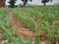
Midwest corn, soybean and winter wheat
Summary...
West: Dry yesterday. Light rain and drizzle has developed in southwest areas overnight. Temperatures averaged near to below normal north, above normal south, yesterday.
East: Mostly dry. Temperatures near to below normal north and northeast areas, above normal elsewhere in the region.
Forecast...
West: Light to moderate precipitation today with the heaviest occurring in western and southern areas. Snow is likely for west and south South Dakota during this time. Rain changing to snow in northwest Iowa and southwest Minnesota but with little accumulation in these areas. Mainly dry Saturday and Sunday. Temperatures average below normal today and Saturday, near to above normal Sunday.
Chance for moderate precipitation during Monday from extreme southern Iowa through north and central Missouri. A little light snow or snow showers favoring western areas during this time. Drier during Tuesday. Dry Wednesday.
Temperatures average near to below normal north and near to above normal south Monday, near to below normal Tuesday and Wednesday.
East: Mainly dry this morning. Light rain or showers favoring western and southern areas later today, during tonight and early Saturday. Drier later Saturday. Dry Sunday. Temperatures average below normal today and Saturday, near to below normal Sunday.
Light to moderate rain and mixed precipitation south, fair north, during Monday. Light snow may linger in the southeast and east areas Tuesday. Mostly dry Wednesday. Temperatures average near to above normal Monday, below normal Tuesday and Wednesday.
6 to 10 day outlook: Temperatures are expected to vary somewhat during this period. Precipitation near to below normal northwest, near to above normal south and east.
Central/Southern Plains (Wheat, livestock)
Summary: Dry yesterday. Overnight a little mixed precipitation developed in eastern Colorado and a few showers developed in eastern Kansas. Temperatures averaged well above normal yesterday. Highs 78-84F yesterday through west and central Kansas.
Forecast: Light to locally moderate precipitation through southern Nebraska today, a little light precipitation otherwise. Strong winds today and tonight.
High wind warnings have been issued for west and south-central Kansas, Red Flag warning for southeast Kansas, much of Oklahoma, west and north-central Texas.
Dry or with only light showers through southeast areas Saturday. Dry early Sunday. Moderate precipitation, mostly rain or showers, is expected late Sunday, Sunday night and early Monday from northeast Colorado through north, central and east Kansas and southern Nebraska. This may be rain changing to snow from northwest Kansas through western Nebraska. Precipitation totals of
0.25-0.50 inch with some heavier in northwest locations. Little is expected during this time in southeast Colorado, southwest Kansas, west and central Oklahoma, the Texas Panhandle or north-central Texas. Mostly dry Tuesday and Wednesday. Temperatures average above normal through Sunday, somewhat colder Monday and Tuesday, a little warmer again Wednesday.
6-10 Day Outlook: Temperatures are expected to average near to above normal during this period. Precipitation below normal west and central areas, near to below normal east areas.
BRAZIL SOYBEANS AND GRAINS
Rio Grande do Sul and Parana...
Summary: Moderate to heavy showers and thunderstorms occurred yesterday from northern RGDS through Parana, some indications of very heavy rains within these areas. Temperatures averaged below normal south and central areas, above normal north.
Forecast: Mostly dry today and Saturday. Scattered showers may develop in RGDS Sunday. Temperatures average below normal today but it should be warmer during the weekend.
Light to locally moderate showers favoring RGDS Monday into Tuesday, favoring Parana Wednesday. Temperatures average near to above normal Monday, cooler south and continued warmer north Tuesday and especially Wednesday.
Mato Grosso, MGDS and southern Goias...
Summary: Mostly dry yesterday. Scattered showers and thundershowers developed in eastern MGDS overnight. Temperatures above normal yesterday.
Forecast: Scattered to widely scattered thundershowers favoring southern areas today, northern areas during the weekend. Temperatures near to above normal.
Dry or with only a few light showers Monday. Scattered to widely scattered showers Tuesday and Wednesday. Temperatures near to above normal.
Argentina Corn, Soybeans and Wheat...
Cordoba, Santa Fe, North Buenos Aires
Summary: Mostly dry. Temperatures averaged below normal yesterday.
Forecast: Mostly dry today and early Saturday. Scattered showers and thunderstorms are expected later Saturday, Saturday night and early Sunday.
Drier later Sunday. The heaviest rainfall, 0.30-1.50 inches, is expected to occur in northern Buenos Aires, southeast Santa Fe and southern Entre Rios.
Northern and western Santa Fe, eastern and southern Cordoba may see only scattered light showers with locally heavier during this time. Temperatures average near to above normal today and Saturday, below normal Sunday.
Mostly dry Monday through Wednesday. Temperatures near to below normal.
La Pampa, South Buenos Aires
Summary: Mostly dry. Temperatures near to above normal west, below normal east.
Forecast: Mostly dry today. Light to moderate showers and thundershowers with locally heavier Saturday and Saturday night, favoring the north and east areas of the southern Buenos Aires region. Showers or light rain may linger in the east during Sunday, drier west. Temperatures near to above normal today, cooler again during the weekend.
Mostly dry Monday through Wednesday. Temperatures vary somewhat.
Joel Burgio can be reached at joel.burgio@dtn.com
(SK)
Copyright 2018 DTN/The Progressive Farmer. All rights reserved.