

Weatherlink
El Nino Gains Influence This Fall
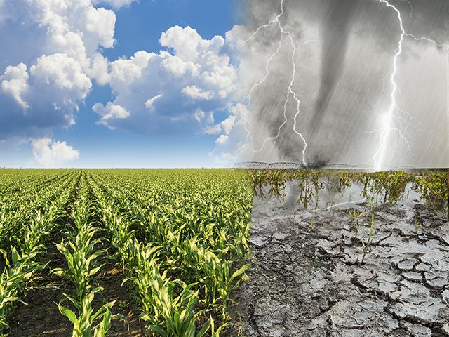
El Nino developed early this summer in the Pacific Ocean, a quick turnaround in conditions from the winter season that saw La Nina have a large hold on the weather patterns. But "the girl" still has had a lingering presence over the last couple of months while El Nino has been developing, leading to a mix of conditions over the summer. With time, though, El Nino should gain more of an influence on the weather through the fall season, leading to likely cooler conditions across the northern tier of the country, while keeping the southern and eastern tiers active with storm systems and thunderstorms.
PACIFIC NORTHWEST (Washington, Oregon and Idaho)
A quiet pattern has led to increasing heat and drought over the summer months, especially in the northwest corner of the region. The forecast favors a little bit of variability in the pattern here, but drought is more likely to grow than shrink due to increasing influence of El Nino. Winter wheat establishment may be more difficult this year, though Idaho may have some better conditions.
SOUTHWEST
The monsoon season has not been gracious to the region this summer, and drought has been slowly increasing. El Nino favors a more active pattern through the southern tier of the country during the fall, and includes this region as well, especially California. Late-fall and early winter storm systems are likely to move through the region, aiding in drought reduction and an early building of snowpack in the highest elevations.
NORTHERN PLAINS
Variable weather over the summer has led to a mix of conditions, and soil moisture has trended lower. More variability regarding precipitation is expected, but cooler conditions could be on the way as El Nino increases its control. History suggests a cooler fall period in October and November, possibly leading to an early frost in some areas. Though crops were planted late, especially in North Dakota, the potential for an early frost having a significant damaging effect is low, but not zero. It's also possible for an early snowstorm to move through the region if right conditions line up. Otherwise, harvest conditions should be fair overall.
P[L1] D[0x0] M[300x250] OOP[F] ADUNIT[] T[]
CENTRAL AND SOUTHERN PLAINS
The weather pattern remained active by summer standards across much of the region, but also came with record heat across Texas and sometimes farther north. While drought has certainly decreased across much of the region compared to where it was in the spring, it's still a concern going forward through harvest and winter wheat planting and establishment. The increasing influence of El Nino should be able to provide some better potential for storm systems and thunderstorms with time. Harvest may be affected, but soil moisture is likely to improve and be more favorable for winter wheat establishment.
COASTAL TEXAS AND LOUISIANA
Hot and relatively dry conditions for much of the summer have led to increased drought in the region. Increasing influence from El Nino should promote a more active storm track and chance for precipitation across the region for the fall season, while also reducing risks of damaging tropical systems. We could certainly see one sneak through, but the risk is lower. Overall, this should be favorable for increasing soil moisture, but also disrupting harvest.
MIDWEST
While a month of dryness in late spring and early summer put much of the region in drought, somewhat regular rainfall and temperatures that followed were able to carve out some beneficial conditions. Of course, we saw that shift at the end of July when the heat increased, leading to harsher conditions on the tail end of the season for some areas. The increasing influence of El Nino may bring in some cooler periods with time in October and November as well as potential for increased rainfall in some areas. However, the main influence of El Nino will be in the winter, which tends to leave the eastern areas of the region drier. Until that occurs, mixed conditions should lead to more haves and have-nots for rainfall, which could disrupt harvest at times but also increase soil moisture for winter wheat establishment.
DELTA
The weather pattern remained overall active for the summer, but not as much as we typically see during the season. Temperatures above normal also led to some dryness and drought concerns at times. El Nino's increasing influence does favor a more active period of weather in the fall season, which could disrupt maturing and harvesting of crops, but also produce some decent gains in soil moisture for any winter crop establishment.
MID-ATLANTIC AND NORTHEAST
Frequent rains and mixed temperatures have led to overall favorable conditions through most of the summer with very limited areas missing out and seeing increased drought. El Nino's presence in the fall sometimes leads to increased coastal storm threats, especially as time wears on, which may disrupt harvest of some crops but provide beneficial rainfall for any winter crop establishment.
SOUTHEAST
Variable and sometimes frequent organized precipitation supplanted a regular pop-up type of thunderstorm season in the summer and made for some good rainfall for most areas. Temperatures rose above normal for the second half of the summer but were not extreme enough to have a huge influence on crop conditions. El Nino favors a wetter period with more organized precipitation for the fall season, which could disrupt harvest. But much like the rest of the Gulf Coast, the active pattern tends to steer tropical systems away from the area. One may sneak through anyway, but the overall risk is lower this fall.
**
-- Read John's weather blog at https://about.dtnpf.com/…
-- You may email John at john.baranick@dtn.com
[PF_0923]
(c) Copyright 2023 DTN, LLC. All rights reserved.