

Weatherlink
La Nina Brings Mixed South America Prospect
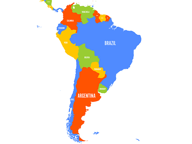
The 2021-22 crop year is off to a much better start in South America than producers experienced in 2020-21. Last year, dryness in the central Brazil state of Mato Grosso resulted in extensive planting delays for the soybean crop.
That late start to the soybean season in turn meant that second-crop corn was planted late and pollinated after the end of the rainy season. The bottom line: South America soybean production was large, but corn production was not -- at least in today's market. And, Brazil corn deficits, in particular, contributed to the big corn market rally during spring/summer 2021.
Conditions this year are more favorable. September rainfall in Brazil was variable but at least occurred. This improved rainfall compared with a year ago was also noted in Mato Grosso with enough rain to begin planting in late September. That improved planting scenario augurs well for soybean harvest and for planting the second corn crop at least a month earlier in 2022 than this past season -- which implies bigger production. In fact, Brazil ag officials project record-large output for both corn and soybeans in 2021-22.
Argentina has a less-favorable start to its row-crop season. Much of Argentina's crop areas had very little moisture heading into the start of corn- and soybean-planting season. The country's largest row-crop sector of Cordoba, Santa Fe, Entre Rios and northern Buenos Aires is included in the dryness coverage.
P[L1] D[0x0] M[300x250] OOP[F] ADUNIT[] T[]
LA NINA INFLUENCE
Looking to the balance of the South America crop year, a redeveloping La Nina cool-water sea surface temperature pattern in the equatorial Pacific Ocean is bringing some concern into the picture, notably for Argentina. La Nina set in during September and is forecast to remain in effect through the southern hemisphere summer in December/January/February.
Research done by National Oceanic and Atmospheric Administration scientists Chet Ropelewski and Michael Halpert in 1986 and 1987, and follow-up research by USDA meteorologists Mark Brusberg and Eric Luebelhusen in 2018 concluded La Nina has a dry influence on the Argentina rainfall pattern. The big impact is that displacement of the southern jet stream during La Nina results in weaker spring storms over Argentina with generally less moisture available.
The drier tendency also extends into far southern Brazil's Rio Grande do Sul state. Along with the drier trend, sporadic heat waves are also possible in the key central-Argentina crop areas. Temperatures of 40 degrees C (104 degrees F) have been recorded in the Cordoba/Santa Fe/Entre Rios/northern Buenos Aires area during the heart of the South America summer when La Nina is going on.
La Nina's effect will be a notable focus the rest of this year and into 2022. Its strength and longevity may go a long way in determining the world grain and oilseed supply and demand scenario and, of course, the impact on price and profitability for U.S. producers.
**
-- Read Bryce's weather blog atabout.dtnpf.com/weather
-- You may email Bryce at bryce.anderson@dtn.com
[PF_1121]
(c) Copyright 2021 DTN, LLC. All rights reserved.