
Weatherlink
Trends Rule This Summer
The terms "nonthreatening" or "benign" usually do not fit in a weather forecast discussion. Nonetheless, for most -- not all, but most -- crop areas, those terms apply to the 2020 summer forecast. The summer pattern offers temperature and precipitation combinations that point to generally large crop prospects.
Consistent trends appear to be running the show. One of the big trends is a central-U.S. temperature pattern that has not been very hot in the past few years. The last year central-U.S. summer temperatures were hot was back in 2012. The past eight years have seen a trend of above-normal precipitation in the Midwest.
What's more, the Pacific Ocean shows no sign of being a big influence source this year. Equator-region ocean temperatures and barometric pressure readings point to a "La Nada" -- neutral -- in the Pacific. That leaves the trends in charge.
Here are the regional forecast details.
MIDWEST:
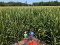
Near- to above-normal temperatures and above-normal precipitation highlight the forecast. Ample soil moisture going into summer and the extensive crop vegetation serve as low-level moisture sources to act like a thermostat and keep temperatures from getting into stressful categories.
DELTA:
Temperatures are forecast to be above normal with precipitation near to above normal. The strength of the summer Bermuda high in the western Atlantic Ocean and the Gulf of Mexico will be closely watched.
P[L1] D[0x0] M[300x250] OOP[F] ADUNIT[] T[]
SOUTHEAST:
Above-normal temperatures and near- to above-normal precipitation are featured in the forecast. We have seen occurrences of flash drought develop in late summer in the past few years; this prospect will bear watching.
GULF COAST:
The forecast highlights above-normal temperatures and near- to above-normal precipitation. As with the Delta and Southeast, the influence of the summer Bermuda high will be a key item.
MID-ATLANTIC AND NORTHEAST:
Widespread above-normal temperatures are forecast. Precipitation shows an above-normal tendency in the Mid-Atlantic region and near to above normal in the Northeast. Northern New England has generally seasonal precipitation prospects.
NORTHERN PLAINS:
A warm and dry pattern -- above-normal temperatures and below-normal precipitation -- is indicated for the western half of the region. The eastern half has near-normal temperatures and normal to above-normal precipitation.
CENTRAL AND SOUTHERN PLAINS:
As with the Northern Plains, the western sector has above-normal temperatures and below-normal precipitation indicated. Irrigation demand will likely be higher. Dryland crop yields may underperform because of a lack of moisture.
SOUTHWEST:
Above-normal temperatures and mostly near-normal precipitation are forecast. The region enters the summer in need of moisture. The late-season monsoon will be needed to offer dryness easing.
FAR WEST:
The summer trends have a warm to hot and dry trend -- above-normal temperatures and near- to below-normal precipitation -- indicated. Drought is likely to be in effect through the season.
NORTHWEST:
The region looks to be in the center of an above-normal temperature and below-normal precipitation pattern. This suggests drought conditions either developing or continuing.
> Read Bryce's weather blog at about.dtnpf.com/weather.
> You may email Bryce at bryce.anderson@dtn.com, or call 402-399-6419.
[PF_0620]
(c) Copyright 2020 DTN, LLC. All rights reserved.