
WeatherLink
Fall Forecast Remains Uncertain
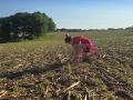
Approaching the 2019 harvest season, conditions would seem to favor a pretty benign weather pattern. Following the extremely wet spring, precipitation declined during the summer, leading to a drying trend in much of the central U.S. As an example of that tendency, the month of July saw soil moisture levels decline across most of the Midwest, the Delta and the Central through Southern Plains. Only in the Northern Plains and the northern Midwest did we see soil moisture levels increase.
But, there are two big wild cards that could lead to a colder and stormier season. The first one is well known: hurricane prospects. The waters off the Gulf and Southeast U.S. coasts are warmer than normal. This increases the odds that any tropical weather systems that form could spin up into hurricane status. This feature, in turn, raises the specter of hurricanes that make landfall. We saw what Hurricane Barry could do in the way of being a huge rainmaker in the lower Delta earlier this summer.
The second wild card is a feature that, should it form, would be in the far northern, or high, latitudes. This is blocking high pressure in the upper atmosphere. This feature is difficult to predict farther out than about 10 days to two weeks--but when it forms, it has a tendency to stick around for weeks at a time. High-latitude high pressure blocks the west-to-east jet stream flow and tends to force the standing low-pressure area, known as the polar vortex, farther south. This can lead to a colder pattern; and, in the major U.S. crop areas, such an occurrence could also line up with an early freeze. We all know this is not what crops need to finish out this year.
Regional forecast details follow. They reflect the perspective of a limited impact from high-latitude blocking high pressure:
MIDWEST
Above-normal temperatures near normal precipitation are forecast for the Midwest in fall 2019. The prospect for temperatures to be above normal is very important for the entire region, since the entire season was mothballed early by round after round of heavy rain. Every single day of warm and dry conditions will be welcome for crops moving into the home stretch, and certainly needing the first freeze to hold off until October at the earliest.
DELTA
A warm and dry pattern--above-normal temperatures and below-normal precipitation--is forecast for the region in the fall 2019 season. This pattern would be favorable for harvest and also would offer further easing of high river water levels in the region that have been in effect through the entire growing season.
P[L1] D[0x0] M[300x250] OOP[F] ADUNIT[] T[]
SOUTHEAST
Above-normal temperatures and generally below-normal precipitation are forecast. Florida is the exception, with above-normal precipitation in its forecast. The potential for tropical system formation holds a big key to the season, as we are only one year removed from the severe damage caused by Hurricanes Florence and Michael.
MID-ATLANTIC AND NORTHEAST
Temperatures are forecast to be above normal, possibly much above normal. Precipitation has a variable trend, with some chance at above-normal amounts near the Canadian border. Crop harvest and fall work have a generally favorable outlook.
NORTHERN PLAINS
Temperatures are forecast to be above normal, with precipitation generally below normal. A warm and dry pattern would be very welcome after the late planting season. Everyone connected with agriculture knows the complications that an early freeze could bring. There is a general hope this first freeze can actually hold off to a later-than-normal occurrence.
CENTRAL, SOUTHERN PLAINS
Temperatures generally have an above-normal trend in the forecast, with precipitation below normal. Row-crop harvest and winter wheat planting do not appear to have the sort of wet conditions that made for a difficult time last year. Late-summer heat and dryness, however, means, topsoil moisture for the winter wheat crop will be less than we'd like to see.
SOUTHWEST
Temperatures are forecast to be above normal. The precipitation outlook is more variable; below normal on the western flank of the Colorado Plateau and near normal on the eastern side and in the southern Rockies. Drought conditions in the Colorado River Basin eased notably following an extended snow season during the first half of 2019. However, dry conditions could form quickly with this pattern.
FAR WEST
Temperatures are forecast to be above to much-above normal, with precipitation below to much-below normal. We saw a big difference in the weather pattern develop during mid- to late summer, as soil-moisture levels declined throughout the season.
NORTHWEST
Temperatures are forecast to be above normal, possibly much above normal for the fall season. We're expecting precipitation to be below normal. In other words, a warm and dry fall season is indicated. This forecast continues a trend that began to form in the last third of the summer season.
Once again, the presence, or lack, of high-latitude blocking high pressure will be an important feature in the evolution of the fall 2019 harvest weather pattern. After all that U.S. agriculture has endured this year, a delayed onset of that northern high would be more than welcome.
> Read Bryce's weather blog at about.dtnpf.com/weather.
> You may email Bryce at bryce.anderson@dtn.com, or call 402-399-6419.
[PF_0919]
Copyright 2019 DTN/The Progressive Farmer. All rights reserved.