
DTN Ag Weather Brief
DTN Ag Weather Brief
There is a trough in the East, but temporarily. A ridge in the Central will push them offshore and try and anchor itself in the East over the next day or two. There is a trough in western Canada, another in the Southwest, and yet another moving into the Pacific Northwest. This ridge-east and trough-west look is going to keep the pattern very active going through early May.
EXTENDED OUTLOOK:Though the forecast may change with the specifics, a very active and overall warm pattern are forecast for the next couple of weeks.
The U.S. and European models just took a split overnight for next week's forecast. I will use the GFS, which did not make as much of a shift as the European did.
For the outlook period, temperatures should be above normal for most places underneath that ridge. Disturbances moving through should produce scattered showers and thunderstorms back into the Plains by late next week after a day or two break from the previous systems that moved through over the weekend and early next week.
NATIONAL TEMPERATURE/RAINFALL EXTREMES:HIGH WED...103 AT CASTOLON, TX
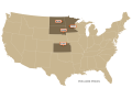
LOW WED...15 AT SEA GULL STATION, MN AND HOVLAND, MN
24-HOUR PRECIPITATION ENDING AT 7PM CDT WEDNESDAY...LANSING, MI 0.36 INCHES
US OUTLOOK AND MODEL DISCUSSION 6- TO 10-DAY PERIOD:There is a trough in the East, but temporarily. A ridge in the Central will push them offshore and try and anchor itself in the East over the next day or two. There is a trough in western Canada, another in the Southwest, and yet another moving into the Pacific Northwest. This ridge-east and trough-west look is going to keep the pattern very active going through early May.
The U.S. and European models just took a split overnight for next week's forecast. I will use the GFS, which did not make as much of a shift as the European did.
For the outlook period, temperatures should be above normal for most places underneath that ridge. Disturbances moving through should produce scattered showers and thunderstorms back into the Plains by late next week after a day or two break from the previous systems that moved through over the weekend and early next week.
MAJOR WORLD HIGHLIGHTS/IMPACT:NORTHERN PLAINS (LIVESTOCK/WHEAT/CORN/SOYBEANS): There is potential for widespread and heavier showers starting on Thursday and continuing through the weekend as two systems move close by. This favors the Dakotas more than Montana with heavier amounts, but all areas have potential for some needed rain. If rain is heavy, it could lead to some wetter fields and slow planting progress.
More disturbances will move through next week with areas of scattered showers and thunderstorms as well.
CENTRAL/SOUTHERN PLAINS (LIVESTOCK/WINTER WHEAT/CORN/SOYBEANS): Several storm systems are going to move through the region going into early May that will keep the region busy. Widespread showers and thunderstorms, some severe weather and heavy rain, and strong winds are all going to be on the table in the active pattern. That does include some better chances at getting moisture into drier areas around Kansas that have seen drought increasing lately, but could slow down planting progress in places that have better soil moisture at the moment like Nebraska. The gaps between storms will be short for at least the next 10 days. Though not all areas will see rain falling from each storm, this will likely lead to some sort of delay in planting.
MIDWEST (CORN/SOYBEANS/WINTER WHEAT): Frost occurred on Thursday morning across the eastern half of the region, but that may be the end of the frost risk this spring. Warmth will return Friday but so will an active pattern that will bring multiple storm systems through going into early May. Gaps between storms will be short, leading to delays in planting either due to soaked fields or just wet conditions.
DELTA (SOYBEANS/COTTON): Recent heavy rain has kept soils wet and likely caused some producers to delay planting, though that had been off to a quick start in most areas anyway. It could get busy again as the storm track runs from the Southern Plains through the Midwest going through next week, bringing risks of thunderstorms, severe weather, and heavy rain through the region going into May. The region will be on the edge of the storm track though, and may luck out with some more limited precipitation in areas that have become too wet.
P[L1] D[0x0] M[300x250] OOP[F] ADUNIT[] T[]
CANADIAN PRAIRIES (SPRING WHEAT/CANOLA): Mixed conditions over the winter and early spring have not been able to affect drought much in the region, which is expansive. An active pattern this week and next will bring rounds of showers through the region, but nothing overly heavy or widespread is forecast at the moment, which causes some delays to planting without providing much for soil moisture. Eastern areas have done better recently, though, and soil moisture there may be more favorable than for most of Alberta.
BRAZIL (CORN/SOYBEANS/WINTER WHEAT): Much of the safrinha corn growing areas will be dry for the foreseeable future. That means that it will also be hot, which will force corn to draw upon its limited subsoil moisture as the crop goes through the rest of pollination and grain-fill. Damage to the crop will become more apparent with time. Rio Grande do Sul, which is in the midst of corn and soybean harvest, is seeing showers, but those will pull back south on Friday. The front makes a return next week, which may disrupt harvest, but may also get into the far southern safrinha corn areas as well.
ARGENTINA (CORN/SOYBEANS/WINTER WHEAT): A front will continue to waffle around the northern end of the country through the weekend before getting pushed northward next week. Areas of heavier rain will affect harvest and make it difficult going into May as well as lead to quality issues for a fairly good looking crop. Soil moisture for the coming winter wheat crop is very favorable, however.
EUROPE (WINTER WHEAT/CORN): Cool and wet conditions have infiltrated much of Europe over the last week. Frosts have been common across northern growing areas where wheat is less developed, but has likely slowed down early planting of summer crops. Areas in the northwest like France and the UK continue to be too wet while Spain and areas in the south are welcoming the rain. The storm track will favor western areas with rainfall starting this weekend as it dries out a bit farther east. That will also increase temperatures across most of the continent. But the rain will likely migrate eastward later next week and could be followed by another burst of colder air.
BLACK SEA (WINTER WHEAT/CORN/SUNFLOWERS): The storm track has favored systems moving through western and central Ukraine at the expense of eastern Ukraine and most of southwestern Russia recently. Only streaks of light rain have moved through at times. That pattern continues through the weekend before getting drier everywhere next week. Hotter and drier conditions in the east have been unfavorable for wheat that is developing quickly after a warm and wet winter.
Crop conditions for winter grains are no doubt falling in the region while planting progress is likely quicker than normal. The region could see more widespread rain next weekend, but that is a ways off.
AUSTRALIA (COTTON/SORGHUM/WINTER WHEAT/CANOLA): Dry conditions are favored in most areas for the next week, though western areas should see some rain early next week and some showers may develop along the east coast next week as well.
Cotton and sorghum harvest continues to increase in mostly favorable conditions. But wheat and canola are being planted in fair to poor soil moisture for the most part. This could cause delays to planting as the country awaits better soil moisture conditions for winter crop establishment. The ending El Nino and eventual turn to La Nina should favor the winter crops later this year.
EXPANDED SUMMARIES FORECASTS:
Midwest (corn, soybeans and winter wheat)
Summary:
West: Mostly dry. Temperatures near to below normal.
East: Mostly dry. Temperatures below normal.
Forecast:
West: Scattered showers Thursday night-Sunday. Mostly dry Monday. Temperatures near to above normal Thursday, above normal Friday-Saturday, near to above normal Sunday-Monday.
East: Mostly dry Thursday. Scattered showers Friday-Monday. Temperatures below normal Thursday, near to above normal Friday, well above normal Saturday-Monday.
6 to 10 day outlook: Isolated to scattered showers Tuesday. Mostly dry Wednesday-Friday. Scattered showers Saturday. Temperatures above normal Tuesday-Saturday.
Central and Southern Plains (winter wheat/corn/livestock)
Summary: Isolated showers. Temperatures near to above normal.
Forecast: Scattered showers through Sunday. Isolated showers Monday.
Temperatures above normal Thursday-Friday, near to above normal Saturday, below normal northwest and above normal southeast Sunday, near to above normal Monday.
6 to 10 day outlook: Isolated to scattered showers Tuesday-Saturday.
Temperatures above normal Tuesday-Saturday.
Brazil Soybeans and Corn...
Rio Grande do Sul and Parana...
Summary: Isolated showers north. Temperatures above normal.
Forecast: Isolated to scattered showers Thursday. Mostly dry Friday. Scattered showers south Saturday-Monday. Temperatures above normal through Monday.
Mato Grosso, MGDS and southern Goias...
Summary: Mostly dry. Temperatures above normal.
Forecast: Mostly dry through Monday. Temperatures above normal through Monday.
John Baranick can be reached at John.Baranick@dtn.com
(c) Copyright 2024 DTN, LLC. All rights reserved.