
Commodities Market Impact Weather
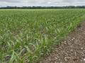
Frost Potential Coming to Corn Belt
MINNEAPOLIS (DTN) -- Up-and-down temperatures in the U.S., including a risk of frost in the Corn Belt, and heavy rain in southern Brazil are the weather factors driving the markets Wednesday.
RISK OF FROST FOR MIDWEST
A front will move across the Midwest through Friday with widespread showers. Temperatures will fall dramatically behind the front and there is potential for frost this weekend, especially across the north. Some isolated showers may continue into the weekend in the cooler air over the Great Lakes. Dryness and warmth should return next week, though may be slow to warm up over eastern areas. Any fieldwork delays due to rainfall are likely to be short, but we'll watch for another potential storm system late next week.
SHOT OF COLD FOR CENTRAL AND SOUTHERN PLAINS
A front continues to push through the Southern Plains Wednesday with widespread showers and thunderstorms and potential for severe weather and heavy rain. Afterward, cooler temperatures will move in, and could potentially produce some frosts Friday through Sunday mornings across northern areas. The cold will be temporary as temperatures rise next week. Drier weather that follows should allow equipment to move back into the region rather quickly. Soil moisture increases for winter-wheat establishment should be favorable as well. The next system may move through on the back half of next week with scattered showers.
FROSTS LIKELY FOR NORTHERN PLAINS
P[L1] D[0x0] M[300x250] OOP[F] ADUNIT[] T[]
Cold air is moving into the Northern Plains behind a front and will produce a few showers the next couple of days. Frost will be possible Friday and Saturday that could put an end to any immature crops. The cold will only be temporary as a ridge brings in more warmth next week. Recent showers will cause some delays to harvest this week, but dryness that follows should allow equipment back out into the fields after a short period.
LIMITED SHOWERS FOR THE DELTA
A front will move through the Delta Thursday and Friday but showers are forecast to be limited. Drought continues to build in the area, but conditions are good for harvest.
MORE HEAVY RAIN FOR SOUTHERN BRAZIL
Wet season showers continue in central Brazil, though they may be isolated at times. A front will continue over southern areas through the weekend with bouts of heavy rain again. Southern areas are dealing with too much rainfall, which has caused flooding and the need to replant early corn in some instances. Other than those issues, increased rainfall is favorable for early establishment.
DRIER AGAIN IN ARGENTINA
A front moved through Argentina on Tuesday, but rainfall was mostly light and more is needed. While planting conditions are good, establishment conditions are not. Dry weather forecast to follow for the next week is not favorable either. The next system is forecast to move through in the middle of next week, but forecasts are not favoring the widespread heavy rain that is needed just yet.
LIMITED SHOWERS IN NORTHERN EUROPE
Isolated showers moved through Europe early this week across the north. More are forecast for the northeast later this week and weekend. Otherwise, drier and warmer weather should be expected, favorable for fieldwork, but decreasing soil moisture on the continent for winter-wheat establishment. The forecast brings in more widespread showers but not until the end of the week.
STILL DRY IN THE BLACK SEA
Showers may move through the Black Sea region later this week and weekend with a couple of systems moving through, but will also bring a burst of cold temperatures, which may produce some frosts. Soil moisture continues to fall in winter wheat areas, unfavorable for establishment. The region typically has the month of October for establishment before winter freezes come in November from north to south.
STRONG COLD FRONT MOVING THROUGH AUSTRALIA
A stronger cold front is moving through eastern Australia which brought significant rainfall to southeastern areas and a burst of colder air that should ease stress from recent heat. Other areas will not have much precipitation out of the system, which is still largely unfavorable for filling winter wheat and canola.
John Baranick can be reached at john.baranick@dtn.com
(c) Copyright 2023 DTN, LLC. All rights reserved.