

Best Blog of the Week
Cash Market Moves: Mother Nature Took The Spring Out of Spring Wheat
It's as if Mother Nature didn't get the memo that the official first day of spring was Monday, March 20, which is the astronomical beginning of the spring season in the Northern Hemisphere.
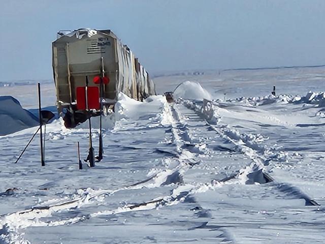
Spring wheat growing areas in South Dakota, eastern North Dakota and northwest Minnesota were hammered with heavy snow and winds during the first seven days of April.
Tim Luken, manager Oahe Grain, Onida, South Dakota, said the elevator was closed for two days and he finally made it there Friday. "We shut down the elevator at noon on Tuesday because it was snowing very hard. Guessing we had 10 inches so far already. The storm lasted through Thursday, and we picked up at least another 6 inches. The wind made it worse, and visibility was zero until Friday. It will be interesting to see what happens now and with the moisture what crops will be shifted. As of now, I don't think any changes; it's still early enough. I talked to one producer and he normally starts around April 12-16, and as late as first week in May."
"We got around 11 inches of snow. A lot of gravel roads are impassible; school is still canceled as of Friday because the road grader is still clearing roads," said Darrin Schmidt, eastern North Dakota farmer. "Wind is what made it so bad. We were able to get to our farm Friday after trying three times to get there. Third time's the charm, and there was still a single road to our farm. There are areas that are clear on the road then there are areas that are 5- to 6-feet deep on the road."
Nathan Riskey, Warsaw, North Dakota, said, "We got just over 2 feet. Had roads under last spring for six-plus weeks and it is not looking good right now. The spring will be interesting to say the least."
"I had 9 inches of snow with lots of drifting," said Tim Dufault, Crookston, Minnesota. "People are saying the frost isn't very deep and the soil is dry, which would really minimize flooding and speed up getting the fields ready to plant. If I was a betting man, which I am, I would bet we can be seeding spring wheat by the second week of May."
P[L1] D[0x0] M[300x250] OOP[F] ADUNIT[] T[]
Ryan Wagner, Wagner Farms, Roslyn, South Dakota, said, "We have had a rough winter approaching 100 inches of snowfall, and it seems as though every snowfall has come with 20- to 30-mile-per-hour winds, but hopefully this week's storm was the final one. The forecast looks good for getting some serious melting done in the next couple weeks and I do think the snow will disappear quickly from the fields, but some of these huge drifts and piles will stick around for another month which will be a problem."
Wagner added, "There will be some flooding this year but hopefully the dry soil conditions going into the fall and shallow frost depth will allow some of the melting snow to get into the ground rather than run off. I'm optimistic that we will be able to get something done by the end of April, but we have a long way to go before we can even think about fieldwork. As of now, we are not going to alter planting intentions and will stick with our typical spring wheat/corn/soybean rotation. We have planted wheat as late as May 25 in recent years and still had very good yields, and we will not be afraid to do that again this year if we have to, but hopefully it gets planted much sooner than that."
I asked Policy and Marketing Director of the North Dakota Wheat Commission Jim Peterson if it was too soon to talk about planting spring wheat. "Probably a bit too soon, unfortunately, but mid- to late-next week we might have a better idea on whether the forecasted warm up is going to happen, and what the 'melt; might look like for guys in the central and east," he said. "A little bit of discrepancy on how much will work into the soils given that the frost layer is not as deep as usual due to early snow and constant cover much of the winter, or if it will all run off and cause major flooding along rivers.
"Some feel that the eastern areas will have a hard time getting above 50 degrees for a while given the snowpack, which will slow the flood risk, but probably extend planting delays. In the western areas, a week of 50 to 60 degrees could quickly change things, but, even there, most are thinking the last week in April at the earliest. In the central and east, most guys are saying May 10-15, barring any more Colorado lows or heavy rain events."
FLOODING FEARS RISE ALONG THE RED RIVER OF THE NORTH
The recent snowstorm is not good news for the Red River of the North. Prior to that snow event, the National Weather Service (NWS), in their March 16 forecast, said moderate flooding is expected along the Red River of the North in North Dakota and the James River in South Dakota. Amanda Lee, service hydrologist for the NWS in Grand Forks, said the latest round of snow could push more areas to major flood levels this spring, according to the Grand Forks Herald on April 5.
"Up here in the Grand Forks and Oslo (Minnesota) areas, like Grand Forks and northward, breaching major flood stages is looking to be nearly a guarantee after this precipitation," she said. The Grand Forks Herald noted that, with additional precipitation from the recent storm, which could bring an inch or more of additional water content, Lee said river heights that were 50% chances at the last flood outlook are now almost guaranteed.
DTN Ag Meteorologist John Baranick said the flooding that is expected from the snowpack in the Northern Plains and Canadian Prairies almost "has" to happen at this point to have any sort of positive outlook on planting. "Soils were covered quickly in the winter, mostly before the ground froze. That means the soils underneath are not very cold and will soak up a good chunk of that water. It's still an estimated 4-6 inches of water locked in a good portion of that snowpack though, so flooding is all but certain at this point. But, in my opinion, the faster it melts, the faster the region gets to workable conditions."
Now, it's up to Mother Nature to cooperate.
Link to the entire March 23 NWS flood outlook: https://www.weather.gov/….
Mary Kennedy can be reached at Mary.Kennedy@dtn.com
Follow her on Twitter @MaryCKenn
(c) Copyright 2023 DTN, LLC. All rights reserved.