

Ag Weather Forum
Roller Coaster November Weather Pattern Continuing
So far, November is feeling like a fall month. A strong cold front, up-and-down temperatures, and strong storm systems in the forecast all point toward a normal month like we would expect for this time of year as opposed to the very warm months of September and October.
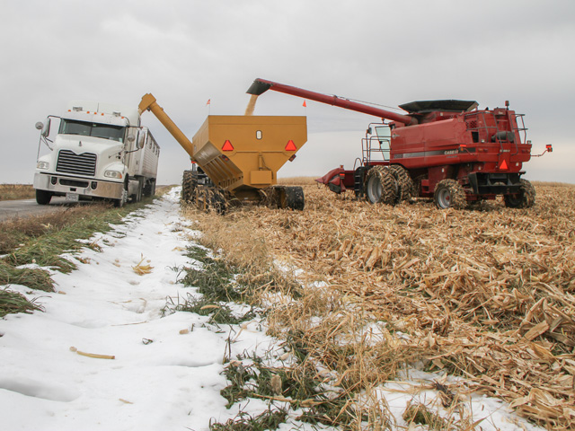
Harvest progress has faced some challenges so far this year, especially in the Eastern Corn Belt, as some periods of heavy rain in the latter half of October kept folks from getting out into their fields. But a week of good weather last week, albeit a bit chilly, has many places in the home stretch. With corn at 84% complete and soybeans at 87% complete, we are only really concerned about some of the regional spots in the Eastern Corn Belt as having significant progress yet to go.
Indiana, Michigan and Ohio all are behind on soybean harvest but near to ahead on corn harvest. Still, that is leaving roughly 20% to 35% of soybeans and 25% to 40% of corn still left out in the fields waiting to be harvested. A couple of good harvest days this week will help out, but there is still a ways to go.
Unfortunately for some of these farmers, they will have to wait even longer. A system developing in the Western U.S. Nov. 9 will move into the Plains on Nov. 10. A nearly solid line of showers and thunderstorms are expected to develop from Canada down to Texas and push eastward through Nov. 12. Most areas are in for moderate precipitation on the order of 0.50 to 1 inch of accumulation. But that will not be the end of it.
The system will wrap up across Minnesota and Wisconsin on Nov. 10-11 and bring down some cold air from Canada. That will induce a band of snow across the eastern Dakotas into western Minnesota Nov. 11-12. Snowfall amounts do not look overly heavy, on the order of a few inches in the worst spots, but winds that accompany the snow will reduce visibility, cause drifting, and create potential blizzard conditions.
P[L1] D[0x0] M[300x250] OOP[F] ADUNIT[] T[]
Back to the Eastern Corn Belt, the line of showers will not leave dry conditions in its wake. The storm should bring in enough moisture to continue isolated showers through the weekend, which could mix with snow at times as well. All-in-all, starting Nov. 10 harvest conditions will go downhill again.
The system is going to bring widespread precipitation to much of the country, but it is going to leave out a key area and that is winter wheat in the southwestern Plains.
Winter wheat conditions noted in this week's USDA Crop Progress Report noted that Texas is off to an abysmal start. Only 23% of the crop is rated good-to-excellent and 43% of the crop is rated poor-to-very poor. With better rainfall last week, Oklahoma avoided disaster, but the percentage of wheat that was in the good-to-excellent category fell from 59% last week to 52% this week.
Kansas, at 62% good-to-excellent, did not see any changes. As showers develop from central Kansas to central Texas and move eastward on Nov. 10, they will leave behind dryness across the west.
La Nina typically produces warmer and drier conditions for the winter months in this region and thus it is very important to get rain in the fall to put the crop on good footing for hopeful spring rains. But so far, this is not the case and there does not seem to be many good chances for rain for the month of November.
That is somewhat hard to believe since the pattern has been and continues to look active for the rest of the month. There are no good blocking features that will stagnate the pattern. That should allow systems to freely pass through the country.
It will also mean that temperatures should swing up-and-down rather easily and frequently with the passing systems. In fact, a similar storm system to this week could be on tap for next week. But the precipitation continues to be more concentrated from the eastern Plains eastward.
We should see most of the systems that are set to move through skip over the southwestern Plains with their precipitation. Drought challenges are shifting from the Northern Plains to the Southern Plains, indicative of La Nina and the conditions to start off the 2022 growing season.
Get a full rundown on the 2022 outlook for weather affecting U.S. and international crop areas during the DTN Ag Summit, Dec. 5-7, in Chicago. Visit www.dtn.com/agsummit for more details about the summit and to register. Register before Nov. 26 for the early bird rate.
John Baranick can be reached at john.baranick@dtn.com
(c) Copyright 2021 DTN, LLC. All rights reserved.