
Commodities Market Impact Weather
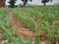
Harvest Delays Continuing in the Midwest
MINNEAPOLIS (DTN) -- A system moving across the United States with widespread rain and wind hazards, and increasing chances for rain in Argentina, are the weather factors holding the market's attention Thursday.
MIDWEST RAIN THROUGH SATURDAY
Rain will move through the Midwest during the next few days and will exacerbate wet field conditions over a good portion of the region and continue to delay harvest and winter wheat planting. Cold weather moving in this weekend into next week will slow drainage and could lead to some more precipitation for southern and eastern areas for further delays.
SOUTHERN PLAINS WINDS BLOWING SOILS DRY
A system brought scattered showers to much of the Southern Plains during the last few days and will exit eastward Thursday. These showers missed western winter wheat areas that did not get much precipitation out of the last couple of systems. Modeled soil moisture is still adequate in some of these areas, but lacking in others. Windy conditions during the last couple of days continues Thursday, drying out topsoils, which could hurt winter wheat establishment. Precipitation will come to these areas next week, but that could come in the form of snow with very low temperatures moving in as well.
COLD AIR COMING TO THE NORTHERN PLAINS
P[L1] D[0x0] M[300x250] OOP[F] ADUNIT[] T[]
Showers this week in the Northern Plains may have affected the remaining corn harvest. Mostly dry weather is expected for the next several days, but low temperatures will make their way in this weekend and continue next week.
SCATTERED SHOWERS FOR NORTHERN DELTA
A system moving through the Delta already brought moderate rainfall to some areas, which may be causing harvest delays, but good moisture for winter wheat. A few showers will linger over northern areas into Friday. More showers are expected with a front that moves through next week, along with falling temperatures.
WIDESPREAD SOUTHEAST RAIN THURSDAY
A system is moving through the Southeast with widespread and heavy showers that could cause more of a delay to cotton harvest Thursday. Some lighter showers may linger into the weekend before going on a drier trend into next week.
LOW RAIN CHANCES FOR PACIFIC NORTHWEST
A trough off the Pacific Coast has brought some periods of showers to the region during the last week, being beneficial for winter wheat establishment in some spots, but too light in others. This trough will continue to bring moisture into the region through the weekend, but is mostly falling out over the mountains. Another wave or two may be possible next week as the trough remains offshore.
BLACK SEA KEEPING WARM AND DRY THROUGH WEEKEND
Dry weather looks to be in place for Ukraine and western Russia through Monday along with above-normal temperatures going through next week. Winter wheat is starting to run out of time before lower temperatures settle in for the year and wheat goes dormant. Some showers may move through the region next week but are forecast to be spotty.
SHOWERS INCREASING ACROSS BRAZIL THIS WEEKEND
Scattered showers will continue over central Brazil for the next week, continuing to benefit soybean and full-season corn planting and early growth. Dry conditions across the south continue to favor winter wheat harvest while there is still plenty of soil moisture for early plant growth. Isolated showers will move back into southern areas this weekend and scattered showers are expected next week as a system moves through.
INCREASING CHANCES FOR RAIN IN ARGENTINA NEXT WEEK
Dry conditions in Argentina this week will continue to be unfavorable for corn and soybean planting and establishment. Isolated showers will start to move back into the country Friday through the weekend with a better chance at scattered showers next week as a system moves through.
John Baranick can be reached at john.baranick@dtn.com
(c) Copyright 2021 DTN, LLC. All rights reserved.