
DTN Ag Weather Brief
DTN Ag Weather Brief
HIGH THU...88 AT 3 MILES NORTHEAST OF MALIBU, CA
LOW THU...27 BELOW ZERO AT 31 MILES NORTHEAST OF FOREST CENTER, MN
24-HOUR PRECIPITATION ENDING AT 7PM CDT THURSDAY...ORLANDO, FL 0.53 INCHES
US OUTLOOK AND MODEL DISCUSSION:There is a ridge in the West up into Alaska and troughs in the Central and East. The ridge continues northwest through Alaska and the Bering Sea next week, which should shift the trough through most of Canada while a ridge pops up in the Southeast at least a little bit. This should become a much more volatile pattern for the end of January.
The U.S. and European models are fairly similar. I will use a blend, but favor the European.
Another clipper system will be possible in the middle of next week with some lighter snow across the north. Cold air will pool up in Canada while warmth spreads across the South next week. Eventually the cold is going to win out, probably with a big system bringing it down. That process may start late next week or weekend.
MAJOR WORLD HIGHLIGHTS/IMPACT:NORTHERN PLAINS (LIVESTOCK/WHEAT): Clippers are bringing more cold air through the region going into the middle of next week. It will not be significantly below normal until later next week as cold air pools up in Canada and leaks southward through the region for the end of January.
CENTRAL/SOUTHERN PLAINS (LIVESTOCK/WINTER WHEAT): Wheat has limited cold hardiness after recent weeks of warmth. Though some colder temperatures will occur over the next few mornings, the pattern is more threatening by the end of next week. To go along with a push of some cold air, there could be wintry weather as well. There is significant uncertainty in the specifics, however, and that matters because of the timing. If snow can develop before the cold air comes in, or the cold air only leaks down into northern portions of the region, wheat will be more protected. If not, the cold could have more widespread damaging impacts.
MIDWEST (LIVESTOCK/WINTER WHEAT): Winter is back as clippers continue to move through with limited showers through the middle of next week. Though some milder temperatures may move in ahead of each clipper, the trend is for below-normal temperatures and we may have to watch for a bigger system and stronger burst of cold air to move through at the end of next week.
DELTA/LOWER MISSISSIPPI RIVER (RIVER TRANSPORTATION): Water levels on the Mississippi River are getting a boost from a system that brought showers late last week, but are still low and not a long-term solution to the low water levels. Clipper systems moving through this week into next are not providing a meaningful boost to levels either. A better storm track through the region will be necessary. That may start late next week or weekend, but is forecast to be more favorable in February and March.
BRAZIL (CORN/SOYBEANS): Rainfall coverage has increased across central Brazil this week, which is beneficial for filling soybeans. Recent heat and limited showers may have been somewhat stressful in some areas, but the rain is likely to relieve much of that stress. A front will move up from Argentina this weekend to give some showers to southern areas going into next week, and enhance showers in central Brazil around the middle of next week.
ARGENTINA (WINTER WHEAT/CORN/SOYBEANS): Southern and central areas have been much drier and are seeing soil moisture and crop conditions falling. A front will sweep through the country on Friday with some showers lingering over northern areas this weekend. Rainfall amounts may be impressive for locations in the north, but the south continues to look very dry. After the front leaves this weekend, dryness looks to continue next week. Crop conditions are forecast to continue falling, which has been planned for by many producers that understand the risk for dryness in January. There will be some effect for corn and soybeans, however.
EUROPE (WINTER WHEAT): Soil moisture is still favorable across most of the continent for dormant winter wheat across the north and vegetative winter wheat in the Mediterranean. The storm track remains active but will favor the west for the next week. Some areas in the south and southeast may dry out a bit, but are still in good shape. Longer-range forecasts have precipitation increasing across more of the continent later next week.
P[L1] D[0x0] M[300x250] OOP[F] ADUNIT[] T[]
BLACK SEA (WINTER WHEAT): Cold air continues to sit in the Black Sea region through next week. Ukraine has better snow coverage, but that is more limited farther east, which may need to worry about winterkill damage. Very little protective snow is forecast through next week. Wheat went into dormancy in mixed condition and will need more precipitation over the winter before the wheat awakens from dormancy in the spring.
AUSTRALIA (COTTON/SORGHUM): Soil moisture continues to fall in many areas of Australia, though that is somewhat mixed across the east. Dry weather continues for most areas over the next week and will not be favorable for developing to reproductive cotton and sorghum.
CHINA (WINTER WHEAT/CANOLA): Winter wheat and canola are in dormancy in largely good condition, but precipitation has been limited over the last couple of months. Showers may move through these areas early next week. It is a long time before wheat and canola awaken from dormancy, but they will need more precipitation.
EXPANDED SUMMARIES FORECASTS:Midwest (corn, soybeans and winter wheat)
Summary:
West: Isolated showers. Temperatures near to above normal.
East: Isolated showers. Temperatures near to below normal.
Forecast:
West: Isolated to scattered showers through Sunday. Mostly dry Monday. Isolated showers Tuesday. Temperatures near to above normal Friday, below normal Saturday-Monday, near to below normal Tuesday.
East: Isolated to scattered showers through Tuesday. Temperatures near to above normal Friday, below normal Saturday-Tuesday.
6- to 10-day outlook: Isolated to scattered showers Tuesday-Saturday.
Temperatures near to below normal Wednesday, near to above normal Thursday-Friday, below normal Saturday-Sunday.
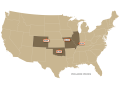
Central and Southern Plains (winter wheat/corn/livestock)
Summary: Isolated showers. Temperatures above normal.
Forecast: Isolated showers Friday-Saturday. Mostly dry Sunday-Tuesday.
Temperatures near normal Friday, near to below normal Saturday-Monday, near to above normal Tuesday.
6- to 10-day outlook: Isolated to scattered showers Wednesday-Sunday.
Temperatures near to above normal Wednesday-Friday, near to below normal Saturday-Sunday.
Rio Grande do Sul and Parana...
Summary: Mostly dry. Temperatures above normal.
Forecast: Scattered showers through Sunday, north Monday. Mostly dry Tuesday.
Temperatures near normal Friday-Saturday, near to below normal Sunday, below normal Monday-Tuesday.
Mato Grosso, MGDS and southern Goias...
Summary: Isolated showers. Temperatures near to above normal.
Forecast: Isolated to scattered showers through Tuesday. Temperatures near to above normal Friday-Saturday, near normal Sunday-Monday, near to below normal Tuesday.
John Baranick can be reached at john.baranick@dtn.com
(c) Copyright 2026 DTN, LLC. All rights reserved.